

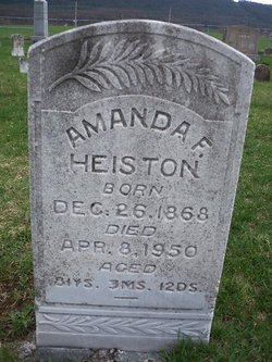
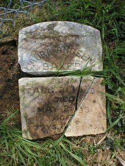
Joseph Samuel “Joe Sam” Heiston
| Birth | : | 28 Jun 1877 Compton, Page County, Virginia, USA |
| Death | : | 8 Oct 1954 Compton, Page County, Virginia, USA |
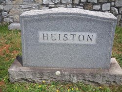
| Burial | : | Locust Grove Cemetery, Brewster, Okanogan County, USA |
| Coordinate | : | 48.1114006, -119.7746964 |
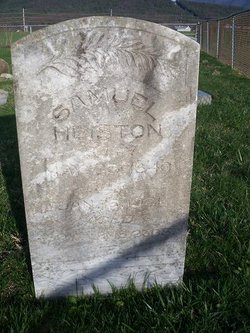
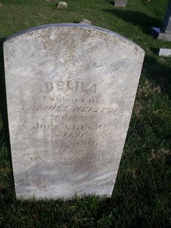
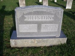
| Description | : | J. S. Heiston Dies in Page Co. Luray, Oct. 5 - Joseph Samuel Heiston, 77, Page County farmer died suddenly at his home on Dry Run, near here this morning. Mr. Heiston suffered a broken hip in August but was believed to be recovering. A son of the late Samuel and Delilah Fox Heiston, he is survived by his widow, the former Miss Dora Griffith and three children, Cletus F. and John S. Heiston and Mrs. Phillip Dinges, all of Luray. He also leaves one sister, Mrs. Joseph Sours, of Culpeper. Five sisters and one brother preceded him in... Read More |
frequently asked questions (FAQ):
-
Where is Joseph Samuel “Joe Sam” Heiston's memorial?
Joseph Samuel “Joe Sam” Heiston's memorial is located at: Locust Grove Cemetery, Brewster, Okanogan County, USA.
-
When did Joseph Samuel “Joe Sam” Heiston death?
Joseph Samuel “Joe Sam” Heiston death on 8 Oct 1954 in Compton, Page County, Virginia, USA
-
Where are the coordinates of the Joseph Samuel “Joe Sam” Heiston's memorial?
Latitude: 48.1114006
Longitude: -119.7746964
Family Members:
Parent
Spouse
Siblings
Children

Flowers:


Nearby Cemetories:
1. Locust Grove Cemetery
Brewster, Okanogan County, USA
Coordinate: 48.1114006, -119.7746964
2. Elizabeth Osborn Mikel Gravesite
Brewster, Okanogan County, USA
Coordinate: 48.1498900, -119.7514700
3. Paradise Hill Cemetery
Brewster, Okanogan County, USA
Coordinate: 48.1848980, -119.8411900
4. Fort Okanogan Memorial Cemetery
Okanogan, Okanogan County, USA
Coordinate: 48.1594009, -119.6632996
5. Packwood Memorial Cemetery
Dyer, Douglas County, USA
Coordinate: 48.0118305, -119.8178880
6. Pateros Cemetery
Pateros, Okanogan County, USA
Coordinate: 48.0516600, -119.9097300
7. Dick Family Cemetery
Okanogan County, USA
Coordinate: 48.0502700, -119.9241700
8. Miller Family Cemetery
Okanogan County, USA
Coordinate: 48.0530300, -119.9288000
9. Bridgeport Cemetery
Bridgeport, Douglas County, USA
Coordinate: 48.0050000, -119.6738800
10. Chiliwist Cemetery
Okanogan County, USA
Coordinate: 48.2630997, -119.7363968
11. Methow Cemetery
Methow, Okanogan County, USA
Coordinate: 48.1102982, -120.0124969
12. Malott Community Cemetery
Malott, Okanogan County, USA
Coordinate: 48.2925000, -119.7047300
13. Cameron Lake Pioneer Memorial Cemetery
Malott, Okanogan County, USA
Coordinate: 48.2708330, -119.5700000
14. Buckingham Cemetery
Douglas County, USA
Coordinate: 47.8669014, -119.6286011
15. Okanogan City Cemetery
Okanogan, Okanogan County, USA
Coordinate: 48.3546982, -119.6061020
16. Beaver Creek Cemetery
Twisp, Okanogan County, USA
Coordinate: 48.3272000, -120.0564000
17. Spring Coulee Family Cemetery
Okanogan County, USA
Coordinate: 48.3895950, -119.6289460
18. Chelan Fraternal Cemetery
Chelan, Chelan County, USA
Coordinate: 47.8502998, -120.0081024
19. Mount Olivet Cemetery
Chelan, Chelan County, USA
Coordinate: 47.8451000, -119.9946000
20. Okanogan Valley Memorial Gardens
Omak, Okanogan County, USA
Coordinate: 48.3911018, -119.5691986
21. Omak Memorial Cemetery
Okanogan, Okanogan County, USA
Coordinate: 48.3874000, -119.5565800
22. Mansfield Cemetery
Mansfield, Douglas County, USA
Coordinate: 47.8088880, -119.6508330
23. Riverview Cemetery
Chelan, Chelan County, USA
Coordinate: 47.8335991, -119.9944000
24. Saint Andrews Episcopal Church
Chelan, Chelan County, USA
Coordinate: 47.8397460, -120.0183780