| Birth | : | 24 Apr 1833 Allegheny County, Pennsylvania, USA |
| Death | : | 25 Dec 1864 Annapolis, Anne Arundel County, Maryland, USA |
| Burial | : | Oceola Cemetery #2, Oceola, Crawford County, USA |
| Coordinate | : | 40.8388350, -83.0927630 |
| Plot | : | Row 12, Stone 5 Grave 202 |
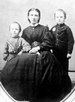
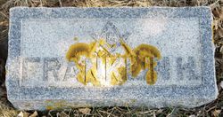
| Description | : | Josiah was the 7th of 12 children born to his parents, Jacob and Margaret Staley. When he was a teenager, he traveled with his family from Allegheny County, Pennsylvania, to Crawford County, Ohio, a distance of about 200 miles. Josiah married Hannah Parthenia Stephens December 10, 1854 in Crawford Co, Ohio. They had three sons, Marion, Franklin H. and J. Melroy. Marion died in childhood. Josiah was mustered into service on September 24, 1862, at Monroeville Ohio. He belonged to the 123rd Regiment, Company H, Ohio Volunteers. He was captured at Winchester, and taken to Libby Prison,... Read More |
frequently asked questions (FAQ):
-
Where is Josiah Staley's memorial?
Josiah Staley's memorial is located at: Oceola Cemetery #2, Oceola, Crawford County, USA.
-
When did Josiah Staley death?
Josiah Staley death on 25 Dec 1864 in Annapolis, Anne Arundel County, Maryland, USA
-
Where are the coordinates of the Josiah Staley's memorial?
Latitude: 40.8388350
Longitude: -83.0927630
Family Members:
Parent
Spouse
Siblings
Children
Flowers:
Nearby Cemetories:
1. Oceola Cemetery #2
Oceola, Crawford County, USA
Coordinate: 40.8388350, -83.0927630
2. Oceola Cemetery #3
Oceola, Crawford County, USA
Coordinate: 40.8416110, -83.0934010
3. Oceola Cemetery #1
Oceola, Crawford County, USA
Coordinate: 40.8439630, -83.0886740
4. Captain Harters Farm Burial Site
Oceola, Crawford County, USA
Coordinate: 40.8465500, -83.0967700
5. Nevada Cemetery
Nevada, Wyandot County, USA
Coordinate: 40.8342018, -83.1327972
6. Martin Luther Cemetery
Bucyrus, Crawford County, USA
Coordinate: 40.8113650, -83.0744290
7. Hill Burial Site
Edenville, Wyandot County, USA
Coordinate: 40.8541490, -83.1318860
8. Spore Cemetery
Spore, Crawford County, USA
Coordinate: 40.8633064, -83.0520272
9. Burke's Church Cemetery
Nevada, Wyandot County, USA
Coordinate: 40.7893982, -83.1500015
10. Gilliland Cemetery
Edenville, Wyandot County, USA
Coordinate: 40.8331100, -83.1793600
11. Mount Zion Cemetery
Bucyrus, Crawford County, USA
Coordinate: 40.7759552, -83.0548328
12. Ulrich Cemetery
Wyandot County, USA
Coordinate: 40.8480988, -83.1913986
13. Salem Cemetery
Eden Township, Wyandot County, USA
Coordinate: 40.8408230, -83.1929050
14. Union Church Cemetery
Upper Sandusky, Wyandot County, USA
Coordinate: 40.8774185, -83.1894226
15. Quaker Cemetery
Bucyrus, Crawford County, USA
Coordinate: 40.8335090, -82.9790930
16. Swartz Cemetery
Nevada, Wyandot County, USA
Coordinate: 40.7728336, -83.1688090
17. Benton Cemetery
Benton, Crawford County, USA
Coordinate: 40.9270009, -83.0985258
18. Wyandot Indian Cemetery
Nevada, Wyandot County, USA
Coordinate: 40.7675216, -83.1617790
19. Holy Trinity Cemetery
Bucyrus, Crawford County, USA
Coordinate: 40.8145750, -82.9803230
20. Union Cemetery
Bucyrus, Crawford County, USA
Coordinate: 40.8147640, -82.9794310
21. Oakwood Cemetery
Bucyrus, Crawford County, USA
Coordinate: 40.7989006, -82.9863968
22. City Cemetery
Bucyrus, Crawford County, USA
Coordinate: 40.7975750, -82.9857500
23. Bucyrus Mausoleum
Bucyrus, Crawford County, USA
Coordinate: 40.7971700, -82.9856500
24. Lutheran Burying Ground (Defunct)
Bucyrus, Crawford County, USA
Coordinate: 40.8071380, -82.9791190


