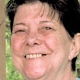
Joyce Galbraith Bridges
| Birth | : | 29 Apr 1942 El Dorado, Union County, Arkansas, USA |
| Death | : | 9 Mar 2019 Sherwood, Pulaski County, Arkansas, USA |
| Burial | : | Old Parkers Chapel Cemetery, Parkers Chapel, Union County, USA |
| Coordinate | : | 33.1470000, -92.7258300 |
| Description | : | Obituary for Joyce G Bridges Joyce Galbraith Bridges age 76 of El Dorado, AR passed away Saturday, March 9, 2019 at CHI St. Vincent North Health System in Sherwood, AR. Joyce was born on April 29, 1942 in El Dorado the late Floy English Galbraith and George Galbraith. Joyce began working at AandW Root Beer Stand when she was just a young woman, which is where she met her future husband R.B. Bridges. She later worked at Samples Department Store, Bell Ladyman Department Store, Chick A Dilly Chicken and was the owner and operator of Handee Wash... Read More |
frequently asked questions (FAQ):
-
Where is Joyce Galbraith Bridges's memorial?
Joyce Galbraith Bridges's memorial is located at: Old Parkers Chapel Cemetery, Parkers Chapel, Union County, USA.
-
When did Joyce Galbraith Bridges death?
Joyce Galbraith Bridges death on 9 Mar 2019 in Sherwood, Pulaski County, Arkansas, USA
-
Where are the coordinates of the Joyce Galbraith Bridges's memorial?
Latitude: 33.1470000
Longitude: -92.7258300
Family Members:
Parent
Spouse
Flowers:
Nearby Cemetories:
1. Old Parkers Chapel Cemetery
Parkers Chapel, Union County, USA
Coordinate: 33.1470000, -92.7258300
2. Shady Grove Cemetery
Parkers Chapel, Union County, USA
Coordinate: 33.1350000, -92.7093000
3. Meek-Traylor Cemetery
Parkers Chapel, Union County, USA
Coordinate: 33.1333677, -92.7002846
4. Parkers Chapel Church Cemetery
Parkers Chapel, Union County, USA
Coordinate: 33.1724500, -92.7217700
5. Galilee Cemetery
El Dorado, Union County, USA
Coordinate: 33.1716995, -92.6841965
6. Beulah Grove Cemetery
El Dorado, Union County, USA
Coordinate: 33.1954000, -92.7133000
7. Wesson Cemetery
Wesson, Union County, USA
Coordinate: 33.1074300, -92.7642700
8. Wyatt-Parnell Cemetery
El Dorado, Union County, USA
Coordinate: 33.1958008, -92.7442017
9. Cummings Cemetery
Junction City, Union County, USA
Coordinate: 33.0989000, -92.7037800
10. Rogers Family Cemetery
El Dorado, Union County, USA
Coordinate: 33.2010440, -92.7245660
11. Hammond Cemetery
El Dorado, Union County, USA
Coordinate: 33.1988983, -92.7071991
12. Beulah Grove Wesson Cemetery
Wesson, Union County, USA
Coordinate: 33.1063995, -92.7696991
13. Friendship Cemetery
El Dorado, Union County, USA
Coordinate: 33.1936000, -92.6818000
14. Stamps Cemetery
El Dorado, Union County, USA
Coordinate: 33.1490000, -92.6539000
15. Mount Calvary Cemetery
El Dorado, Union County, USA
Coordinate: 33.1900000, -92.6645000
16. Lott-Burgy Cemetery
El Dorado, Union County, USA
Coordinate: 33.1917000, -92.6649000
17. Saint Marks Cemetery
Union County, USA
Coordinate: 33.1006000, -92.6639000
18. Carroll Cemetery
Wesson, Union County, USA
Coordinate: 33.1724000, -92.8037000
19. Pleasant Hill Cemetery
Wesson, Union County, USA
Coordinate: 33.1025000, -92.7946000
20. Centre Point Cemetery
El Dorado, Union County, USA
Coordinate: 33.2198982, -92.7304993
21. Presbyterian Cemetery
El Dorado, Union County, USA
Coordinate: 33.2085991, -92.6631012
22. Harris Cemetery
El Dorado, Union County, USA
Coordinate: 33.1966600, -92.8031000
23. Smyrna Cemetery
El Dorado, Union County, USA
Coordinate: 33.1143990, -92.6342010
24. Warner Brown Cemetery
El Dorado, Union County, USA
Coordinate: 33.2108002, -92.6614990


