| Birth | : | 7 Nov 1943 Boone, Boone County, Iowa, USA |
| Death | : | 10 Jan 2009 Boone, Boone County, Iowa, USA |
| Burial | : | Greenwood Cemetery, Georgetown, Halton Regional Municipality, Canada |
| Coordinate | : | 43.6545830, -79.9119110 |
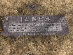
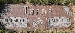
| Description | : | Joyce (Thede) Lindahl 1943 - 2009 Joyce Lindahl, age 65, of 1191-198th Road, died January 10, 2009, at the Boone County Hospital. Funeral services are Thursday, January 15, 2009, at 10:30 a.m. at the Augustana Lutheran Church with Rev. Daniel Solomon officiating. Burial will be in the Rose Hill Cemetery, west of Boone. Joyce was born in Boone on November 7, 1943, the daughter of Henry and Mae (Spreager) Thede. She graduated from Boone High School in 1961 and from DMACC Boone Campus in 1992. On December 31, 1961, Joyce married James LaVerne Lindahl in Boone. From 1980... Read More |
frequently asked questions (FAQ):
-
Where is Joyce Rae Thede Lindahl's memorial?
Joyce Rae Thede Lindahl's memorial is located at: Greenwood Cemetery, Georgetown, Halton Regional Municipality, Canada.
-
When did Joyce Rae Thede Lindahl death?
Joyce Rae Thede Lindahl death on 10 Jan 2009 in Boone, Boone County, Iowa, USA
-
Where are the coordinates of the Joyce Rae Thede Lindahl's memorial?
Latitude: 43.6545830
Longitude: -79.9119110
Family Members:
Parent
Spouse
Siblings
Children
Flowers:
Nearby Cemetories:
1. Greenwood Cemetery
Georgetown, Halton Regional Municipality, Canada
Coordinate: 43.6545830, -79.9119110
2. Saint George's Anglican Church Cemetery
Georgetown, Halton Regional Municipality, Canada
Coordinate: 43.6507300, -79.9224000
3. Glen Williams Cemetery
Halton Hills, Halton Regional Municipality, Canada
Coordinate: 43.6729600, -79.9220800
4. Saint John's Anglican Church Cemetery
Georgetown, Halton Regional Municipality, Canada
Coordinate: 43.6307330, -79.9239600
5. Georgetown Wesleyan Methodist Cemetery (Defunct)
Georgetown, Halton Regional Municipality, Canada
Coordinate: 43.6490000, -79.9479998
6. Holy Redeemer Cemetery
Georgetown, Halton Regional Municipality, Canada
Coordinate: 43.6303865, -79.9387223
7. Devereaux Cemetery
Halton Hills, Halton Regional Municipality, Canada
Coordinate: 43.6303865, -79.9387223
8. Mount Pleasant Wesleyan Methodist Cemetery
Georgetown, Halton Regional Municipality, Canada
Coordinate: 43.6196000, -79.9098000
9. Union Presbyterian Church Cemetery
Georgetown, Halton Regional Municipality, Canada
Coordinate: 43.6929340, -79.9177998
10. Saint Paul's Anglican Church Cemetery
Halton Hills, Halton Regional Municipality, Canada
Coordinate: 43.6442010, -79.8575000
11. McNabb Cemetery
Halton Hills, Halton Regional Municipality, Canada
Coordinate: 43.6490000, -79.8559998
12. Hillcrest Cemetery
Halton Hills, Halton Regional Municipality, Canada
Coordinate: 43.6432490, -79.8570010
13. Limehouse Presbyterian Cemetery
Limehouse, Halton Regional Municipality, Canada
Coordinate: 43.6467990, -79.9699990
14. St. Elias Church and Cemetery
Brampton, Peel Regional Municipality, Canada
Coordinate: 43.6612500, -79.8456900
15. Ashgrove United Church Cemetery
Halton Hills, Halton Regional Municipality, Canada
Coordinate: 43.6037000, -79.8890000
16. Alloa Methodist United Church Cemetery
Brampton, Peel Regional Municipality, Canada
Coordinate: 43.6957420, -79.8457570
17. Huttonville Cemetery
Huttonville, Peel Regional Municipality, Canada
Coordinate: 43.6593323, -79.8191147
18. Page's Methodist Episcopal Church Cemetery
Brampton, Peel Regional Municipality, Canada
Coordinate: 43.6413100, -79.8188760
19. Bannockburn Pioneer Cemetery
Halton Hills, Halton Regional Municipality, Canada
Coordinate: 43.6569350, -80.0068750
20. Brampton Memorial Gardens
Brampton, Peel Regional Municipality, Canada
Coordinate: 43.6877200, -79.8098200
21. Brampton Cemetery
Brampton, Peel Regional Municipality, Canada
Coordinate: 43.6872680, -79.8086580
22. Brownridge Family Cemetery
Halton Hills, Halton Regional Municipality, Canada
Coordinate: 43.5782990, -79.8647790
23. Ballinafad Cemetery
Ballinafad, Wellington County, Canada
Coordinate: 43.6959000, -80.0128400
24. Pickard Family Farm Cemetery
Halton, Halton Regional Municipality, Canada
Coordinate: 43.5889367, -79.8377190


