| Birth | : | 8 Mar 1813 San Diego, San Diego County, California, USA |
| Death | : | 5 Sep 1833 Monterey, Monterey County, California, USA |
| Burial | : | Mission San Carlos Cemetery, Monterey, Monterey County, USA |
| Coordinate | : | 36.5956078, -121.8904190 |
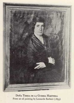
| Description | : | Juan José Antonio María de la Guerra y Carrillo was born at San Diego, Alta California, New Spain, where he was baptized at the Presidio Chapel March 18, 1813 (SD Baptism 04031). He was the son of teniente (lieutenant) Juan José Antonio Julian de la Guerra y Noriega and María Antonia Juliana Carrillo y Lugo. As a young man he went to Monterey to stay with his brother-in-law, William Hartnell, in order to attend surveying classes under the tutelage of Fr. Patrick Short at Mission Carmel. While in Monterey he met a Scottish botanist, David Douglas, who also encouraged... Read More |
frequently asked questions (FAQ):
-
Where is Juan Jose de la Guerra's memorial?
Juan Jose de la Guerra's memorial is located at: Mission San Carlos Cemetery, Monterey, Monterey County, USA.
-
When did Juan Jose de la Guerra death?
Juan Jose de la Guerra death on 5 Sep 1833 in Monterey, Monterey County, California, USA
-
Where are the coordinates of the Juan Jose de la Guerra's memorial?
Latitude: 36.5956078
Longitude: -121.8904190
Family Members:
Parent
Siblings
Flowers:
Nearby Cemetories:
1. Mission San Carlos Cemetery
Monterey, Monterey County, USA
Coordinate: 36.5956078, -121.8904190
2. San Carlos Cemetery
Monterey, Monterey County, USA
Coordinate: 36.5951881, -121.8871460
3. Monterey City Cemetery
Monterey, Monterey County, USA
Coordinate: 36.5954475, -121.8845215
4. Alexis Nino Burial Site
Monterey, Monterey County, USA
Coordinate: 36.6055565, -121.8955307
5. Presidio of Monterey Cemetery
Monterey, Monterey County, USA
Coordinate: 36.6058006, -121.9151306
6. Steinbeck Estate Burial Site
Pacific Grove, Monterey County, USA
Coordinate: 36.6197319, -121.9080276
7. Saint Mary's Episcopal Church Leslie Garden
Pacific Grove, Monterey County, USA
Coordinate: 36.6211200, -121.9145800
8. City of Carmel Memorials
Carmel-by-the-Sea, Monterey County, USA
Coordinate: 36.5552979, -121.9203339
9. El Carmelo Cemetery
Pacific Grove, Monterey County, USA
Coordinate: 36.6325836, -121.9319763
10. Carmel Mission Cemetery
Carmel-by-the-Sea, Monterey County, USA
Coordinate: 36.5430603, -121.9199600
11. Mission Memorial Park
Seaside, Monterey County, USA
Coordinate: 36.6191635, -121.8217926
12. Carmelite Monastery Cemetery
Monterey, Monterey County, USA
Coordinate: 36.5231400, -121.9232635
13. California Central Coast Veterans Cemetery
Seaside, Monterey County, USA
Coordinate: 36.6371900, -121.7963600
14. Saint Dunstans Episcopal Church Columbarium
Carmel Valley, Monterey County, USA
Coordinate: 36.5197330, -121.8059160
15. Whitcher Cemetery
East Garrison, Monterey County, USA
Coordinate: 36.6501730, -121.7305270
16. Church of the Good Shepherd Cemetery
Salinas, Monterey County, USA
Coordinate: 36.5413990, -121.7260410
17. Calvary Catholic Cemetery
Salinas, Monterey County, USA
Coordinate: 36.6880341, -121.6818085
18. Saint Pauls Episcopal Church Columbarium
Salinas, Monterey County, USA
Coordinate: 36.6588430, -121.6558850
19. Garden of Memories
Salinas, Monterey County, USA
Coordinate: 36.6565247, -121.6384125
20. Castroville Public Cemetery
Moss Landing, Monterey County, USA
Coordinate: 36.7930145, -121.7851410
21. Yamato Cemetery
Salinas, Monterey County, USA
Coordinate: 36.6552811, -121.6307297
22. Chinese Cemetery
Salinas, Monterey County, USA
Coordinate: 36.6952057, -121.6390381
23. Monterey County Potters Field Cemetery
Salinas, Monterey County, USA
Coordinate: 36.6960900, -121.6381950
24. Saint Georges Episcopal Church Columbarium
Salinas, Monterey County, USA
Coordinate: 36.7062580, -121.6440980


