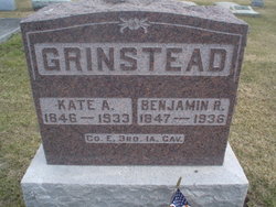
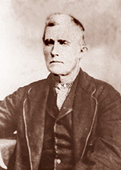
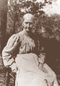
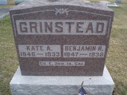
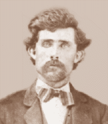
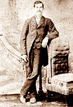
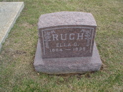
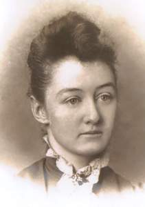
Kate Amanda “Mandy” Rugh Grinstead
| Birth | : | 5 Jun 1846 Dauphin County, Pennsylvania, USA |
| Death | : | 8 Feb 1933 Scotland County, Missouri, USA |
| Burial | : | Christ Church Cemetery, Redding, Fairfield County, USA |
| Coordinate | : | 41.3136444, -73.3509903 |
| Description | : | Kate married 1st in 1864 to Alanson L. Weed. A letter from Alanson Lockwood Weed, Sr. to Edward Franklin Weed of Rowayton, Connecticut, states his first wife was born in Dauphin county, Pennsylvania. Also he filled out a questionnaire that stated his first wife’s maiden name was Amanda Rugh and she was a daughter of John Rugh and Catherine Gorman. (this information from Robyn Weed contirbutor# 47822378. She married 2nd on January 20, 1870, Scotland County, Missouri, to Benjamin Rufus Grinstead. |
frequently asked questions (FAQ):
-
Where is Kate Amanda “Mandy” Rugh Grinstead's memorial?
Kate Amanda “Mandy” Rugh Grinstead's memorial is located at: Christ Church Cemetery, Redding, Fairfield County, USA.
-
When did Kate Amanda “Mandy” Rugh Grinstead death?
Kate Amanda “Mandy” Rugh Grinstead death on 8 Feb 1933 in Scotland County, Missouri, USA
-
Where are the coordinates of the Kate Amanda “Mandy” Rugh Grinstead's memorial?
Latitude: 41.3136444
Longitude: -73.3509903
Family Members:
Parent
Spouse
Siblings
Children
Flowers:
Nearby Cemetories:
1. Christ Church Cemetery
Redding, Fairfield County, USA
Coordinate: 41.3136444, -73.3509903
2. Redding Ridge Cemetery
Redding, Fairfield County, USA
Coordinate: 41.3088989, -73.3475037
3. Hopewell Cemetery
Redding, Fairfield County, USA
Coordinate: 41.3315000, -73.3390000
4. First Church of Christ Congregational Mem Garden
West Redding, Fairfield County, USA
Coordinate: 41.3047400, -73.3787580
5. Sanford Cemetery
Redding, Fairfield County, USA
Coordinate: 41.3013260, -73.3226520
6. Redding Center Cemetery
Redding, Fairfield County, USA
Coordinate: 41.3035545, -73.3822784
7. Great Pasture Road Cemetery
Redding, Fairfield County, USA
Coordinate: 41.2990000, -73.3901000
8. Den Cemetery
Easton, Fairfield County, USA
Coordinate: 41.2810300, -73.3401300
9. Isaac Hamilton Cemetery
Redding, Fairfield County, USA
Coordinate: 41.3297424, -73.3904114
10. Lyon Cemetery
Easton, Fairfield County, USA
Coordinate: 41.2919000, -73.3146000
11. Putnam Memorial State Park
Redding, Fairfield County, USA
Coordinate: 41.3421478, -73.3833084
12. Hull Cemetery
Redding, Fairfield County, USA
Coordinate: 41.2971992, -73.3972015
13. Bennett Cemetery
Easton, Fairfield County, USA
Coordinate: 41.3015214, -73.2870569
14. Wolfpit Cemetery
Bethel, Fairfield County, USA
Coordinate: 41.3591000, -73.3789000
15. Umpawaug Cemetery
Redding, Fairfield County, USA
Coordinate: 41.2949982, -73.4197006
16. Morgan Cemetery
Newtown, Fairfield County, USA
Coordinate: 41.3671989, -73.3308029
17. Huntingtown Cemetery
Newtown, Fairfield County, USA
Coordinate: 41.3499985, -73.2932968
18. Godfrey Cemetery
Weston, Fairfield County, USA
Coordinate: 41.2596300, -73.3738980
19. Union Cemetery
Easton, Fairfield County, USA
Coordinate: 41.2728004, -73.2972031
20. Benedictine Grange Cemetery
Redding, Fairfield County, USA
Coordinate: 41.2740370, -73.4065730
21. Flat Swamp Cemetery #01
Newtown, Fairfield County, USA
Coordinate: 41.3745689, -73.3469772
22. Flat Swamp Cemetery #2
Newtown, Fairfield County, USA
Coordinate: 41.3752556, -73.3464661
23. Stepney Cemetery
Monroe, Fairfield County, USA
Coordinate: 41.3224983, -73.2632980
24. Saint Marys Cemetery
Bethel, Fairfield County, USA
Coordinate: 41.3591995, -73.4167023

