


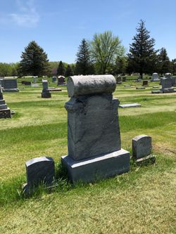
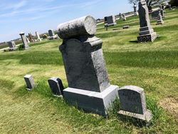
Katherina Maria Sophia Noehring Abel
| Birth | : | 11 Mar 1836 Mecklenburg-Vorpommern, Germany |
| Death | : | 30 Nov 1922 Burnside, Webster County, Iowa, USA |
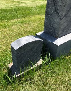
| Burial | : | Dayton Cemetery, Dayton, Webster County, USA |
| Coordinate | : | 42.2675000, -94.0755000 |
| Plot | : | Section 3 |
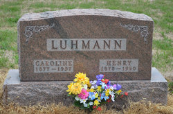
| Description | : | Dayton Review December 14, 1922 Mrs. August Abel died November 30 at Burnside Township. Katherina Maria Sophia Moehring was born March 11, 1836 in Guitsheff, Mecklenburg province, Germany. She married there in 1865. In 1868 she came to the United States and Fort Dodge, Iowa, and three years later to a farm that is still farmed by her son, August. She was preceded in death by her husband in 1904 and a son, Otto, in 1886 at the age of 14 years. She leaves children, August and Caroline (Mrs. Henry Luhmann); three sisters, Mrs. Sophie Schlief of Chicago, Mrs.... Read More |
frequently asked questions (FAQ):
-
Where is Katherina Maria Sophia Noehring Abel's memorial?
Katherina Maria Sophia Noehring Abel's memorial is located at: Dayton Cemetery, Dayton, Webster County, USA.
-
When did Katherina Maria Sophia Noehring Abel death?
Katherina Maria Sophia Noehring Abel death on 30 Nov 1922 in Burnside, Webster County, Iowa, USA
-
Where are the coordinates of the Katherina Maria Sophia Noehring Abel's memorial?
Latitude: 42.2675000
Longitude: -94.0755000
Family Members:
Spouse
Children
Flowers:


Nearby Cemetories:
1. Dayton Cemetery
Dayton, Webster County, USA
Coordinate: 42.2675000, -94.0755000
2. Christ the King Catholic Cemetery
Dayton, Webster County, USA
Coordinate: 42.2601929, -94.0727539
3. Bass Cemetery
Dayton, Webster County, USA
Coordinate: 42.2966995, -94.0149994
4. Swedish Lutheran Church Cemetery
Dayton, Webster County, USA
Coordinate: 42.2175000, -94.1065000
5. Oak Grove Cemetery
Lehigh, Webster County, USA
Coordinate: 42.3438988, -94.0475006
6. Hardin Township Cemetery
Hardin Township, Webster County, USA
Coordinate: 42.2411003, -93.9708023
7. Linn Cemetery
Pilot Mound, Boone County, USA
Coordinate: 42.2045330, -93.9970230
8. Lawn Cemetery
Boone County, USA
Coordinate: 42.1771011, -94.0867996
9. West Lawn Cemetery
Lehigh, Webster County, USA
Coordinate: 42.3616982, -94.0678024
10. McGuire Bend Cemetery
Dayton, Webster County, USA
Coordinate: 42.3410000, -93.9880000
11. Runyan Cemetery
Pilot Mound, Boone County, USA
Coordinate: 42.1749992, -94.0015030
12. Pilot Mound Cemetery
Pilot Mound, Boone County, USA
Coordinate: 42.1636200, -94.0282600
13. Vegors Cemetery
Webster County, USA
Coordinate: 42.3177986, -93.9421997
14. Lost Grove Cemetery
Harcourt, Webster County, USA
Coordinate: 42.2583008, -94.2331009
15. Hooks Point Cemetery
Hamilton County, USA
Coordinate: 42.2944530, -93.9199090
16. Oakwood Cemetery
Stratford, Hamilton County, USA
Coordinate: 42.2942009, -93.9182968
17. Hartman Cemetery
Lehigh, Webster County, USA
Coordinate: 42.3666397, -93.9835627
18. White Cemetery
Boone County, USA
Coordinate: 42.1777992, -93.9636002
19. Border Plains Cemetery
Border Plains, Webster County, USA
Coordinate: 42.3917000, -94.0448000
20. Ober and Scott Cemetery
Duncombe, Webster County, USA
Coordinate: 42.3841390, -93.9982856
21. Union Cemetery
Boxholm, Boone County, USA
Coordinate: 42.1369019, -94.0852966
22. Renner Cemetery
Boone County, USA
Coordinate: 42.1380420, -94.1256570
23. Otho Cemetery
Otho, Webster County, USA
Coordinate: 42.4025002, -94.1153030
24. Schlicht Cemetery
Fraser, Boone County, USA
Coordinate: 42.1444200, -93.9780100