
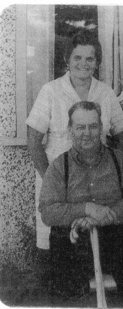

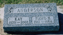
Kathleen “Kay” Donick Anderson
| Birth | : | 14 Aug 1920 Taber, Lethbridge Census Division, Alberta, Canada |
| Death | : | 29 Jan 2003 Taber, Lethbridge Census Division, Alberta, Canada |
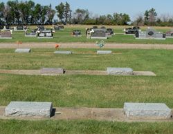
| Burial | : | Iantha Cemetery, Iantha, Barton County, USA |
| Coordinate | : | 37.5250015, -94.4049988 |
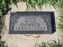
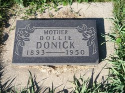
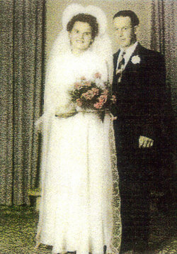
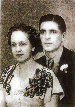
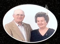
| Description | : | KAY ANDERSON 1920 - 2003 Kay Anderson of Taber, beloved wife of the late Mr. Floyd Anderson, passed away on Wednesday, January 29, 2003 at the age of 82 years. Kay was born in Taber on August 14, 1920, one of eight children born to Nicholas and Dorothy Donick. On September 2, 1946 she was united in marriage to Floyd Anderson. They remained in the Taber area where they farmed for many years before retiring to the Town of Taber in 1974. Kay always kept busy working hard on the farm and at the Cannery but always had the time... Read More |
frequently asked questions (FAQ):
-
Where is Kathleen “Kay” Donick Anderson's memorial?
Kathleen “Kay” Donick Anderson's memorial is located at: Iantha Cemetery, Iantha, Barton County, USA.
-
When did Kathleen “Kay” Donick Anderson death?
Kathleen “Kay” Donick Anderson death on 29 Jan 2003 in Taber, Lethbridge Census Division, Alberta, Canada
-
Where are the coordinates of the Kathleen “Kay” Donick Anderson's memorial?
Latitude: 37.5250015
Longitude: -94.4049988
Family Members:
Parent
Spouse
Siblings
Flowers:


Nearby Cemetories:
1. Iantha Cemetery
Iantha, Barton County, USA
Coordinate: 37.5250015, -94.4049988
2. Barton City Cemetery
Liberal, Barton County, USA
Coordinate: 37.5774994, -94.4721985
3. Oak Grove Cemetery
Oakton, Barton County, USA
Coordinate: 37.4556007, -94.3544006
4. Barton County Poor Farm Cemetery
Lamar, Barton County, USA
Coordinate: 37.4754500, -94.3248900
5. Liberal City Cemetery
Liberal, Barton County, USA
Coordinate: 37.5621986, -94.5057983
6. Saint Marys Cemetery
Lamar Heights, Barton County, USA
Coordinate: 37.4958000, -94.2968979
7. Lake Cemetery
Lamar Heights, Barton County, USA
Coordinate: 37.4956017, -94.2957993
8. Bakers Grove Cemetery
Barton County, USA
Coordinate: 37.6063995, -94.3516998
9. Apostolic Christian Cemetery
Barton County, USA
Coordinate: 37.4301340, -94.4050990
10. Bluff Cemetery
Verdella, Barton County, USA
Coordinate: 37.6301220, -94.3785450
11. Nigh Cemetery
Lamar, Barton County, USA
Coordinate: 37.5341988, -94.2643967
12. Memory Gardens Cemetery
Lamar, Barton County, USA
Coordinate: 37.4854000, -94.2663900
13. Pierce Cemetery
Barton County, USA
Coordinate: 37.4207993, -94.4736023
14. East Side Cemetery
Lamar, Barton County, USA
Coordinate: 37.4878006, -94.2619019
15. Killey Cemetery
Boston, Barton County, USA
Coordinate: 37.4163100, -94.3129100
16. Forest Grove Cemetery
Lamar, Barton County, USA
Coordinate: 37.4338500, -94.2606400
17. Waters Cemetery
Barton County, USA
Coordinate: 37.3708000, -94.3647003
18. Mindenmines Cemetery
Mindenmines, Barton County, USA
Coordinate: 37.4639381, -94.5913460
19. Nashville Cemetery
Nashville, Barton County, USA
Coordinate: 37.3752690, -94.4828300
20. Leroy Cemetery
Barton County, USA
Coordinate: 37.6246986, -94.5753021
21. Shiloh Cemetery
Liberal, Barton County, USA
Coordinate: 37.6455994, -94.5563965
22. Yale Cemetery
Mindenmines, Barton County, USA
Coordinate: 37.4836900, -94.6155000
23. Rosebank Cemetery
Mulberry, Crawford County, USA
Coordinate: 37.5518990, -94.6194000
24. Fair View Cemetery
Barton County, USA
Coordinate: 37.4914017, -94.1864014