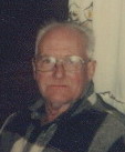
Kenneth Lionell “Red” Colahan
| Birth | : | 8 Jan 1912 Kirkland, DeKalb County, Illinois, USA |
| Death | : | 4 Aug 1995 Topeka, Shawnee County, Kansas, USA |
| Burial | : | Mays Chapel Cemetery, Timonium, Baltimore County, USA |
| Coordinate | : | 39.4503000, -76.6618300 |
| Plot | : | Memorial Lawn A, Lot 518, Sp3 |
| Inscription | : | PFC US ARMY WORLD WAR II |
| Description | : | Kenneth L. "Red" Colahan, 83, Topeka KS, died Friday, Aug 4, 1995 at a Topeka nursing home. He had been employed by the United Methodist Home. Mr Colahan served in the Army during World War II from Aug 31, 1943 until Dec 29, 1945. He was born on Jan 7, 1912 in Kirkland IL (to James Levi and Cora May Hummell Colahan) He was raised by Willis and Pearl (Cora) Vanderbilt. He was married to Elva Olive Ewing on March 13, 1937 in Hartington NE. They divorced. His wife, Nettie Ruth Blanton Smith, preceded him in death. He... Read More |
frequently asked questions (FAQ):
-
Where is Kenneth Lionell “Red” Colahan's memorial?
Kenneth Lionell “Red” Colahan's memorial is located at: Mays Chapel Cemetery, Timonium, Baltimore County, USA.
-
When did Kenneth Lionell “Red” Colahan death?
Kenneth Lionell “Red” Colahan death on 4 Aug 1995 in Topeka, Shawnee County, Kansas, USA
-
Where are the coordinates of the Kenneth Lionell “Red” Colahan's memorial?
Latitude: 39.4503000
Longitude: -76.6618300
Family Members:
Parent
Spouse
Siblings
Flowers:
Nearby Cemetories:
1. Mays Chapel Cemetery
Timonium, Baltimore County, USA
Coordinate: 39.4503000, -76.6618300
2. Cockey Family Cemetery
Cockeysville, Baltimore County, USA
Coordinate: 39.4635010, -76.6426010
3. Saint Joseph Cemetery
Cockeysville, Baltimore County, USA
Coordinate: 39.4622700, -76.6388100
4. Saters Baptist Historical Church Cemetery
Timonium, Baltimore County, USA
Coordinate: 39.4362920, -76.6870810
5. Almshouse Cemetery
Cockeysville, Baltimore County, USA
Coordinate: 39.4596200, -76.6278900
6. Nisbet Cemetery
Cockeysville, Baltimore County, USA
Coordinate: 39.4627160, -76.6282660
7. Cockey-Reed Cemetery
Greenspring, Baltimore County, USA
Coordinate: 39.4196400, -76.6671300
8. Sherwood Episcopal Church Cemetery
Cockeysville, Baltimore County, USA
Coordinate: 39.4828600, -76.6438100
9. Old Gunpowder Friends' Burying Ground
Cockeysville, Baltimore County, USA
Coordinate: 39.4824917, -76.6426611
10. Dulaney Valley Memorial Gardens
Timonium, Baltimore County, USA
Coordinate: 39.4562300, -76.6160700
11. Bazil African Methodist Episcopal Church Cemetery
Cockeysville, Baltimore County, USA
Coordinate: 39.4828000, -76.6293600
12. Baltimore County Graveyard #86
Sparks, Baltimore County, USA
Coordinate: 39.4606500, -76.7146800
13. Ridgely and Talbott Family Cemetery
Baltimore County, USA
Coordinate: 39.4701960, -76.6116200
14. Carrolls-Gills United Methodist Church Cemetery
Lutherville, Baltimore County, USA
Coordinate: 39.4465300, -76.7185900
15. Grace Falls Road United Methodist Church Cemetery
Reisterstown, Baltimore County, USA
Coordinate: 39.4771300, -76.7081700
16. Ashland Presbyterian Church Cemetery
Cockeysville, Baltimore County, USA
Coordinate: 39.4940800, -76.6430400
17. Saint Paul's Evangelical Lutheran Church Cemetery
Shawan, Baltimore County, USA
Coordinate: 39.4716830, -76.7174190
18. Hunt Valley Towne Center
Hunt Valley, Baltimore County, USA
Coordinate: 39.4986763, -76.6553421
19. Convent of the Mission Helpers of the Sacred Heart
Towson, Baltimore County, USA
Coordinate: 39.4091500, -76.6267530
20. Price Family Cemetery
Oregon, Baltimore County, USA
Coordinate: 39.4968583, -76.6840278
21. Long Crandon Cemetery
Timonium, Baltimore County, USA
Coordinate: 39.4532980, -76.5967770
22. Church of the Good Shepherd Memorial Garden
Ruxton, Baltimore County, USA
Coordinate: 39.4024300, -76.6416600
23. Saint Johns AME Chapel Cemetery
Ruxton, Baltimore County, USA
Coordinate: 39.3944300, -76.6458400
24. Jessops United Methodist Church Cemetery
Sparks, Baltimore County, USA
Coordinate: 39.5078011, -76.6408005


