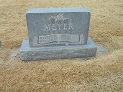
| Birth | : | 27 Sep 1928 Brule, Keith County, Nebraska, USA |
| Death | : | 28 May 2017 Nebraska, USA |
| Burial | : | Brule Cemetery, Brule, Keith County, USA |
| Coordinate | : | 41.1060982, -101.8822021 |
| Description | : | LaMoin was born south of Brule, Nebraska, the son of Henry & Minnie Meyer. He attended country school district 17, as well as Grant & Ogallala High School. He attended Southwest Community College Vo-Tech at the Milford Campus in Milford, NE., in 1949 before being drafted to serve in the Korean War in 1950. He trained at Fort Riley, Kansas before being shipped out from San Francisco to fight on the front lines of the Eastern Flank. LaMoin did forward reconnaissance for a year before his talent for fixing radios was noticed. He was transferred to Regimental Headquarters and promoted to... Read More |
frequently asked questions (FAQ):
-
Where is LaMoin Meyer's memorial?
LaMoin Meyer's memorial is located at: Brule Cemetery, Brule, Keith County, USA.
-
When did LaMoin Meyer death?
LaMoin Meyer death on 28 May 2017 in Nebraska, USA
-
Where are the coordinates of the LaMoin Meyer's memorial?
Latitude: 41.1060982
Longitude: -101.8822021
Family Members:
Parent
Spouse
Siblings
Flowers:
Nearby Cemetories:
1. Brule Cemetery
Brule, Keith County, USA
Coordinate: 41.1060982, -101.8822021
2. Ogallala Cemetery
Ogallala, Keith County, USA
Coordinate: 41.1286011, -101.7472000
3. Boot Hill Cemetery
Ogallala, Keith County, USA
Coordinate: 41.1324997, -101.7256012
4. Big Springs Cemetery
Big Springs, Deuel County, USA
Coordinate: 41.0592003, -102.0931015
5. Lemoyne Cemetery
Lemoyne, Keith County, USA
Coordinate: 41.2723000, -101.8123000
6. Trinity Lutheran Cemetery
Grant, Perkins County, USA
Coordinate: 40.9605000, -101.7478000
7. Day Cemetery
Deuel County, USA
Coordinate: 41.1921997, -102.1331024
8. Zion Cemetery
Deuel County, USA
Coordinate: 41.1641998, -102.1530991
9. Saint John's Lutheran Church Cemetery
Ogallala, Keith County, USA
Coordinate: 41.0617000, -101.5983000
10. Ash Hollow Cemetery
Lewellen, Garden County, USA
Coordinate: 41.3083000, -102.1252975
11. Plum Creek Cemetery
Garden County, USA
Coordinate: 41.3469009, -102.0828018
12. Fairview Cemetery
Grant, Perkins County, USA
Coordinate: 40.8372002, -101.7391968
13. Hillside Cemetery
Julesburg, Sedgwick County, USA
Coordinate: 40.9692001, -102.2406006
14. Ash Creek Cemetery
Lewellen, Garden County, USA
Coordinate: 41.3521996, -102.1205978
15. Pickard Cemetery
Keith County, USA
Coordinate: 41.0482240, -101.4809320
16. Durham Cemetery
Garden County, USA
Coordinate: 41.3314018, -102.2074966
17. Green Cemetery
Julesburg, Sedgwick County, USA
Coordinate: 40.8650000, -102.2284090
18. Berea Lutheran Cemetery
Chappell, Deuel County, USA
Coordinate: 41.2008900, -102.3439080
19. Fairview Cemetery
Garden County, USA
Coordinate: 41.4524994, -102.0233002
20. Madrid Cemetery
Madrid, Perkins County, USA
Coordinate: 40.8371510, -101.5380900
21. Venango Cemetery
Venango, Perkins County, USA
Coordinate: 40.7416992, -102.0175018
22. Ovid Cemetery
Ovid, Sedgwick County, USA
Coordinate: 40.9756012, -102.3632965
23. Mennonite Cemetery
Chappell, Deuel County, USA
Coordinate: 41.1244011, -102.3993988
24. Paxton Cemetery
Paxton, Keith County, USA
Coordinate: 41.1088982, -101.3569031


