
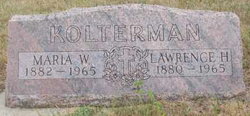
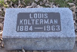
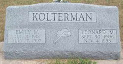
Lawrence H Kolterman
| Birth | : | 14 Feb 1880 Pierce County, Nebraska, USA |
| Death | : | 5 Feb 1965 Pierce County, Nebraska, USA |
| Burial | : | Netherlands American Cemetery and Memorial, Margraten, Eijsden-Margraten Municipality, Netherlands |
| Coordinate | : | 50.8176918, 5.8046441 |
frequently asked questions (FAQ):
-
Where is Lawrence H Kolterman's memorial?
Lawrence H Kolterman's memorial is located at: Netherlands American Cemetery and Memorial, Margraten, Eijsden-Margraten Municipality, Netherlands.
-
When did Lawrence H Kolterman death?
Lawrence H Kolterman death on 5 Feb 1965 in Pierce County, Nebraska, USA
-
Where are the coordinates of the Lawrence H Kolterman's memorial?
Latitude: 50.8176918
Longitude: 5.8046441
Family Members:
Parent
Spouse

Siblings
Children
Flowers:


Nearby Cemetories:
1. Netherlands American Cemetery and Memorial
Margraten, Eijsden-Margraten Municipality, Netherlands
Coordinate: 50.8176918, 5.8046441
2. Cadier en Keer Kerkhof
Cadier en Keer, Eijsden-Margraten Municipality, Netherlands
Coordinate: 50.8268600, 5.7695500
3. Begraafplaats Banholt
Banholt, Eijsden-Margraten Municipality, Netherlands
Coordinate: 50.7911800, 5.8139700
4. Reijmerstok Begraafplaats
Reijmerstok, Gulpen-Wittem Municipality, Netherlands
Coordinate: 50.7994500, 5.8407600
5. Algemene Begraafplaats
Valkenburg, Valkenburg aan de Geul Municipality, Netherlands
Coordinate: 50.8611100, 5.8248500
6. Oude Joodse Begraafplaats
Valkenburg, Valkenburg aan de Geul Municipality, Netherlands
Coordinate: 50.8613900, 5.8314100
7. Zusterbegraafplaats Rijckholt
Rijckholt, Eijsden-Margraten Municipality, Netherlands
Coordinate: 50.7961186, 5.7328002
8. Joodse Begraafplaats
Gulpen, Gulpen-Wittem Municipality, Netherlands
Coordinate: 50.8135290, 5.8865910
9. Wijlre Kerkhof
Wijlre, Gulpen-Wittem Municipality, Netherlands
Coordinate: 50.8315400, 5.8945100
10. Maastricht Oostermaas Cemetery
Maastricht, Maastricht Municipality, Netherlands
Coordinate: 50.8533700, 5.7224900
11. Begraafplaats Katholieke Kerk Heugem
Maastricht, Maastricht Municipality, Netherlands
Coordinate: 50.8315572, 5.7026935
12. Sint-Martens-Voeren Churchyard
Voeren, Arrondissement Tongeren, Belgium
Coordinate: 50.7492100, 5.8127200
13. Joodse Begraafplaats
Schimmert, Nuth Municipality, Netherlands
Coordinate: 50.8875400, 5.8149000
14. Kerkhof van Sint Pieter Op de Berg
Sint Pieter, Maastricht Municipality, Netherlands
Coordinate: 50.8313511, 5.6929176
15. Joodse Begraafplaats Meerssen
Meerssen Municipality, Netherlands
Coordinate: 50.8800900, 5.7473400
16. Joodse Begraafplaats
Eijsden-Margraten Municipality, Netherlands
Coordinate: 50.7760600, 5.7065700
17. Lanaye Communal Cemetery
Visé, Arrondissement de Liège, Belgium
Coordinate: 50.7819100, 5.6966500
18. Begraafplaats R.K. Parochie H Remigius
Klimmen, Voerendaal Municipality, Netherlands
Coordinate: 50.8764108, 5.8855418
19. Mechelen Kerkhof Cemetery
Mechelen, Gulpen-Wittem Municipality, Netherlands
Coordinate: 50.7964000, 5.9256700
20. Kanne Cemetery
Riemst, Arrondissement Tongeren, Belgium
Coordinate: 50.8143100, 5.6774900
21. Basiliek van Sint Servaas
Maastricht, Maastricht Municipality, Netherlands
Coordinate: 50.8487670, 5.6871100
22. Mechelen Kerk Begraafplaats apex
Mechelen, Gulpen-Wittem Municipality, Netherlands
Coordinate: 50.7981500, 5.9282700
23. R.K. Begraafplaats
Eys, Gulpen-Wittem Municipality, Netherlands
Coordinate: 50.8260056, 5.9327850
24. Belgische Oorlogsbegraafplaats Kanne
Riemst, Arrondissement Tongeren, Belgium
Coordinate: 50.8101400, 5.6682500