
| Birth | : | 25 Sep 1923 Phillips County, Montana, USA |
| Death | : | 2 Aug 2017 Corpus Christi, Nueces County, Texas, USA |
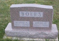
| Burial | : | Murray Cemetery, Murray, Clarke County, USA |
| Coordinate | : | 41.0278015, -93.9456024 |
| Description | : | LCDR Carl Woods, USN Retired, 93, of Corpus Christi, Texas went to his eternal patrol, on August 2, 2017 at his home in Corpus Christi. A Celebration of Life Service will be at 11:00 a.m. on Saturday, August 12, 2017 at the Murray Church of Christ in Murray, IA. Rev. Roger Woods will officiate. Interment will be at the Murray Cemetery south of Murray with military graveside rites by the William Lochery American Legion Post # 405 of Murray. Open visitation with family receiving friends will be 5-8 p.m. Friday, August 11, 2017 at the Powers Funeral Home in Afton.... Read More |
frequently asked questions (FAQ):
-
Where is LCDR Carl Ronald Woods's memorial?
LCDR Carl Ronald Woods's memorial is located at: Murray Cemetery, Murray, Clarke County, USA.
-
When did LCDR Carl Ronald Woods death?
LCDR Carl Ronald Woods death on 2 Aug 2017 in Corpus Christi, Nueces County, Texas, USA
-
Where are the coordinates of the LCDR Carl Ronald Woods's memorial?
Latitude: 41.0278015
Longitude: -93.9456024
Family Members:
Parent

Spouse
Siblings
Flowers:


Nearby Cemetories:
1. Murray Cemetery
Murray, Clarke County, USA
Coordinate: 41.0278015, -93.9456024
2. Bell Family Cemetery
Murray, Clarke County, USA
Coordinate: 41.0625267, -93.9240036
3. Sanders Cemetery
Doyle Township, Clarke County, USA
Coordinate: 40.9730000, -93.9016000
4. Claypool Cemetery
Thayer, Union County, USA
Coordinate: 41.0126114, -94.0303497
5. Thayer Catholic Cemetery
Thayer, Union County, USA
Coordinate: 41.0374985, -94.0357971
6. Olinger Cemetery
Union County, USA
Coordinate: 40.9690208, -94.0274887
7. Hopeville Cemetery
Hopeville, Clarke County, USA
Coordinate: 40.9450000, -93.9870000
8. West Union Cemetery
Thayer, Union County, USA
Coordinate: 41.0191994, -94.0721970
9. Bethel Cemetery
Thayer, Union County, USA
Coordinate: 41.0600014, -94.0693970
10. Lacelle Cemetery
Clarke County, USA
Coordinate: 40.9446500, -93.8690300
11. Union Cemetery
Murray, Clarke County, USA
Coordinate: 41.1265000, -93.9115000
12. Beulah Cemetery
Thayer, Union County, USA
Coordinate: 41.0589981, -94.0759964
13. Pierson Cemetery
Osceola, Clarke County, USA
Coordinate: 40.9954491, -93.8131104
14. Monette Cemetery
Lorimor, Union County, USA
Coordinate: 41.0800743, -94.0715866
15. Cox Cemetery
Osceola, Clarke County, USA
Coordinate: 41.0722008, -93.8142014
16. Otterbein Cemetery
Thayer, Union County, USA
Coordinate: 40.9990005, -94.0879974
17. Gregg Cemetery
Doyle Township, Clarke County, USA
Coordinate: 40.9138000, -93.9520000
18. Lorimor Cemetery
Lorimor, Union County, USA
Coordinate: 41.1128006, -94.0516968
19. Browns Mountain Cemetery
Thayer, Union County, USA
Coordinate: 41.0499992, -94.0999985
20. Mount Pisgah Cemetery
Thayer, Union County, USA
Coordinate: 41.0511017, -94.1007996
21. Maple Hill Cemetery
Osceola, Clarke County, USA
Coordinate: 41.0278015, -93.7794037
22. Homewood Cemetery
Thayer, Union County, USA
Coordinate: 40.9220009, -94.0419998
23. Warrick Cemetery
Decatur County, USA
Coordinate: 40.8960000, -93.9234000
24. Leas Cemetery
Union County, USA
Coordinate: 40.9080009, -94.0220032