
| Birth | : | 25 Dec 1897 |
| Death | : | 12 Mar 1984 Cape Girardeau, Cape Girardeau County, Missouri, USA |
| Burial | : | Dotterer Cemetery, Auglaize Township, Paulding County, USA |
| Coordinate | : | 41.1727982, -84.4614029 |
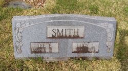
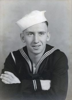
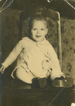
| Description | : | Buried at Parkview Cemetery, Lee Edward Smith was the son of Charles E. & Cora Isabella (nee Perry) Smith. He married Lucinda "Lucy" (nee Green) Smith, daughter of William Newton and Lucinda Adeline "Addie" (nee Moore) Green. Lee & Lucy had at least five children: Robert Smith (1925-2008) Betty Joe Smith (b. circa 1927, md. Mr. French) Mary Jane Smith (1930-1932) Edward Smith (died at birth) Rachel Lee Smith (1934-1982, md. William Hinkle) View Lee's obituary at Mackley Genealogy web-site. Lee & Lucy Smith are buried in Section H-3 in Parkview Cemetery. Currently have no information or picture of Mr.... Read More |
frequently asked questions (FAQ):
-
Where is Lee Edward Smith's memorial?
Lee Edward Smith's memorial is located at: Dotterer Cemetery, Auglaize Township, Paulding County, USA.
-
When did Lee Edward Smith death?
Lee Edward Smith death on 12 Mar 1984 in Cape Girardeau, Cape Girardeau County, Missouri, USA
-
Where are the coordinates of the Lee Edward Smith's memorial?
Latitude: 41.1727982
Longitude: -84.4614029
Family Members:
Parent
Spouse
Siblings
Children
Flowers:


Nearby Cemetories:
1. Saint Marys Catholic Church Cemetery
Junction, Paulding County, USA
Coordinate: 41.1870003, -84.4599991
2. Junction Cemetery
Paulding County, USA
Coordinate: 41.1878014, -84.4589005
3. Landis-Harvey Cemetery
Junction, Paulding County, USA
Coordinate: 41.1655830, -84.4430690
4. Myers-Hosterman Cemetery
Junction, Paulding County, USA
Coordinate: 41.1763690, -84.4402500
5. Barton Cemetery
Junction, Paulding County, USA
Coordinate: 41.1885630, -84.4688710
6. Potter and Kline Cemetery
Junction, Paulding County, USA
Coordinate: 41.2038994, -84.4381027
7. Bakle Cemetery
Junction, Paulding County, USA
Coordinate: 41.2091510, -84.4922230
8. Kinzer Cemetery
Paulding County, USA
Coordinate: 41.2016983, -84.5049973
9. Sherman Cemetery
Paulding, Paulding County, USA
Coordinate: 41.1347008, -84.4266968
10. Blair-Adams Sun Valley Cemetery
Cecil, Paulding County, USA
Coordinate: 41.2177180, -84.4772200
11. Up the Grove Cemetery
Paulding County, USA
Coordinate: 41.1646996, -84.5242004
12. Ankney-Blaine Cemetery
Junction, Paulding County, USA
Coordinate: 41.1850014, -84.5239029
13. Blakeslee Cemetery
Charloe, Paulding County, USA
Coordinate: 41.1288986, -84.4330978
14. Renollet Cemetery
Paulding County, USA
Coordinate: 41.2122002, -84.5000000
15. Hoover Cemetery
Brown Township, Paulding County, USA
Coordinate: 41.1358720, -84.4011130
16. Latty Cemetery
Paulding, Paulding County, USA
Coordinate: 41.1872220, -84.5408330
17. Pleasant Grove Cemetery
Paulding, Paulding County, USA
Coordinate: 41.1506004, -84.5391998
18. Ankney Farm Cemetery
Paulding County, USA
Coordinate: 41.1981010, -84.5389023
19. Angrove Cemetery
Paulding, Paulding County, USA
Coordinate: 41.1857210, -84.5456140
20. Bowholtz Cemetery
Oakwood, Paulding County, USA
Coordinate: 41.1074982, -84.4705963
21. Cromley Cemetery
Defiance County, USA
Coordinate: 41.2305984, -84.4197006
22. Kingery Cemetery
Paulding County, USA
Coordinate: 41.1138992, -84.4107971
23. Fort Brown Cemetery
Melrose, Paulding County, USA
Coordinate: 41.1116420, -84.4146810
24. County Home Cemetery
Paulding, Paulding County, USA
Coordinate: 41.1502762, -84.5541306