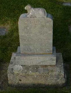
Lena Mae Schwartz Ellis
| Birth | : | 13 Apr 1912 Mondovi, Lincoln County, Washington, USA |
| Death | : | 29 Jul 2008 Spokane, Spokane County, Washington, USA |
| Burial | : | Gore Hill Cemetery, St Leonards, North Sydney Council, Australia |
| Coordinate | : | -33.8229500, 151.1887590 |
| Plot | : | Block E2, Lot 18, Plot 6 |
| Description | : | REARDAN – Memorial service for Lena Mae Schwartz Ellis, 96, a longtime area resident, is scheduled at 3 p.m. Monday, Aug. 4, in the Strate Funeral Home Chapel in Davenport. Mrs. Ellis died July 29 in Spokane. Born April 13, 1912, to Anna and Peter Schwartz on the farm at Mondovi, she attended country schools, including Windy Hill School and Coulee Center School. She graduated in 1930 from Reardan High School, attended Kinman Business School and obtained a CPA business degree before she moved to Seattle for work. She returned to Reardan during World War II and worked several... Read More |
frequently asked questions (FAQ):
-
Where is Lena Mae Schwartz Ellis's memorial?
Lena Mae Schwartz Ellis's memorial is located at: Gore Hill Cemetery, St Leonards, North Sydney Council, Australia.
-
When did Lena Mae Schwartz Ellis death?
Lena Mae Schwartz Ellis death on 29 Jul 2008 in Spokane, Spokane County, Washington, USA
-
Where are the coordinates of the Lena Mae Schwartz Ellis's memorial?
Latitude: -33.8229500
Longitude: 151.1887590
Family Members:
Parent
Spouse
Siblings
Flowers:
Nearby Cemetories:
1. Gore Hill Cemetery
St Leonards, North Sydney Council, Australia
Coordinate: -33.8229500, 151.1887590
2. St. Thomas Rest Park
Crows Nest, North Sydney Council, Australia
Coordinate: -33.8244490, 151.2063050
3. St Aidan's Anglican Church
Longueville, Lane Cove Municipality, Australia
Coordinate: -33.8281510, 151.1709560
4. Mary MacKillop Memorial Chapel
North Sydney, North Sydney Council, Australia
Coordinate: -33.8388250, 151.2049160
5. Northern Suburbs Memorial Gardens and Crematorium
North Ryde, Ryde City, Australia
Coordinate: -33.7954460, 151.1511550
6. Royal Botanic Gardens
Sydney, City of Sydney, Australia
Coordinate: -33.8647440, 151.2170610
7. Gladesville Asylum Cemetery
Gladesville, Hunter's Hill Municipality, Australia
Coordinate: -33.8393010, 151.1342490
8. Macquarie Park Cemetery and Crematorium
North Ryde, Ryde City, Australia
Coordinate: -33.7937180, 151.1420060
9. Parish Church of Saint James
Sydney, City of Sydney, Australia
Coordinate: -33.8693760, 151.2111540
10. Garden Island
Potts Point, City of Sydney, Australia
Coordinate: -33.8613635, 151.2280308
11. Saint Mary's Cathedral
Sydney, City of Sydney, Australia
Coordinate: -33.8708540, 151.2135820
12. Old Sydney Burial Ground
Sydney, City of Sydney, Australia
Coordinate: -33.8731750, 151.2063850
13. Rawson Park
Mosman, Mosman Municipality, Australia
Coordinate: -33.8350640, 151.2504980
14. Field of Mars Cemetery
East Ryde, Ryde City, Australia
Coordinate: -33.8120030, 151.1246480
15. Pioneers Memorial Park
Leichhardt, Inner West Council, Australia
Coordinate: -33.8780800, 151.1575000
16. Devonshire Street Cemetery (Defunct)
Sydney, City of Sydney, Australia
Coordinate: -33.8828080, 151.2066180
17. St Charles Borromeo Cemetery
Ryde, Ryde City, Australia
Coordinate: -33.8188360, 151.1146200
18. Balmain Catholic Cemetery (Defunct)
Leichhardt, Inner West Council, Australia
Coordinate: -33.8797270, 151.1523730
19. Ryde Baptist Graveyard
Ryde, Ryde City, Australia
Coordinate: -33.8062930, 151.1119180
20. Saint Annes Church Cemetery
Ryde, Ryde City, Australia
Coordinate: -33.8156960, 151.1042650
21. Camperdown Cemetery
Newtown, City of Sydney, Australia
Coordinate: -33.8942220, 151.1804900
22. St. John's Anglican Church Cemetery
Gordon, Ku-ring-gai Council, Australia
Coordinate: -33.7571060, 151.1519580
23. St David’s Presbyterian Cemetery
Haberfield, Inner West Council, Australia
Coordinate: -33.8823220, 151.1378500
24. Church of St. Francis and St. Alban
Gordon, Ku-ring-gai Council, Australia
Coordinate: -33.7563700, 151.1522220


