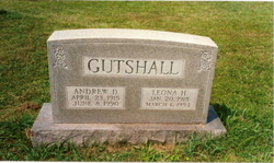
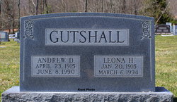
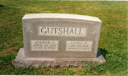
Leona Hammer Gutshall
| Birth | : | 20 Jan 1915 |
| Death | : | 6 Mar 1994 |
| Burial | : | Frenchs Forest Cemetery, Davidson, Northern Beaches Council, Australia |
| Coordinate | : | -33.7392360, 151.2020750 |
| Description | : | Leona Hammer Gutshall, age 79, of Monterey, died Sunday evening (March 6, 1994) in King's Daughters' Hospital. She was born Jan. 20, 1915 at Blue Grass, VA and was the daughter of the late Luther and Ester (Waybright) Hammer. She was a member of the Monterey United Methodist Church and a life member of the United Methodist Women. She was educated in the Highland schools, Dunsmore Business College and Madison College. She taught in the Hghland School System for 18 years and served as clerk of the Highland Combined Courts until her retirement in 1985. She is survived by a daughter and son-in-law,... Read More |
frequently asked questions (FAQ):
-
Where is Leona Hammer Gutshall's memorial?
Leona Hammer Gutshall's memorial is located at: Frenchs Forest Cemetery, Davidson, Northern Beaches Council, Australia.
-
When did Leona Hammer Gutshall death?
Leona Hammer Gutshall death on 6 Mar 1994 in
-
Where are the coordinates of the Leona Hammer Gutshall's memorial?
Latitude: -33.7392360
Longitude: 151.2020750
Family Members:
Parent
Spouse
Siblings
Flowers:
Nearby Cemetories:
1. Frenchs Forest Cemetery
Davidson, Northern Beaches Council, Australia
Coordinate: -33.7392360, 151.2020750
2. Church of St. Francis and St. Alban
Gordon, Ku-ring-gai Council, Australia
Coordinate: -33.7563700, 151.1522220
3. St. John's Anglican Church Cemetery
Gordon, Ku-ring-gai Council, Australia
Coordinate: -33.7571060, 151.1519580
4. Northern Suburbs Memorial Gardens and Crematorium
North Ryde, Ryde City, Australia
Coordinate: -33.7954460, 151.1511550
5. Macquarie Park Cemetery and Crematorium
North Ryde, Ryde City, Australia
Coordinate: -33.7937180, 151.1420060
6. Manly Cemetery
Manly, Northern Beaches Council, Australia
Coordinate: -33.7922700, 151.2715000
7. Gore Hill Cemetery
St Leonards, North Sydney Council, Australia
Coordinate: -33.8229500, 151.1887590
8. St. Thomas Rest Park
Crows Nest, North Sydney Council, Australia
Coordinate: -33.8244490, 151.2063050
9. St Aidan's Anglican Church
Longueville, Lane Cove Municipality, Australia
Coordinate: -33.8281510, 151.1709560
10. Mona Vale Cemetery
Mona Vale, Northern Beaches Council, Australia
Coordinate: -33.6752140, 151.2879720
11. Field of Mars Cemetery
East Ryde, Ryde City, Australia
Coordinate: -33.8120030, 151.1246480
12. The Old Man's Valley Cemetery
Hornsby, Hornsby Shire, Australia
Coordinate: -33.6994480, 151.0923970
13. Mary MacKillop Memorial Chapel
North Sydney, North Sydney Council, Australia
Coordinate: -33.8388250, 151.2049160
14. Ryde Baptist Graveyard
Ryde, Ryde City, Australia
Coordinate: -33.8062930, 151.1119180
15. Rawson Park
Mosman, Mosman Municipality, Australia
Coordinate: -33.8350640, 151.2504980
16. Mona Vale Anglican Church
Mona Vale, Northern Beaches Council, Australia
Coordinate: -33.6745924, 151.3031547
17. St Charles Borromeo Cemetery
Ryde, Ryde City, Australia
Coordinate: -33.8188360, 151.1146200
18. Sydney North Head Quarantine Cemetery
Manly, Northern Beaches Council, Australia
Coordinate: -33.8177130, 151.2947000
19. Saint Annes Church Cemetery
Ryde, Ryde City, Australia
Coordinate: -33.8156960, 151.1042650
20. Gladesville Asylum Cemetery
Gladesville, Hunter's Hill Municipality, Australia
Coordinate: -33.8393010, 151.1342490
21. Church Point Historic Cemetery
Church Point, Northern Beaches Council, Australia
Coordinate: -33.6450120, 151.2841090
22. Garden Island
Potts Point, City of Sydney, Australia
Coordinate: -33.8613635, 151.2280308
23. Royal Botanic Gardens
Sydney, City of Sydney, Australia
Coordinate: -33.8647440, 151.2170610
24. Carlingford Anglican Cemetery
Carlingford, City of Parramatta Council, Australia
Coordinate: -33.7833430, 151.0598510


