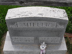
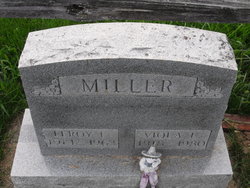
Leroy F Miller
| Birth | : | 16 Jul 1914 Hume, Allen County, Ohio, USA |
| Death | : | 27 Nov 1963 Lima, Allen County, Ohio, USA |
| Burial | : | Our Lady's Roman Catholic Churchyard, Lydiate, Metropolitan Borough of Sefton, England |
| Coordinate | : | 53.5396850, -2.9599940 |
| Plot | : | Section H, Row 4 |
| Description | : | Leroy Francis Miller was born on July16, 1914 in Hume Ohio to Sherman and Ethel"Bechdolt". He married Viola Burden on May 25, 1935, between them they had seven sons: John H., Guy E. (Gene), Donald, William, Terry, Phillip and Ronnie, six daughters: Kay, Beckie, Martha, Rachel , Muriel and Erma. He was employed by the Nickle Plate Railroad and was a member of the Fraternal Order of Eagles post 691 of Wapakoneta. Leroy had suffered a heart attack in his home. Survivors include his wife and children plus three sisters Mrs. Rachel Wiewell, Mrs. Clara Cunningham, Mrs. Orval... Read More |
frequently asked questions (FAQ):
-
Where is Leroy F Miller's memorial?
Leroy F Miller's memorial is located at: Our Lady's Roman Catholic Churchyard, Lydiate, Metropolitan Borough of Sefton, England.
-
When did Leroy F Miller death?
Leroy F Miller death on 27 Nov 1963 in Lima, Allen County, Ohio, USA
-
Where are the coordinates of the Leroy F Miller's memorial?
Latitude: 53.5396850
Longitude: -2.9599940
Family Members:
Parent
Spouse
Siblings
Children
Flowers:
Nearby Cemetories:
1. Our Lady's Roman Catholic Churchyard
Lydiate, Metropolitan Borough of Sefton, England
Coordinate: 53.5396850, -2.9599940
2. St Catherine Churchyard
Lydiate, Metropolitan Borough of Sefton, England
Coordinate: 53.5368000, -2.9612660
3. St Thomas Churchyard
Lydiate, Metropolitan Borough of Sefton, England
Coordinate: 53.5443480, -2.9621640
4. Saint Michael's Churchyard
Aughton, West Lancashire District, England
Coordinate: 53.5419170, -2.9197240
5. St. Andrew Churchyard
Maghull, Metropolitan Borough of Sefton, England
Coordinate: 53.5104770, -2.9428820
6. Sefton Parish Churchyard
Sefton, Metropolitan Borough of Sefton, England
Coordinate: 53.5044060, -2.9712190
7. Christ Churchyard
Aughton, West Lancashire District, England
Coordinate: 53.5583510, -2.9046990
8. Ince Blundell Cemetery
Ince Blundell, Metropolitan Borough of Sefton, England
Coordinate: 53.5213570, -3.0208750
9. St. Michael and All Angels Churchyard
Great Altcar, Metropolitan Borough of Sefton, England
Coordinate: 53.5507770, -3.0279540
10. Thornton Garden of Rest and Crematorium
Thornton, Metropolitan Borough of Sefton, England
Coordinate: 53.5001850, -2.9951960
11. Saint Anne's Roman Catholic Church Cemetery
Ormskirk, West Lancashire District, England
Coordinate: 53.5626520, -2.8935560
12. St. Cuthbert's Churchyard
Halsall, West Lancashire District, England
Coordinate: 53.5852140, -2.9529650
13. St Thomas and the Holy Rood Churchyard
Melling, Metropolitan Borough of Sefton, England
Coordinate: 53.4954510, -2.9227850
14. Melling Churchyard
Melling, Metropolitan Borough of Sefton, England
Coordinate: 53.4953370, -2.9228780
15. Friends Burial Ground
Bickerstaffe, West Lancashire District, England
Coordinate: 53.5347720, -2.8748780
16. St. Mary Roman Catholic Churchyard
Little Crosby, Metropolitan Borough of Sefton, England
Coordinate: 53.5076380, -3.0274720
17. Harkirk Burial Ground
Little Crosby, Metropolitan Borough of Sefton, England
Coordinate: 53.5016890, -3.0191220
18. St Peter and St Paul Churchyard
Ormskirk, West Lancashire District, England
Coordinate: 53.5692640, -2.8877690
19. Ford Cemetery
Ford, Metropolitan Borough of Sefton, England
Coordinate: 53.4824040, -2.9925980
20. Our Lady Of Compassion RC Churchyard
Formby, Metropolitan Borough of Sefton, England
Coordinate: 53.5574060, -3.0575020
21. St Luke Churchyard
Great Crosby, Metropolitan Borough of Sefton, England
Coordinate: 53.4909310, -3.0240300
22. St. Peter's Churchyard
Formby, Metropolitan Borough of Sefton, England
Coordinate: 53.5663834, -3.0594721
23. St Peter and St Paul Churchyard
Crosby, Metropolitan Borough of Sefton, England
Coordinate: 53.4858300, -3.0234920
24. St. James Churchyard
Westhead, West Lancashire District, England
Coordinate: 53.5582324, -2.8527492


