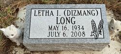
Letha Ilene Dizmang Long
| Birth | : | 16 May 1934 Benkelman, Dundy County, Nebraska, USA |
| Death | : | 6 Jul 2008 Wauneta, Chase County, Nebraska, USA |
| Burial | : | Salmon Hole Cemetery, Lisbon, Grafton County, USA |
| Coordinate | : | 44.2359600, -71.8848200 |
| Plot | : | Sec E, Blk 162, Lot 2, Grave 1 |
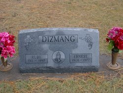
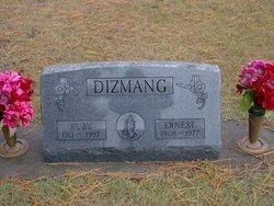
| Description | : | *~*~*~*~*~*~*~*~*~*~*~*~*~*~*~*~*~*~*~*~*~* Letha Ilene Long of Wauneta died Sunday, July 6, 2008, at Heritage of Wauneta. She was 74 years old. Letha was born May 16, 1934, to Ernest and Ruby Anita (Hays) Dizmang at Benkelman. She attended a school for the blind in eastern Nebraska. She married Clyde George Long in Greeley, Colo., on Oct. 14, 1955. They had two children, Jerry and Marilyn. Letha loved her family, church and socializing with friends. She knitted and learned how to work the rug loom and to quilt. She played the piano and... Read More |
frequently asked questions (FAQ):
-
Where is Letha Ilene Dizmang Long's memorial?
Letha Ilene Dizmang Long's memorial is located at: Salmon Hole Cemetery, Lisbon, Grafton County, USA.
-
When did Letha Ilene Dizmang Long death?
Letha Ilene Dizmang Long death on 6 Jul 2008 in Wauneta, Chase County, Nebraska, USA
-
Where are the coordinates of the Letha Ilene Dizmang Long's memorial?
Latitude: 44.2359600
Longitude: -71.8848200
Family Members:
Parent
Siblings
Flowers:
Nearby Cemetories:
1. Salmon Hole Cemetery
Lisbon, Grafton County, USA
Coordinate: 44.2359600, -71.8848200
2. Grove Hill Cemetery
Lisbon, Grafton County, USA
Coordinate: 44.2108002, -71.9094009
3. Pond Cemetery
Lyman, Grafton County, USA
Coordinate: 44.2671800, -71.9093700
4. Parker Hill Cemetery
Lyman, Grafton County, USA
Coordinate: 44.2582400, -71.9458800
5. Center Cemetery
Lyman, Grafton County, USA
Coordinate: 44.2672200, -71.9381400
6. Sunnyside Cemetery
Sugar Hill, Grafton County, USA
Coordinate: 44.2130300, -71.8061600
7. Landaff Center Cemetery
Landaff, Grafton County, USA
Coordinate: 44.1739860, -71.8847040
8. Pettyboro District Cemetery
Pettyboro, Grafton County, USA
Coordinate: 44.2038310, -71.9620880
9. Noyes Cemetery
Landaff, Grafton County, USA
Coordinate: 44.1830560, -71.8286110
10. Moulton Hill Cemetery
Lyman, Grafton County, USA
Coordinate: 44.2457400, -71.9862900
11. Bath Village Cemetery
Bath, Grafton County, USA
Coordinate: 44.1693500, -71.9617800
12. Ammonoosuc Meadows Cemetery
Littleton, Grafton County, USA
Coordinate: 44.3013992, -71.8043976
13. Upper Smith Road Cemetery
Bath, Grafton County, USA
Coordinate: 44.2202780, -72.0075000
14. Adams-Pfaelzer Cemetery
Littleton, Grafton County, USA
Coordinate: 44.3185210, -71.8283880
15. West Bath Cemetery
Bath, Grafton County, USA
Coordinate: 44.1750930, -71.9865080
16. Pattenville Cemetery (Defunct)
Littleton, Grafton County, USA
Coordinate: 44.3310320, -71.8624310
17. West Littleton Cemetery
Littleton, Grafton County, USA
Coordinate: 44.3319016, -71.9199982
18. Elmwood Cemetery
Franconia, Grafton County, USA
Coordinate: 44.2219009, -71.7474976
19. Saint Rose of Lima New Catholic Cemetery
Littleton, Grafton County, USA
Coordinate: 44.3130989, -71.7949982
20. Glenwood Cemetery
Littleton, Grafton County, USA
Coordinate: 44.3116100, -71.7901400
21. Willow Cemetery
Franconia, Grafton County, USA
Coordinate: 44.1968994, -71.7530975
22. Eli Wallace Horse Cemetery
Littleton, Grafton County, USA
Coordinate: 44.2981300, -71.7714081
23. North Monroe Cemetery
Monroe, Grafton County, USA
Coordinate: 44.3067680, -71.9998780
24. Riverside Cemetery
Waterford, Caledonia County, USA
Coordinate: 44.3456001, -71.8897018


