
| Birth | : | 1 Apr 1870 Polk County, Iowa, USA |
| Death | : | 29 Dec 1936 Des Moines, Polk County, Iowa, USA |
| Burial | : | St Michael's Churchyard, Broome, South Norfolk District, England |
| Coordinate | : | 52.4860360, 1.4547410 |
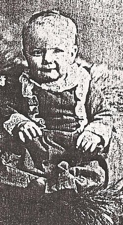
| Description | : | Lewis is a son of Benjamin Franklin Elliott and Colista (Burns) Elliott, and the husband of Hattie Elizabeth (Scott) Elliott. OBITUARY FUNERAL SERVICES HELD AT CAMBRIDGE FOR LEW ELLIOTT Cambridge, Jan. 7--- Funeral services were held for Lew Elliott, aged 66, from the home Friday afternoon. Mr. Elliott passed away at the Mercy Hospital, Des Moines, where he was rushed in the feeble hope that an emergency operation might be of benefit, but it was of no avail and death released him of his suffering. He leaves his wife, three sons and five daughters all of whom were at the bedside when... Read More |
frequently asked questions (FAQ):
-
Where is Lewis Levi “Lew” Elliott's memorial?
Lewis Levi “Lew” Elliott's memorial is located at: St Michael's Churchyard, Broome, South Norfolk District, England.
-
When did Lewis Levi “Lew” Elliott death?
Lewis Levi “Lew” Elliott death on 29 Dec 1936 in Des Moines, Polk County, Iowa, USA
-
Where are the coordinates of the Lewis Levi “Lew” Elliott's memorial?
Latitude: 52.4860360
Longitude: 1.4547410
Family Members:
Parent

Spouse
Siblings
Children
Flowers:


Nearby Cemetories:
1. St Michael's Churchyard
Broome, South Norfolk District, England
Coordinate: 52.4860360, 1.4547410
2. Ditchingham Cemetery
Ditchingham, South Norfolk District, England
Coordinate: 52.4793614, 1.4307304
3. St. Mary's Churchyard
Ditchingham, South Norfolk District, England
Coordinate: 52.4776358, 1.4282946
4. St Mary's Churchyard
Ellingham, South Norfolk District, England
Coordinate: 52.4739393, 1.4827976
5. All Saints Churchyard
Kirby Cane, South Norfolk District, England
Coordinate: 52.4937500, 1.4952820
6. St. Peter's Churchyard
Hedenham, South Norfolk District, England
Coordinate: 52.4891780, 1.4041660
7. Holy Trinity Churchyard
Bungay, Waveney District, England
Coordinate: 52.4553310, 1.4399650
8. All Saints Churchyard
Mettingham, Waveney District, England
Coordinate: 52.4566620, 1.4764720
9. St. Mary's Churchyard and Priory
Bungay, Waveney District, England
Coordinate: 52.4555100, 1.4375800
10. St Edmunds RC Churchyard
Bungay, Waveney District, England
Coordinate: 52.4550570, 1.4381220
11. Emmanuel Church Cemetery
Bungay, Waveney District, England
Coordinate: 52.4526800, 1.4382410
12. Bungay Cemetery
Bungay, Waveney District, England
Coordinate: 52.4475475, 1.4444244
13. Wangford Union Workhouse Cemetery
Shipmeadow, Waveney District, England
Coordinate: 52.4540960, 1.4997050
14. St Margaret Churchyard
Hales, South Norfolk District, England
Coordinate: 52.5109380, 1.5110840
15. St. Bartholomew's Churchyard
Shipmeadow, Waveney District, England
Coordinate: 52.4557540, 1.5046408
16. All Saints Churchyard
Earsham, South Norfolk District, England
Coordinate: 52.4480480, 1.4212330
17. St Michael Churchyard
Geldeston, South Norfolk District, England
Coordinate: 52.4759460, 1.5246070
18. St Peter's Churchyard
Mundham, South Norfolk District, England
Coordinate: 52.5303890, 1.4260120
19. St Margaret and St Remigius Churchyard
Seething, South Norfolk District, England
Coordinate: 52.5303390, 1.4185000
20. Saint John Churchyard
Ilketshall St John, Waveney District, England
Coordinate: 52.4349960, 1.4707000
21. Holy Trinity Churchyard
Loddon, South Norfolk District, England
Coordinate: 52.5350430, 1.4832560
22. St Andrews Churchyard
Raveningham, South Norfolk District, England
Coordinate: 52.5126430, 1.5323570
23. Saint Andrews Churchyard
Bedingham, South Norfolk District, England
Coordinate: 52.4902500, 1.3643180
24. Holy Trinity Churchyard
Barsham, Waveney District, England
Coordinate: 52.4520000, 1.5263000