
| Birth | : | 1900 Gann Valley, Buffalo County, South Dakota, USA |
| Death | : | 5 Mar 1985 Oakdale, Stanislaus County, California, USA |
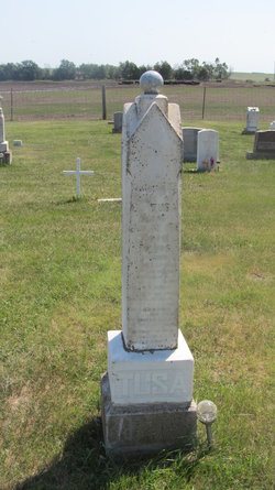
| Burial | : | Tracy Public Cemetery, Tracy, San Joaquin County, USA |
| Coordinate | : | 37.7251358, -121.4189453 |
| Plot | : | Section O Row 7 Grave 16 |
| Inscription | : | MOTHER IN GOD'S CARE |
| Description | : | (Cemetery record shows name as Lillian Frances Williams/McLaughlin) |
frequently asked questions (FAQ):
-
Where is Lillian Frances “Lillie” Tusa McLaughlin's memorial?
Lillian Frances “Lillie” Tusa McLaughlin's memorial is located at: Tracy Public Cemetery, Tracy, San Joaquin County, USA.
-
When did Lillian Frances “Lillie” Tusa McLaughlin death?
Lillian Frances “Lillie” Tusa McLaughlin death on 5 Mar 1985 in Oakdale, Stanislaus County, California, USA
-
Where are the coordinates of the Lillian Frances “Lillie” Tusa McLaughlin's memorial?
Latitude: 37.7251358
Longitude: -121.4189453
Family Members:
Parent
Spouse

Siblings
Flowers:


Nearby Cemetories:
1. Tracy Public Cemetery
Tracy, San Joaquin County, USA
Coordinate: 37.7251358, -121.4189453
2. Tracy Mausoleum
Tracy, San Joaquin County, USA
Coordinate: 37.7250214, -121.4150696
3. Valpico Memorial Park
Tracy, San Joaquin County, USA
Coordinate: 37.7113260, -121.4656510
4. Brichetto Tomb
San Joaquin County, USA
Coordinate: 37.6272011, -121.3871994
5. East Union Cemetery
Manteca, San Joaquin County, USA
Coordinate: 37.8114014, -121.2350006
6. Congregation of Ahavas Achim Cemetery
French Camp, San Joaquin County, USA
Coordinate: 37.8778419, -121.2753067
7. Chinese Cemetery
French Camp, San Joaquin County, USA
Coordinate: 37.8819962, -121.2805862
8. Congregation Adas Yeshuran of Stockton Cemetery
French Camp, San Joaquin County, USA
Coordinate: 37.8784065, -121.2740784
9. Park View Cemetery
Manteca, San Joaquin County, USA
Coordinate: 37.8617249, -121.2238312
10. Five Pillars Farm Cemetery
Livermore, Alameda County, USA
Coordinate: 37.7262764, -121.7105789
11. Ripon Cemetery
Ripon, San Joaquin County, USA
Coordinate: 37.7420311, -121.1238708
12. Atlanta Cemetery
Five Corners, San Joaquin County, USA
Coordinate: 37.8270035, -121.1420135
13. Grayson Cemetery
Grayson, Stanislaus County, USA
Coordinate: 37.5594559, -121.1802826
14. Thomas Lindsay Gravesite
San Joaquin County, USA
Coordinate: 37.9573110, -121.2918430
15. David Kelsey Gravesite
Stockton, San Joaquin County, USA
Coordinate: 37.9573110, -121.2918430
16. Citizens Cemetery
Stockton, San Joaquin County, USA
Coordinate: 37.9559410, -121.2769120
17. Union Cemetery
Brentwood, Contra Costa County, USA
Coordinate: 37.9103012, -121.6477966
18. Temple Israel Cemetery
Stockton, San Joaquin County, USA
Coordinate: 37.9640541, -121.2784348
19. Stockton State Hospital Cemetery
Stockton, San Joaquin County, USA
Coordinate: 37.9663110, -121.2846850
20. Saint Michaels Cemetery
Livermore, Alameda County, USA
Coordinate: 37.6797790, -121.7519150
21. San Joaquin Catholic Cemetery
Stockton, San Joaquin County, USA
Coordinate: 37.9707830, -121.2850190
22. IOOF Memory Gardens Cemetery
Livermore, Alameda County, USA
Coordinate: 37.6797850, -121.7526100
23. Casa Bonita Mausoleum
Stockton, San Joaquin County, USA
Coordinate: 37.9752340, -121.2877800
24. Stockton Woodland Mausoleum
Stockton, San Joaquin County, USA
Coordinate: 37.9762400, -121.2878000