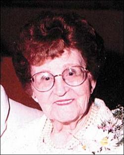
Linden Oakley Smith
| Birth | : | 13 Nov 1900 Owsley County, Kentucky, USA |
| Death | : | 1 Sep 1966 Cincinnati, Hamilton County, Ohio, USA |
| Burial | : | Hurst Cemetery, Chester County, USA |
| Coordinate | : | 35.2881012, -88.7319031 |
| Description | : | First name in Linden according to World War I draft registration card. ******************************************** Rushville Republican Friday, 2 Sept 1966 Services for L. Oakley Smith, 66, R.R. 1, Rushville, who died at 9:30 a.m. Thursday at Good Samaritan Hospital in Cincinnati, will be held at 1:30 p.m. Saturday at Moster and Sons Mortuary. The Revs. Howard Jaquess and Art Dunham will officiate, and burial will follow in Maple Grove Cemetery at Brookville. Masonic rites will be conducted at 8 o'clock tonight at Moster and Sons Mortuary, where friends my call after 5 p.m. Mr. Smith had spent... Read More |
frequently asked questions (FAQ):
-
Where is Linden Oakley Smith's memorial?
Linden Oakley Smith's memorial is located at: Hurst Cemetery, Chester County, USA.
-
When did Linden Oakley Smith death?
Linden Oakley Smith death on 1 Sep 1966 in Cincinnati, Hamilton County, Ohio, USA
-
Where are the coordinates of the Linden Oakley Smith's memorial?
Latitude: 35.2881012
Longitude: -88.7319031
Family Members:
Spouse
Children
Flowers:
Nearby Cemetories:
1. Hurst Cemetery
Chester County, USA
Coordinate: 35.2881012, -88.7319031
2. Little Hatchie Cemetery
Woodville, Chester County, USA
Coordinate: 35.2771988, -88.7213974
3. Ingle Cemetery
Chester County, USA
Coordinate: 35.2772010, -88.7143430
4. Pine Bluff Cemetery
Henderson, Chester County, USA
Coordinate: 35.3087200, -88.7377130
5. Davidson Cemetery
Chester County, USA
Coordinate: 35.2984680, -88.7070160
6. Center Ridge Church Cemetery
Bethel Springs, McNairy County, USA
Coordinate: 35.2499530, -88.7128610
7. Palestine Church Cemetery
Palestine, Chester County, USA
Coordinate: 35.2839030, -88.7839180
8. Palestine Church Cemetery
Hornsby, Hardeman County, USA
Coordinate: 35.2839410, -88.7839600
9. Cave Springs Cemetery
Henderson, Chester County, USA
Coordinate: 35.3328018, -88.7221985
10. Woodville Cemetery
Woodville, Chester County, USA
Coordinate: 35.2500000, -88.7630005
11. Gateway Holiness Chapel Cemetery
Bethel Springs, McNairy County, USA
Coordinate: 35.2757390, -88.6718300
12. Smith Cemetery
Finger, McNairy County, USA
Coordinate: 35.3169870, -88.6766370
13. Refuge Church Cemetery
Finger, McNairy County, USA
Coordinate: 35.2888985, -88.6616974
14. Mount Gilead Cemetery
Rose Creek, McNairy County, USA
Coordinate: 35.2305610, -88.7466800
15. Roger Cemetery
Chester County, USA
Coordinate: 35.3386002, -88.6928024
16. Rock Springs Cemetery
Chester County, USA
Coordinate: 35.3318600, -88.7836800
17. Ingle Cemetery
Bethel Springs, McNairy County, USA
Coordinate: 35.2257860, -88.7295090
18. Haltoms Chapel Cemetery
Henderson, Chester County, USA
Coordinate: 35.3513985, -88.7491989
19. Cason Cemetery
Hickory Corners, Chester County, USA
Coordinate: 35.3513480, -88.7051580
20. Cason Cemetery
Chester County, USA
Coordinate: 35.3513985, -88.7050018
21. Curtis Hill Church Cemetery
Bethel Springs, McNairy County, USA
Coordinate: 35.2257840, -88.6947630
22. Frye Cemetery
Henderson, Chester County, USA
Coordinate: 35.3613080, -88.7445680
23. Piney Grove Church Cemetery
Piney Grove, Hardeman County, USA
Coordinate: 35.3013750, -88.8243140
24. Silerton Cemetery
Silerton, Hardeman County, USA
Coordinate: 35.3392740, -88.8041850


