| Memorials | : | 1 |
| Location | : | Bethel Springs, McNairy County, USA |
| Coordinate | : | 35.2257840, -88.6947630 |
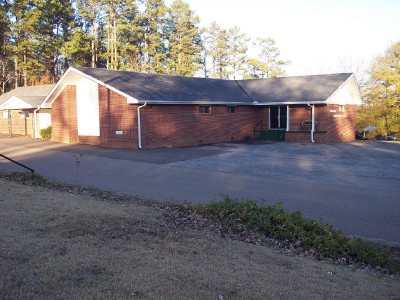
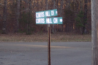
| Description | : | From the intersection of Curtis Hill Rd. & US-64, west of Selmer, travel north on Curtis Hill Rd. for 1.6 mi., continuing straight onto Curtis Hill Church Ln., for 150' to the cemetery on the west (left) side of the road, directly across from the Curtis Hill Church & parking lot. |
frequently asked questions (FAQ):
-
Where is Curtis Hill Church Cemetery?
Curtis Hill Church Cemetery is located at 1642 Curtis Hill Church Road Bethel Springs, McNairy County ,Tennessee , 38315USA.
-
Curtis Hill Church Cemetery cemetery's updated grave count on graveviews.com?
0 memorials
-
Where are the coordinates of the Curtis Hill Church Cemetery?
Latitude: 35.2257840
Longitude: -88.6947630
Nearby Cemetories:
1. McIntire Cemetery
Bethel Springs, McNairy County, USA
Coordinate: 35.2160000, -88.6756000
2. Moores Schoolhouse Church Cemetery
Bethel Springs, McNairy County, USA
Coordinate: 35.2078018, -88.6766968
3. Center Ridge Church Cemetery
Bethel Springs, McNairy County, USA
Coordinate: 35.2499530, -88.7128610
4. Ingle Cemetery
Bethel Springs, McNairy County, USA
Coordinate: 35.2257860, -88.7295090
5. Buena Vista Church Cemetery
Bethel Springs, McNairy County, USA
Coordinate: 35.2394910, -88.6520210
6. Mount Gilead Cemetery
Rose Creek, McNairy County, USA
Coordinate: 35.2305610, -88.7466800
7. Rose Creek Village Cemetery
Selmer, McNairy County, USA
Coordinate: 35.1804070, -88.7074970
8. Mount Pleasant Church Cemetery
Rose Creek, McNairy County, USA
Coordinate: 35.1839790, -88.7295350
9. Gateway Holiness Chapel Cemetery
Bethel Springs, McNairy County, USA
Coordinate: 35.2757390, -88.6718300
10. Ingle Cemetery
Chester County, USA
Coordinate: 35.2772010, -88.7143430
11. Little Hatchie Cemetery
Woodville, Chester County, USA
Coordinate: 35.2771988, -88.7213974
12. New Salem Church Cemetery
Bethel Springs, McNairy County, USA
Coordinate: 35.2608980, -88.6389090
13. Lowrance Cemetery
Rose Creek, McNairy County, USA
Coordinate: 35.1832930, -88.7439180
14. Wallace Cemetery
Selmer, McNairy County, USA
Coordinate: 35.1663889, -88.6836111
15. Woodville Cemetery
Woodville, Chester County, USA
Coordinate: 35.2500000, -88.7630005
16. Hunters Chapel Cemetery
Selmer, McNairy County, USA
Coordinate: 35.1633060, -88.7110830
17. Refuge Church Cemetery
Finger, McNairy County, USA
Coordinate: 35.2888985, -88.6616974
18. Motley Family Cemetery
Bethel Springs, McNairy County, USA
Coordinate: 35.2294220, -88.6108090
19. Hurst Cemetery
Chester County, USA
Coordinate: 35.2881012, -88.7319031
20. Bethel Springs Cemetery
Bethel Springs, McNairy County, USA
Coordinate: 35.2332380, -88.6066780
21. Davidson Cemetery
Chester County, USA
Coordinate: 35.2984680, -88.7070160
22. Lake Hill Memory Gardens
Bethel Springs, McNairy County, USA
Coordinate: 35.2169810, -88.6048380
23. Simpson-Wolfe Cemetery
Selmer, McNairy County, USA
Coordinate: 35.1644420, -88.6240660
24. McCalips Chapel Cemetery
McNairy County, USA
Coordinate: 35.1586510, -88.7573380


