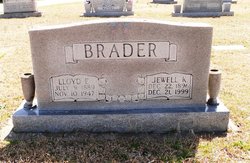
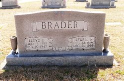
Lloyd Earl Brader
| Birth | : | 9 Jul 1889 Scranton, Greene County, Iowa, USA |
| Death | : | 10 Nov 1947 Spartanburg, Spartanburg County, South Carolina, USA |
| Burial | : | Ever-Rest Cemetery, Waino, Douglas County, USA |
| Coordinate | : | 46.6389008, -91.5631027 |
| Plot | : | Section F |
frequently asked questions (FAQ):
-
Where is Lloyd Earl Brader's memorial?
Lloyd Earl Brader's memorial is located at: Ever-Rest Cemetery, Waino, Douglas County, USA.
-
When did Lloyd Earl Brader death?
Lloyd Earl Brader death on 10 Nov 1947 in Spartanburg, Spartanburg County, South Carolina, USA
-
Where are the coordinates of the Lloyd Earl Brader's memorial?
Latitude: 46.6389008
Longitude: -91.5631027
Family Members:
Parent
Spouse
Siblings
Children
Flowers:
Nearby Cemetories:
1. Ever-Rest Cemetery
Waino, Douglas County, USA
Coordinate: 46.6389008, -91.5631027
2. Oulu Lutheran Cemetery
Oulu, Bayfield County, USA
Coordinate: 46.6549988, -91.5318985
3. Hillcrest Cemetery
Oulu, Bayfield County, USA
Coordinate: 46.6507300, -91.5097200
4. Pine Glade Cemetery
Oulu, Bayfield County, USA
Coordinate: 46.6232986, -91.5113983
5. Resthaven Cemetery
Cloverland, Douglas County, USA
Coordinate: 46.6925011, -91.5738983
6. Covenant Cemetery
Cloverland, Douglas County, USA
Coordinate: 46.6768600, -91.6846400
7. Saint Anns Cemetery
Maple, Douglas County, USA
Coordinate: 46.5821080, -91.6784190
8. Pine Ridge Cemetery
Brule, Douglas County, USA
Coordinate: 46.5363998, -91.5749969
9. Faith Lutheran Cemetery
Maple, Douglas County, USA
Coordinate: 46.6258340, -91.7206050
10. Maple Memorial Cemetery
Maple, Douglas County, USA
Coordinate: 46.6255390, -91.7206050
11. Hillside Cemetery
Port Wing, Bayfield County, USA
Coordinate: 46.6963997, -91.4113998
12. Saint Michaels Cemetery
Iron River, Bayfield County, USA
Coordinate: 46.5602989, -91.4150009
13. Iron River City Cemetery
Iron River, Bayfield County, USA
Coordinate: 46.5668983, -91.3981018
14. Valley View Cemetery
Iron River, Bayfield County, USA
Coordinate: 46.6227989, -91.3600006
15. Lakeside Cemetery
Wentworth, Douglas County, USA
Coordinate: 46.6488991, -91.8063965
16. Lake Nebagamon Cemetery
Lake Nebagamon, Douglas County, USA
Coordinate: 46.5132200, -91.7256100
17. Poplar Cemetery
Poplar, Douglas County, USA
Coordinate: 46.5802994, -91.7956009
18. Greenwood Cemetery
Port Wing, Bayfield County, USA
Coordinate: 46.7668991, -91.3886032
19. Highland Memorial Cemetery
Winneboujou, Douglas County, USA
Coordinate: 46.4168900, -91.6451900
20. Old Parkview Cemetery
Hawthorne, Douglas County, USA
Coordinate: 46.4996920, -91.8615820
21. Parkview Cemetery
Hawthorne, Douglas County, USA
Coordinate: 46.5008011, -91.8711014
22. Lutheran Cemetery
Bennett, Douglas County, USA
Coordinate: 46.4598150, -91.8462820
23. Delta Cemetery
Delta, Bayfield County, USA
Coordinate: 46.4729500, -91.2398911
24. Bennett Cemetery
Bennett, Douglas County, USA
Coordinate: 46.4460983, -91.8597031


