


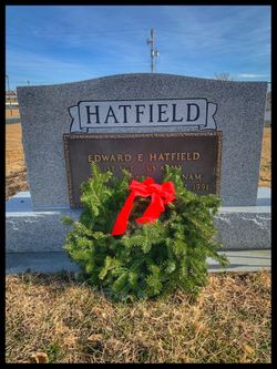

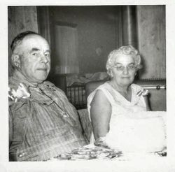
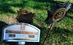
Lola Genevieve Davis Hatfield
| Birth | : | 22 May 1921 Pawnee City, Pawnee County, Nebraska, USA |
| Death | : | 11 Apr 2019 Pawnee City, Pawnee County, Nebraska, USA |
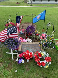
| Burial | : | Pawnee City Cemetery, Pawnee City, Pawnee County, USA |
| Coordinate | : | 40.1109009, -96.1608810 |
| Description | : | Lola G (Davis) Hatfield May 23, 1921 ~ April 11, 2019 (age 97) Lola Genevieve (Davis) Hatfield, 97 of Pawnee City, Nebraska passed away on Thursday April 11, 2019 in Pawnee City. She was born on May 23, 1921 to Melvin and Ollie (Miner) Davis) in Pawnee City, Nebraska. Services 10:00 a.m. on Thursday, April 18. 2019 at the United Methodist Church, Pawnee City, Nebraska. Officiating Reverend Sherry Sklenar. Visitation on Wednesday, April 17, 2019 from 9;00 a.m. to 8:00 p.m., with family greeting friends from 6-8 p.m. at Wherry Mortuary, 919 G Street, Pawnee... Read More |
frequently asked questions (FAQ):
-
Where is Lola Genevieve Davis Hatfield's memorial?
Lola Genevieve Davis Hatfield's memorial is located at: Pawnee City Cemetery, Pawnee City, Pawnee County, USA.
-
When did Lola Genevieve Davis Hatfield death?
Lola Genevieve Davis Hatfield death on 11 Apr 2019 in Pawnee City, Pawnee County, Nebraska, USA
-
Where are the coordinates of the Lola Genevieve Davis Hatfield's memorial?
Latitude: 40.1109009
Longitude: -96.1608810
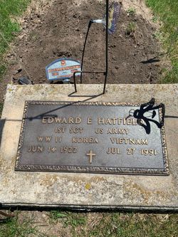
Family Members:
Parent

Spouse
Siblings

Flowers:


Nearby Cemetories:
1. Pawnee City Cemetery
Pawnee City, Pawnee County, USA
Coordinate: 40.1109009, -96.1608810
2. East Amish Cemetery
Table Rock, Pawnee County, USA
Coordinate: 40.1310000, -96.0854000
3. Evergreen Cemetery
Pawnee County, USA
Coordinate: 40.0485992, -96.1417007
4. Pleasant Valley Cemetery
Pawnee County, USA
Coordinate: 40.0299988, -96.1554794
5. Table Rock Cemetery
Table Rock, Pawnee County, USA
Coordinate: 40.1791400, -96.1037400
6. Prairie Star Pioneer Cemetery
Du Bois, Pawnee County, USA
Coordinate: 40.0293000, -96.1041000
7. Beranek Cemetery
Table Rock, Pawnee County, USA
Coordinate: 40.2042007, -96.1607971
8. Pleasant Ridge Cemetery
Du Bois, Pawnee County, USA
Coordinate: 40.0156000, -96.1494000
9. West Branch Cemetery
Pawnee County, USA
Coordinate: 40.0787940, -96.2797160
10. Saint Anthonys Cemetery
Steinauer, Pawnee County, USA
Coordinate: 40.2075005, -96.2189026
11. Johnson Creek Cemetery
Pawnee City, Pawnee County, USA
Coordinate: 40.0270000, -96.2465000
12. Clear Creek Cemetery
Table Rock, Pawnee County, USA
Coordinate: 40.2193985, -96.1391983
13. Bohemian Cemetery
Table Rock, Pawnee County, USA
Coordinate: 40.1786003, -96.0374985
14. Saint Peters Evangelican Cemetery
Du Bois, Pawnee County, USA
Coordinate: 40.0010000, -96.1095000
15. Dry Branch Pioneer Cemetery
Richardson County, USA
Coordinate: 40.1292000, -96.0100021
16. DuBois Cemetery
Du Bois, Pawnee County, USA
Coordinate: 40.0231018, -96.0488968
17. Bohemian Cemetery
Richardson County, USA
Coordinate: 40.1175003, -95.9955978
18. Saint Johns Cemetery
Table Rock, Pawnee County, USA
Coordinate: 40.2148000, -96.0657000
19. Salems Cemetery
Steinauer, Pawnee County, USA
Coordinate: 40.2166000, -96.2555000
20. McCaffrey Cemetery
Nemaha County, USA
Coordinate: 39.9827100, -96.1474500
21. Madden Cemetery
Axtell, Marshall County, USA
Coordinate: 39.9866800, -96.2490300
22. Friedens United Church of Christ Cemetery
Bern, Nemaha County, USA
Coordinate: 39.9929008, -96.0529480
23. Saint Peters Lutheran Church Cemetery
Steinauer, Pawnee County, USA
Coordinate: 40.2555000, -96.1801000
24. Cincinnati Cemetery
Du Bois, Pawnee County, USA
Coordinate: 40.0042000, -96.0274963