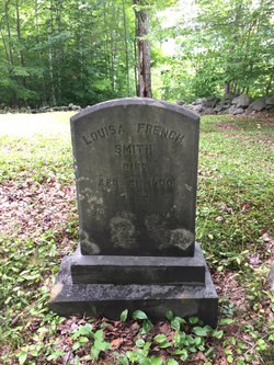
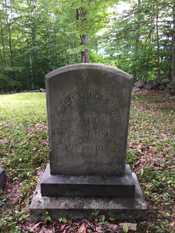
Louisa French Smith
| Birth | : | 24 Aug 1810 Campton, Grafton County, New Hampshire, USA |
| Death | : | 21 Apr 1900 Campton, Grafton County, New Hampshire, USA |
| Burial | : | Partridge Hill Cemetery, West Campton, Grafton County, USA |
| Coordinate | : | 43.8428700, -71.7046900 |
| Inscription | : | ae 90 |
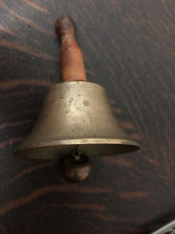
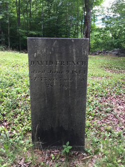
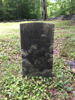
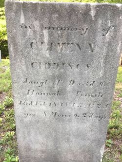
| Description | : | Daughter of David & Hannah (Giddings) French and the wife of Christopher Smith. They married in 1837 at Plymouth, New Hampshire. Family history records that the small school bell was used by Louisa 1826-1837 probably at School House #8, on Mason Rd, by the Apple farm Christopher Smith had. Just up the hill is Partridge cemetery where they are buried. My grandfather Richard Smith, born in 1890 on Bald Mountain, learned about Apples on that farm. |
frequently asked questions (FAQ):
-
Where is Louisa French Smith's memorial?
Louisa French Smith's memorial is located at: Partridge Hill Cemetery, West Campton, Grafton County, USA.
-
When did Louisa French Smith death?
Louisa French Smith death on 21 Apr 1900 in Campton, Grafton County, New Hampshire, USA
-
Where are the coordinates of the Louisa French Smith's memorial?
Latitude: 43.8428700
Longitude: -71.7046900
Family Members:
Parent
Spouse
Siblings
Children
Flowers:
Nearby Cemetories:
1. Partridge Hill Cemetery
West Campton, Grafton County, USA
Coordinate: 43.8428700, -71.7046900
2. West Campton Cemetery
Grafton County, USA
Coordinate: 43.8622220, -71.7052780
3. Town Line Cemetery
Campton, Grafton County, USA
Coordinate: 43.8614570, -71.6678870
4. East Rumney
Rumney, Grafton County, USA
Coordinate: 43.8236110, -71.7483330
5. Bog Road Cemetery
Campton, Grafton County, USA
Coordinate: 43.8152149, -71.6666793
6. Pease Cemetery
Ellsworth, Grafton County, USA
Coordinate: 43.8741100, -71.7382000
7. Old Baptist Church Cemetery
Ellsworth, Grafton County, USA
Coordinate: 43.8738890, -71.7430560
8. Beech Hill Burying Ground
Campton, Grafton County, USA
Coordinate: 43.8000620, -71.7119690
9. Blaisdell Cemetery
Campton, Grafton County, USA
Coordinate: 43.8169440, -71.6555560
10. Blair Cemetery
Campton, Grafton County, USA
Coordinate: 43.8111000, -71.6603012
11. Campton Hollow Cemetery
Campton Hollow, Grafton County, USA
Coordinate: 43.8238150, -71.6409440
12. Avery Cemetery
Ellsworth, Grafton County, USA
Coordinate: 43.8805600, -71.7511200
13. Campton Village Cemetery
Campton, Grafton County, USA
Coordinate: 43.8654440, -71.6364380
14. Blake Mountain Cemetery
Thornton, Grafton County, USA
Coordinate: 43.8963600, -71.6794200
15. Yeaton Cemetery
Thornton, Grafton County, USA
Coordinate: 43.8963800, -71.6794500
16. West Thornton Cemetery
Thornton, Grafton County, USA
Coordinate: 43.8997200, -71.6805600
17. Pine Grove Cemetery
Thornton, Grafton County, USA
Coordinate: 43.9060100, -71.6689000
18. Riverside Cemetery
Plymouth, Grafton County, USA
Coordinate: 43.7736000, -71.6908100
19. Pleasant Valley Cemetery
Plymouth, Grafton County, USA
Coordinate: 43.7741300, -71.7364600
20. Eastern Corner Road Cemetery
Campton, Grafton County, USA
Coordinate: 43.8177540, -71.6045920
21. Spencer Cemetery
Grafton County, USA
Coordinate: 43.7720080, -71.7455500
22. Blake Cemetery
Stinson Lake, Grafton County, USA
Coordinate: 43.8827780, -71.7975000
23. Mad River Cemetery
Thornton, Grafton County, USA
Coordinate: 43.8833670, -71.6077500
24. Rumney Cemetery
Rumney, Grafton County, USA
Coordinate: 43.8026100, -71.8037800

