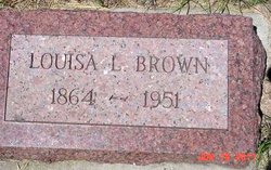
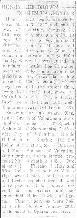
Louisa Lee Hunsaker Brown
| Birth | : | Apr 1864 Missouri, USA |
| Death | : | 1951 Sparks, Cherry County, Nebraska, USA |
| Burial | : | Sparks Cemetery, Sparks, Cherry County, USA |
| Coordinate | : | 42.9399986, -100.2463989 |
| Plot | : | Block 88, Lot 5 |
frequently asked questions (FAQ):
-
Where is Louisa Lee Hunsaker Brown's memorial?
Louisa Lee Hunsaker Brown's memorial is located at: Sparks Cemetery, Sparks, Cherry County, USA.
-
When did Louisa Lee Hunsaker Brown death?
Louisa Lee Hunsaker Brown death on 1951 in Sparks, Cherry County, Nebraska, USA
-
Where are the coordinates of the Louisa Lee Hunsaker Brown's memorial?
Latitude: 42.9399986
Longitude: -100.2463989
Family Members:
Spouse
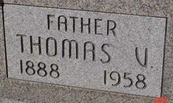
Children
Flowers:
Nearby Cemetories:
1. Sparks Cemetery
Sparks, Cherry County, USA
Coordinate: 42.9399986, -100.2463989
2. Kewanee Cemetery
Cherry County, USA
Coordinate: 42.9332020, -100.3366500
3. Saint Joseph Cemetery
Kewanee, Cherry County, USA
Coordinate: 42.9700000, -100.3373500
4. Norden Cemetery
Norden, Keya Paha County, USA
Coordinate: 42.8685837, -100.0950851
5. Norden West Cemetery
Keya Paha County, USA
Coordinate: 42.8685989, -100.0947037
6. Linden Pioneer Cemetery
Tripp County, USA
Coordinate: 43.0607986, -100.1258011
7. Pleasant Dale Cemetery
Keya Paha County, USA
Coordinate: 42.8494000, -100.0608000
8. Fort Niobrara Post Cemetery
Valentine, Cherry County, USA
Coordinate: 42.8885630, -100.4779260
9. Lost Creek Cemetery
Keya Paha County, USA
Coordinate: 42.9486008, -99.9646988
10. Taylor Cemetery
Thatcher, Cherry County, USA
Coordinate: 42.8131000, -100.4832500
11. Mount Hope Cemetery
Valentine, Cherry County, USA
Coordinate: 42.8669014, -100.5350037
12. Richland Harmony Cemetery
Valentine, Cherry County, USA
Coordinate: 42.9763985, -100.5736008
13. Minnechaduza Cemetery
Valentine, Cherry County, USA
Coordinate: 42.8731003, -100.5674973
14. Ascension Chapel Cemetery
Tripp County, USA
Coordinate: 43.0656400, -99.9211800
15. Union Cemetery
Keya Paha County, USA
Coordinate: 42.8091780, -99.9043730
16. Jerusalem Cemetery
Tripp County, USA
Coordinate: 43.2341995, -100.1856003
17. Mount Hope Cemetery
Wood Lake, Cherry County, USA
Coordinate: 42.6372920, -100.2330200
18. Saint Boniface Catholic Cemetery
Clearfield, Tripp County, USA
Coordinate: 43.2130000, -100.0450000
19. Carroll Cemetery
Olsonville, Todd County, USA
Coordinate: 43.1371300, -100.6085100
20. Saint Agnes Cemetery
Todd County, USA
Coordinate: 43.0372009, -100.6952972
21. Crookston Cemetery
Cherry County, USA
Coordinate: 42.9267970, -100.7313580
22. Congregational Cemetery
Tripp County, USA
Coordinate: 43.1116982, -99.8199997
23. West Enterprise Cemetery
Burton, Keya Paha County, USA
Coordinate: 42.9785995, -99.7478027
24. Highland Grove Cemetery
Ainsworth, Brown County, USA
Coordinate: 42.6954000, -99.8530000


