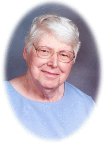
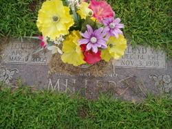
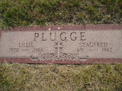
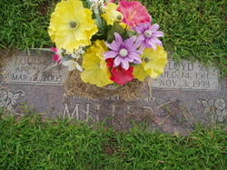
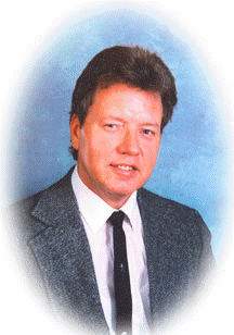
Louise Marie Plugge Miller
| Birth | : | 4 Apr 1921 Columbus, Platte County, Nebraska, USA |
| Death | : | 9 Mar 2005 Columbus, Platte County, Nebraska, USA |
| Burial | : | St Bartholomews Parish Churchyard, Quorn, Charnwood Borough, England |
| Coordinate | : | 52.7440274, -1.1703330 |
| Description | : | Daughter of Seagfred & Lillie (Nauenburg) Plugge. She attended Field Elementary, Columbus Jr. High School and graduated from Kramer High School. She married Floyd Miller on May 29, 1940 in Columbus. Louise worked for nearly 40 years as a cook for Adams Cafe and Husker Steak House. She retired from D & L after 18 years of production work. She enjoyed doing volunteer work at the Columbus Senior Center where she played in the Mulligan Band. She also did volunteer work at Beverly Healthcare. After her retirement from D & L, Louise did a lot... Read More |
frequently asked questions (FAQ):
-
Where is Louise Marie Plugge Miller's memorial?
Louise Marie Plugge Miller's memorial is located at: St Bartholomews Parish Churchyard, Quorn, Charnwood Borough, England.
-
When did Louise Marie Plugge Miller death?
Louise Marie Plugge Miller death on 9 Mar 2005 in Columbus, Platte County, Nebraska, USA
-
Where are the coordinates of the Louise Marie Plugge Miller's memorial?
Latitude: 52.7440274
Longitude: -1.1703330
Family Members:
Parent
Spouse
Siblings
Children
Flowers:
Nearby Cemetories:
1. St Bartholomews Parish Churchyard
Quorn, Charnwood Borough, England
Coordinate: 52.7440274, -1.1703330
2. Quorn Baptist Churchyard
Quorn, Charnwood Borough, England
Coordinate: 52.7407600, -1.1753200
3. Mountsorrel Cemetery
Mountsorrel, Charnwood Borough, England
Coordinate: 52.7378380, -1.1547880
4. Holy Trinity Churchyard
Barrow-upon-Soar, Charnwood Borough, England
Coordinate: 52.7526930, -1.1470900
5. Barrow-Upon-Soar Cemetery
Barrow-upon-Soar, Charnwood Borough, England
Coordinate: 52.7620220, -1.1585640
6. Loughborough Crematorium
Loughborough, Charnwood Borough, England
Coordinate: 52.7575650, -1.1965200
7. Loughborough Cemetery
Loughborough, Charnwood Borough, England
Coordinate: 52.7599400, -1.1951700
8. St. Peter's Churchyard
Mountsorrel, Charnwood Borough, England
Coordinate: 52.7304450, -1.1408620
9. St. Mary in the Elms Churchyard
Woodhouse, Charnwood Borough, England
Coordinate: 52.7313280, -1.2039850
10. Christchurch Churchyard
Mountsorrel, Charnwood Borough, England
Coordinate: 52.7268480, -1.1409340
11. Emmanuel Churchyard
Loughborough, Charnwood Borough, England
Coordinate: 52.7668830, -1.2108020
12. St. Leonard's Churchyard
Swithland, Charnwood Borough, England
Coordinate: 52.7103000, -1.1800300
13. Rothley Cemetery
Rothley, Charnwood Borough, England
Coordinate: 52.7162850, -1.1367740
14. St. Paul's Churchyard
Woodhouse, Charnwood Borough, England
Coordinate: 52.7216880, -1.2139190
15. Prestwold Natural Burial Ground
Loughborough, Charnwood Borough, England
Coordinate: 52.7779510, -1.1538520
16. All Saints with Holy Trinity Churchyard
Loughborough, Charnwood Borough, England
Coordinate: 52.7743880, -1.2035500
17. St. Mary's Churchyard
Sileby, Charnwood Borough, England
Coordinate: 52.7308600, -1.1121420
18. St Mary Churchyard
Walton-on-the-Wolds, Charnwood Borough, England
Coordinate: 52.7712900, -1.1241310
19. Chapel of the Knights Templar
Rothley, Charnwood Borough, England
Coordinate: 52.7056000, -1.1478000
20. St. Mary and St. John Churchyard
Rothley, Charnwood Borough, England
Coordinate: 52.7083290, -1.1340270
21. Sileby Cemetery
Sileby, Charnwood Borough, England
Coordinate: 52.7299340, -1.1004210
22. St. Andrew's Churchyard
Prestwold, Charnwood Borough, England
Coordinate: 52.7875000, -1.1446400
23. All Saints Churchyard
Cossington, Charnwood Borough, England
Coordinate: 52.7173590, -1.1073300
24. Seagrave Swan Street Cemetery
Seagrave, Charnwood Borough, England
Coordinate: 52.7520370, -1.0883200

