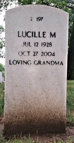
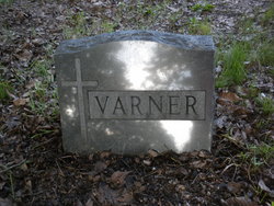
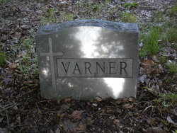
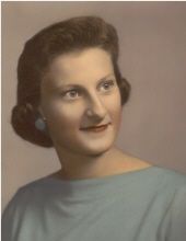
Lucille Mabel Varner Watson
| Birth | : | 12 Jul 1928 |
| Death | : | 27 Oct 2004 Keokuk, Lee County, Iowa, USA |
| Burial | : | St Margaret Churchyard, Cley, North Norfolk District, England |
| Coordinate | : | 52.9463890, 1.0475480 |
| Plot | : | I-0197 |
| Description | : | Lucille M. Watson, 76, of Keokuk, died Wednesday, October 27, at her home. Lucille was born July 12, 1928, the daughter of William and Myrtle Stephenson Varner. She worked at Paetz Super Value, Dixie Cream Donuts, and Like's Jewelry, all in Keokuk. She married Gerald Watson on June 11, 1946. She was a member of the Evangelical Free Church in Keokuk. Survivors include one daughter, Debbie (husband Russell) Suter of Keokuk; one son, Stanley Watson of Keokuk; three brothers, Charles (wife Alice) Varner of California, John (wife Marge) Varner of Keokuk, and Richard Varner of Keokuk; two sisters, Helen Thorn... Read More |
frequently asked questions (FAQ):
-
Where is Lucille Mabel Varner Watson's memorial?
Lucille Mabel Varner Watson's memorial is located at: St Margaret Churchyard, Cley, North Norfolk District, England.
-
When did Lucille Mabel Varner Watson death?
Lucille Mabel Varner Watson death on 27 Oct 2004 in Keokuk, Lee County, Iowa, USA
-
Where are the coordinates of the Lucille Mabel Varner Watson's memorial?
Latitude: 52.9463890
Longitude: 1.0475480
Family Members:
Parent
Spouse
Siblings
Flowers:
Nearby Cemetories:
1. St Margaret Churchyard
Cley, North Norfolk District, England
Coordinate: 52.9463890, 1.0475480
2. St. Nicholas' Churchyard
Blakeney, North Norfolk District, England
Coordinate: 52.9512300, 1.0247250
3. St. Martin's Churchyard, Glandford
Letheringsett, North Norfolk District, England
Coordinate: 52.9311970, 1.0396308
4. Carmelite Friary of the Blessed Virgin
Blakeney, North Norfolk District, England
Coordinate: 52.9553240, 1.0234250
5. St Nicholas Churchyard
Salthouse, North Norfolk District, England
Coordinate: 52.9503200, 1.0889800
6. All Saints Churchyard
Morston, North Norfolk District, England
Coordinate: 52.9543600, 0.9886660
7. St. Margaret's Churchyard
Saxlingham, North Norfolk District, England
Coordinate: 52.9155250, 1.0121410
8. St. Mary the Virgin Churchyard
Kelling, North Norfolk District, England
Coordinate: 52.9322300, 1.1053700
9. St. Andrews Churchyard
Letheringsett, North Norfolk District, England
Coordinate: 52.9081600, 1.0623490
10. St Andrew and St Mary Churchyard
Langham, North Norfolk District, England
Coordinate: 52.9310020, 0.9855430
11. Holt Town Cemetery
Holt, North Norfolk District, England
Coordinate: 52.9117900, 1.0850400
12. Methodist Memorial Gardens
Holt, North Norfolk District, England
Coordinate: 52.9067730, 1.0878360
13. Saint Andrew the Apostle
Holt, North Norfolk District, England
Coordinate: 52.9063400, 1.0933500
14. Saint Andrew's Churchyard
Field Dalling, North Norfolk District, England
Coordinate: 52.9110600, 0.9832800
15. All Saints Churchyard
Cockthorpe, North Norfolk District, England
Coordinate: 52.9407830, 0.9472385
16. All Saints Churchyard
Bale, North Norfolk District, England
Coordinate: 52.8906290, 0.9871950
17. Binham Priory
Binham, North Norfolk District, England
Coordinate: 52.9199700, 0.9452300
18. St. Andrew's Churchyard
Brinton, North Norfolk District, England
Coordinate: 52.8803690, 1.0274610
19. St Lawrence Churchyard
Hunworth, North Norfolk District, England
Coordinate: 52.8772530, 1.0673080
20. St Andrew Churchyard
Hempstead, North Norfolk District, England
Coordinate: 52.8895750, 1.1270070
21. All Saints Churchyard
Hempstead, North Norfolk District, England
Coordinate: 52.8895200, 1.1274620
22. St Mary Churchyard
Gunthorpe, North Norfolk District, England
Coordinate: 52.8767720, 0.9883020
23. All Saints Churchyard
Bodham, North Norfolk District, England
Coordinate: 52.9057700, 1.1596200
24. St Maurice Churchyard
Briningham, North Norfolk District, England
Coordinate: 52.8682680, 1.0271340

