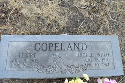
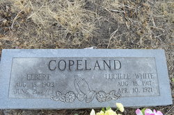
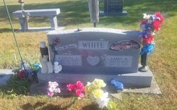
Lucille White Copeland
| Birth | : | 18 Aug 1917 Mayetta, Jackson County, Kansas, USA |
| Death | : | 10 Apr 1971 Topeka, Shawnee County, Kansas, USA |
| Burial | : | Old Union Cemetery, Louisville, Clay County, USA |
| Coordinate | : | 38.8708000, -88.5000000 |
| Description | : | Topeka (Ks) State Journal Sat., 10 Apr., 1971, pg 15: Mrs. Lucille White Copeland, 53, 526 Burgress, died today at a local hospital. She had been in the hospital about a week. She had a liver ailment. She was born Aug. 18, 1917, at Mayetta, and was a resident of Topeka 35 years. She was employed by the Kansas League of Municipalities until 1969 when she retired. Mrs. Copeland was a member of Business and Professional Women's Club of Topeka. Survivors include her widower, Elbert Copeland, at home; her parents, Mr. & Mrs. George O. White, Mayetta; a brother, Larry M. White, Mayetta; and... Read More |
frequently asked questions (FAQ):
-
Where is Lucille White Copeland's memorial?
Lucille White Copeland's memorial is located at: Old Union Cemetery, Louisville, Clay County, USA.
-
When did Lucille White Copeland death?
Lucille White Copeland death on 10 Apr 1971 in Topeka, Shawnee County, Kansas, USA
-
Where are the coordinates of the Lucille White Copeland's memorial?
Latitude: 38.8708000
Longitude: -88.5000000
Family Members:
Parent
Spouse
Siblings
Flowers:
Nearby Cemetories:
1. Old Union Cemetery
Louisville, Clay County, USA
Coordinate: 38.8708000, -88.5000000
2. Conly Cemetery
Clay County, USA
Coordinate: 38.8725014, -88.4899979
3. German Cemetery
Bible Grove, Clay County, USA
Coordinate: 38.8986015, -88.4555969
4. Saint John's Lutheran Church Cemetery
Eberle, Effingham County, USA
Coordinate: 38.9136400, -88.4751600
5. Bible Grove Cemetery
Bible Grove, Clay County, USA
Coordinate: 38.8544006, -88.4396973
6. Tolliver Cemetery
Louisville, Clay County, USA
Coordinate: 38.8217010, -88.5171967
7. Lewis Cemetery
Bible Grove Township, Clay County, USA
Coordinate: 38.8514348, -88.4364355
8. Newton Chapel Cemetery
Louisville, Clay County, USA
Coordinate: 38.8310200, -88.5623100
9. Burge Cemetery
Iola, Clay County, USA
Coordinate: 38.8636017, -88.5813980
10. Saint Paul Cemetery
Bible Grove, Clay County, USA
Coordinate: 38.9094696, -88.4341049
11. Red Brush Cemetery
Louisville, Clay County, USA
Coordinate: 38.7969250, -88.5085415
12. Bethsaida Cemetery
Effingham County, USA
Coordinate: 38.9460983, -88.4832993
13. Fender Cemetery
Clay County, USA
Coordinate: 38.8883781, -88.6028290
14. Riffle Cemetery
Louisville, Clay County, USA
Coordinate: 38.8061562, -88.5681076
15. Shouse Chapel Cemetery
Bible Grove, Clay County, USA
Coordinate: 38.8407300, -88.3993200
16. Kinnamon Cemetery
Louisville, Clay County, USA
Coordinate: 38.7872009, -88.4586029
17. Woods Cemetery
Iola, Clay County, USA
Coordinate: 38.8610992, -88.6157990
18. Rogers Cemetery
Iola, Clay County, USA
Coordinate: 38.8464355, -88.6128311
19. Ridge Cemetery
Effingham County, USA
Coordinate: 38.9569016, -88.5408020
20. Saint Matthews German Lutheran Cemetery
Eberle, Effingham County, USA
Coordinate: 38.9409800, -88.4220800
21. Christian Home Cemetery
Louisville, Clay County, USA
Coordinate: 38.7883900, -88.5572400
22. Orchard Hill Cemetery
Louisville, Clay County, USA
Coordinate: 38.7764500, -88.5097800
23. Brooks Cemetery
Bible Grove, Clay County, USA
Coordinate: 38.8495300, -88.3802000
24. Morris Cemetery
Effingham County, USA
Coordinate: 38.9652000, -88.4623600

