
| Birth | : | 9 Aug 1875 DeKalb County, Illinois, USA |
| Death | : | 26 Jul 1961 Omaha, Douglas County, Nebraska, USA |
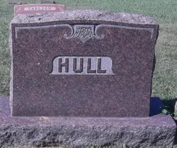
| Burial | : | Trinity Lutheran Cemetery New, Carthage, Miner County, USA |
| Coordinate | : | 44.1812172, -97.7092285 |
| Description | : | CARTHAGE - Final rites for Mrs. Lydia Freed, 85, were held July 31 in the Trinity Lutheran Church at Carthage with interment at the Trinity Cemetery. Mrs Freed died July 27 at the Immanuel Deaconess Home in Omaha NE. Paul bearers were Martin Nelson, Roy Shoemaker, Ernest Anderson, Arthur Magnuson, Emil Swanson, and Edwin Hokanson. Lydia A. Engstrom was born August 9, 1875 at Cable IL. She came with her parents as a child to Page County IA. After her marriage to Victor Freed, January 6, 1917, they made their home at Clarinda IA. In 1931 they... Read More |
frequently asked questions (FAQ):
-
Where is Lydia A Engstrom Freed's memorial?
Lydia A Engstrom Freed's memorial is located at: Trinity Lutheran Cemetery New, Carthage, Miner County, USA.
-
When did Lydia A Engstrom Freed death?
Lydia A Engstrom Freed death on 26 Jul 1961 in Omaha, Douglas County, Nebraska, USA
-
Where are the coordinates of the Lydia A Engstrom Freed's memorial?
Latitude: 44.1812172
Longitude: -97.7092285
Family Members:
Parent

Spouse
Siblings

Flowers:


Nearby Cemetories:
1. Trinity Lutheran Cemetery New
Carthage, Miner County, USA
Coordinate: 44.1812172, -97.7092285
2. Sacred Heart Cemetery
Carthage, Miner County, USA
Coordinate: 44.1824989, -97.7089005
3. Pleasant View Cemetery
Carthage, Miner County, USA
Coordinate: 44.1693993, -97.6983032
4. Trinity Lutheran Cemetery
Carthage, Miner County, USA
Coordinate: 44.1697006, -97.7403030
5. Esmond Cemetery
Esmond, Kingsbury County, USA
Coordinate: 44.2578000, -97.7728000
6. Prairie Flower Cemetery
Fedora, Miner County, USA
Coordinate: 44.0969009, -97.8169022
7. Cloverleaf Colony Cemetery
Howard, Miner County, USA
Coordinate: 44.1858368, -97.5361023
8. Morgans Cemetery
Miner County, USA
Coordinate: 44.0602989, -97.7707977
9. Dow Cemetery
Manchester, Kingsbury County, USA
Coordinate: 44.3112200, -97.6930700
10. Berton Cemetery
Miner County, USA
Coordinate: 44.1542015, -97.4903030
11. Lutheran Cemetery
Artesian, Sanborn County, USA
Coordinate: 44.0967700, -97.9117600
12. Saint Nicholas Cemetery
Roswell, Miner County, USA
Coordinate: 44.0057793, -97.6929626
13. Saint Anthony's Catholic Cemetery
Sanborn County, USA
Coordinate: 44.1478400, -97.9504400
14. Saint Peter Cemetery
De Smet, Kingsbury County, USA
Coordinate: 44.3046000, -97.5313000
15. IOOF Cemetery
Vilas, Miner County, USA
Coordinate: 44.0225067, -97.5940399
16. Norwegian Lutheran Cemetery
Sanborn County, USA
Coordinate: 44.0966988, -97.9332962
17. Immanuel Lutheran Cemetery
Belle Prairie Township, Beadle County, USA
Coordinate: 44.2341003, -97.9559021
18. Belleview Cemetery
Howard, Miner County, USA
Coordinate: 44.1116080, -97.4686910
19. Roswell Cemetery
Roswell, Miner County, USA
Coordinate: 43.9939003, -97.6919022
20. Manchester Cemetery
Manchester, Kingsbury County, USA
Coordinate: 44.3701930, -97.7125530
21. Fedora Cemetery
Fedora, Miner County, USA
Coordinate: 43.9996986, -97.7906036
22. Saint Pauls Catholic Cemetery
Iroquois, Kingsbury County, USA
Coordinate: 44.3679500, -97.8370300
23. Maplewood Cemetery
Iroquois, Kingsbury County, USA
Coordinate: 44.3679000, -97.8385100
24. Pearl Creek Colony Cemetery
Pearl Creek Colony, Beadle County, USA
Coordinate: 44.3289110, -97.9165710