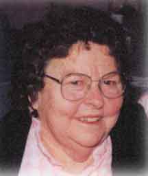
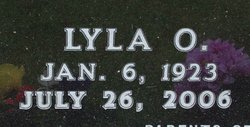
Lyla Opal Ruroden Rodas
| Birth | : | 6 Jan 1923 |
| Death | : | 26 Jul 2006 |
| Burial | : | Ilchester Gallows Field Cemetery, Ilchester, South Somerset District, England |
| Coordinate | : | 50.9996250, -2.6831080 |
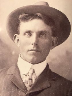
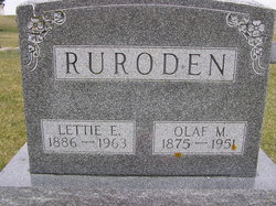
| Description | : | Lyla Rodas of Littleport, died Wednesday, July 26, 2006, at the Edgewood Convalescent Home, Edgewood, following a long illness. Lyla Opal (Ruroden) Rodas was born January 6, 1923, on a farm in Highland Township. She was the youngest daughter of Olaf and Lettie (Malumquist) Ruroden. She was baptized at East Clermont Church, Clermont and confirmed at Highland Lutheran Church, rural Elgin. Lyla attended Spring Valley School #9. She was united in marriage to Elmer John Rodas on October 28, 1940, in Manchester. To this union two sons were born. Elmer and Lyla were married over sixty-three years. Lyla worked on... Read More |
frequently asked questions (FAQ):
-
Where is Lyla Opal Ruroden Rodas's memorial?
Lyla Opal Ruroden Rodas's memorial is located at: Ilchester Gallows Field Cemetery, Ilchester, South Somerset District, England.
-
When did Lyla Opal Ruroden Rodas death?
Lyla Opal Ruroden Rodas death on 26 Jul 2006 in
-
Where are the coordinates of the Lyla Opal Ruroden Rodas's memorial?
Latitude: 50.9996250
Longitude: -2.6831080
Family Members:
Parent
Spouse
Siblings
Children
Flowers:
Nearby Cemetories:
1. Ilchester Gallows Field Cemetery
Ilchester, South Somerset District, England
Coordinate: 50.9996250, -2.6831080
2. St Mary Major Churchyard
Ilchester, South Somerset District, England
Coordinate: 51.0010030, -2.6818120
3. Ilchester County Gaol Cemetery
Ilchester, South Somerset District, England
Coordinate: 51.0023060, -2.6833610
4. St Andrew Churchyard
Ilchester, South Somerset District, England
Coordinate: 51.0056950, -2.6804910
5. Ilchester Parish Cemetery
Ilchester, South Somerset District, England
Coordinate: 50.9993670, -2.6721280
6. Saint Mary Churchyard
Limington, South Somerset District, England
Coordinate: 50.9989000, -2.6546000
7. Blessed Virgin Mary Churchyard
Chilthorne Domer, South Somerset District, England
Coordinate: 50.9721100, -2.6783950
8. St. Peter’s Churchyard
Podimore, South Somerset District, England
Coordinate: 51.0219250, -2.6492310
9. All Saints Churchyard
Kingsdon, South Somerset District, England
Coordinate: 51.0330100, -2.6918330
10. St Vincent Churchyard
Ashington, South Somerset District, England
Coordinate: 50.9904090, -2.6267630
11. St. James Parish Churchyard
Chilton Cantelo, South Somerset District, England
Coordinate: 50.9972730, -2.6136800
12. Holy Trinity Churchyard
Ash, South Somerset District, England
Coordinate: 50.9834250, -2.7528400
13. Ash Parish Cemetery
Ash, South Somerset District, England
Coordinate: 50.9833540, -2.7538380
14. Lufton Anglican Churchyard
Lufton, South Somerset District, England
Coordinate: 50.9491080, -2.6917910
15. Christ Church Cemetery
Long Load, South Somerset District, England
Coordinate: 51.0054700, -2.7639100
16. Blessed Virgin Mary Churchyard
Mudford, South Somerset District, England
Coordinate: 50.9773210, -2.6086310
17. Church of the Virgin Mary
Charlton Mackrell, South Somerset District, England
Coordinate: 51.0524210, -2.6743894
18. Holy Trinity Churchyard
Long Sutton, South Somerset District, England
Coordinate: 51.0246110, -2.7577940
19. Mudford Parish Cemetery
Mudford, South Somerset District, England
Coordinate: 50.9708040, -2.6114880
20. St. Catherine's Churchyard
Montacute, South Somerset District, England
Coordinate: 50.9495420, -2.7178200
21. Montacute Priory
Montacute, South Somerset District, England
Coordinate: 50.9489820, -2.7183880
22. St. Peter & St. Paul's Churchyard
Charlton Adam, South Somerset District, England
Coordinate: 51.0552350, -2.6647930
23. St. James's Churchyard
Preston Plucknett, South Somerset District, England
Coordinate: 50.9437800, -2.6635960
24. Long Sutton Friends Burial Ground
Long Sutton, South Somerset District, England
Coordinate: 51.0302700, -2.7612300

