

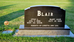
Lyle Loren “Bud” Blair
| Birth | : | 1 Jul 1931 Paton, Greene County, Iowa, USA |
| Death | : | 10 Nov 2008 Fort Dodge, Webster County, Iowa, USA |
| Burial | : | Paton Cemetery, Paton, Greene County, USA |
| Coordinate | : | 42.1624985, -94.2433014 |
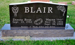
| Inscription | : | Parents of Loretta and Lisa |
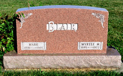
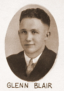
| Description | : | Lyle L. (Bud) Blair - age 77, of Paton, Iowa, died on Monday, November 10, 2008, at Trinity Regional Hospital, Fort Dodge, Iowa. Lyle Loren Blair was born on July 1, 1931, the son of Mark and Myrtle (Wright) Blair. He graduated from Paton Consolidated School in 1949. On November 26, 1950, he was united in marriage to his high school sweetheart, Mary Jane Rundle, at the First Presbyterian Church in Paton. They continued their love affair for nearly 58 years. Lyle was drafted into the U.S. Marine Corps in March of 1952 and began... Read More |
frequently asked questions (FAQ):
-
Where is Lyle Loren “Bud” Blair's memorial?
Lyle Loren “Bud” Blair's memorial is located at: Paton Cemetery, Paton, Greene County, USA.
-
When did Lyle Loren “Bud” Blair death?
Lyle Loren “Bud” Blair death on 10 Nov 2008 in Fort Dodge, Webster County, Iowa, USA
-
Where are the coordinates of the Lyle Loren “Bud” Blair's memorial?
Latitude: 42.1624985
Longitude: -94.2433014
Family Members:
Parent

Spouse

Siblings
Flowers:


Nearby Cemetories:
1. Paton Cemetery
Paton, Greene County, USA
Coordinate: 42.1624985, -94.2433014
2. Dawson Cemetery
Paton, Greene County, USA
Coordinate: 42.1655998, -94.3283005
3. Renner Cemetery
Boone County, USA
Coordinate: 42.1380420, -94.1256570
4. Lost Grove Cemetery
Harcourt, Webster County, USA
Coordinate: 42.2583008, -94.2331009
5. Swedish Lutheran Church Cemetery
Dayton, Webster County, USA
Coordinate: 42.2175000, -94.1065000
6. Lawn Cemetery
Boone County, USA
Coordinate: 42.1771011, -94.0867996
7. Union Cemetery
Boxholm, Boone County, USA
Coordinate: 42.1369019, -94.0852966
8. Grand Ridge Cemetery
Beaver, Boone County, USA
Coordinate: 42.0786018, -94.1157990
9. Gowrie Township Cemetery
Gowrie, Webster County, USA
Coordinate: 42.2813988, -94.3043976
10. Mount Calvary Cemetery
Grand Junction, Greene County, USA
Coordinate: 42.0266000, -94.2325000
11. Beaver Cemetery
Beaver, Boone County, USA
Coordinate: 42.0462000, -94.1446000
12. Junction Township Cemetery
Grand Junction, Greene County, USA
Coordinate: 42.0236015, -94.2593994
13. Maple Grove Cemetery
Boxholm, Boone County, USA
Coordinate: 42.0793690, -94.0859890
14. Maas Cemetery
Boone County, USA
Coordinate: 42.0908012, -94.0618973
15. Pilot Mound Cemetery
Pilot Mound, Boone County, USA
Coordinate: 42.1636200, -94.0282600
16. Christ the King Catholic Cemetery
Dayton, Webster County, USA
Coordinate: 42.2601929, -94.0727539
17. Dayton Cemetery
Dayton, Webster County, USA
Coordinate: 42.2675000, -94.0755000
18. Highland Township Cemetery
Churdan, Greene County, USA
Coordinate: 42.1518310, -94.4699120
19. Saint Joseph Cemetery
Jefferson, Greene County, USA
Coordinate: 42.0289001, -94.3818970
20. Reading Cemetery
Farnhamville, Calhoun County, USA
Coordinate: 42.2593994, -94.4325027
21. Jefferson Cemetery
Jefferson, Greene County, USA
Coordinate: 42.0133018, -94.3591995
22. Runyan Cemetery
Pilot Mound, Boone County, USA
Coordinate: 42.1749992, -94.0015030
23. Our Saviour Cemetery
Callender, Webster County, USA
Coordinate: 42.3396988, -94.3153000
24. Linn Cemetery
Pilot Mound, Boone County, USA
Coordinate: 42.2045330, -93.9970230