
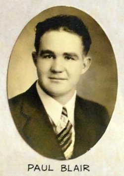
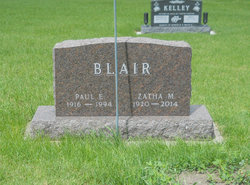
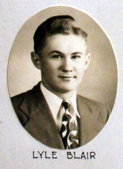
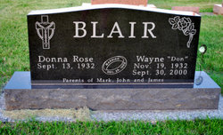
Paul Edwin Blair
| Birth | : | 13 Sep 1916 Richland County, Montana, USA |
| Death | : | 22 Feb 1994 Jefferson, Greene County, Iowa, USA |
| Burial | : | Highland Township Cemetery, Churdan, Greene County, USA |
| Coordinate | : | 42.1518310, -94.4699120 |
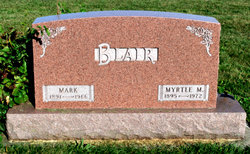
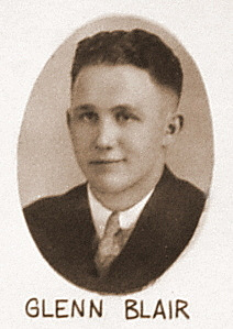
| Description | : | Death: 22 Feb 1994 - Jefferson, Greene, Iowa Father: Mark W Blair (1891-1966) Mother: Myrtle "Mytie" Mae Wright (1895-1972) 1920 United States Federal Census Name: Paul Blair Birth Year: abt 1917 [abt 1916] Birthplace: Montana Home in 1920: School District 119, Richland, Montana Relation to Head of House: Son Father's Name: Mark W Blair Father's Birthplace: Tennessee Mother's Name: Myrtle Blair Mother's Birthplace: Iowa Household Members: Mark W Blair 28, Myrtle Blair 24, Paul Blair 3 3/12, Glen Blair 1 5/12 1930 United States Federal Census Name: Paul E Blair Home in 1930: Paton, Greene, Iowa Household Members: Mark W Blair 38, Myrtle M Blair 34, Paul E Blair 13, Glenn D Blair 11, Earl... Read More |
frequently asked questions (FAQ):
-
Where is Paul Edwin Blair's memorial?
Paul Edwin Blair's memorial is located at: Highland Township Cemetery, Churdan, Greene County, USA.
-
When did Paul Edwin Blair death?
Paul Edwin Blair death on 22 Feb 1994 in Jefferson, Greene County, Iowa, USA
-
Where are the coordinates of the Paul Edwin Blair's memorial?
Latitude: 42.1518310
Longitude: -94.4699120
Family Members:
Parent

Spouse

Siblings
Flowers:


Nearby Cemetories:
1. Highland Township Cemetery
Churdan, Greene County, USA
Coordinate: 42.1518310, -94.4699120
2. Saint Patricks Cemetery
Churdan, Greene County, USA
Coordinate: 42.1605988, -94.5511017
3. Old Cedar Cemetery
Adaza, Greene County, USA
Coordinate: 42.1874821, -94.5419194
4. Dawson Cemetery
Paton, Greene County, USA
Coordinate: 42.1655998, -94.3283005
5. Evergreen Cemetery
Lohrville, Calhoun County, USA
Coordinate: 42.2505989, -94.5330963
6. Saint Joseph Cemetery
Lohrville, Calhoun County, USA
Coordinate: 42.2569008, -94.5119019
7. Gibson-Fleck-Thompson Cemetery
Scranton, Greene County, USA
Coordinate: 42.0428870, -94.4988800
8. Reading Cemetery
Farnhamville, Calhoun County, USA
Coordinate: 42.2593994, -94.4325027
9. Fair Oaks Cemetery
Scranton, Greene County, USA
Coordinate: 42.0355988, -94.4460983
10. Dillavou Cemetery
Kendrick Township, Greene County, USA
Coordinate: 42.0802994, -94.6138992
11. Wright Cemetery
Jefferson, Greene County, USA
Coordinate: 42.0228004, -94.4477997
12. Saint Joseph Cemetery
Jefferson, Greene County, USA
Coordinate: 42.0289001, -94.3818970
13. Scranton Township Cemetery
Scranton, Greene County, USA
Coordinate: 42.0306015, -94.5783005
14. Bishop Cemetery
Calhoun Township, Calhoun County, USA
Coordinate: 42.2230400, -94.6453190
15. Headley Cemetery
Jefferson, Greene County, USA
Coordinate: 42.0041504, -94.4335815
16. North Coon Cemetery
Carroll County, USA
Coordinate: 42.1260986, -94.6716995
17. Jefferson Cemetery
Jefferson, Greene County, USA
Coordinate: 42.0133018, -94.3591995
18. Paton Cemetery
Paton, Greene County, USA
Coordinate: 42.1624985, -94.2433014
19. Dickson Cemetery
Glidden Township, Carroll County, USA
Coordinate: 42.1074982, -94.6939011
20. Gowrie Township Cemetery
Gowrie, Webster County, USA
Coordinate: 42.2813988, -94.3043976
21. Lanesboro Cemetery
Lanesboro, Carroll County, USA
Coordinate: 42.1810989, -94.7230988
22. Cedar Cemetery
Rinard, Calhoun County, USA
Coordinate: 42.3456001, -94.4644012
23. Junction Township Cemetery
Grand Junction, Greene County, USA
Coordinate: 42.0236015, -94.2593994
24. Lost Grove Cemetery
Harcourt, Webster County, USA
Coordinate: 42.2583008, -94.2331009