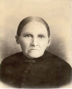
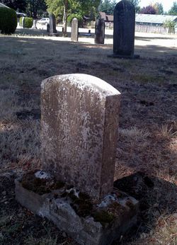
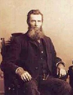
Madora Williams Bowman
| Birth | : | 22 Dec 1832 Jackson County, Missouri, USA |
| Death | : | 20 May 1902 Multnomah County, Oregon, USA |
| Burial | : | Riverview Cemetery, Port Clinton, Ottawa County, USA |
| Coordinate | : | 41.5097008, -82.9599991 |
| Description | : | Born 22 Dec 1832 at Jackson County Missouri, she was the eldest child of Bluford Williams and Elizabeth Lewis. Madora married Merritt Bowman 18 Dec 1851 in Sni-a-Bar Twp, Jackson, Missouri.Thier first child was born Jan 1853.Later in the year 1853 the Bowmans and several other families set out from Kansas City, Missouri on the long and arduous trail west, Hoping to carve a better future from an unknown frontier. The wagons were drawn by oxen and the journey took six moths to complete. The hardships of the trail were appalling and many turned back or died in the attempt, but... Read More |
frequently asked questions (FAQ):
-
Where is Madora Williams Bowman's memorial?
Madora Williams Bowman's memorial is located at: Riverview Cemetery, Port Clinton, Ottawa County, USA.
-
When did Madora Williams Bowman death?
Madora Williams Bowman death on 20 May 1902 in Multnomah County, Oregon, USA
-
Where are the coordinates of the Madora Williams Bowman's memorial?
Latitude: 41.5097008
Longitude: -82.9599991
Family Members:
Spouse
Children
Flowers:
Nearby Cemetories:
1. Riverview Cemetery
Port Clinton, Ottawa County, USA
Coordinate: 41.5097008, -82.9599991
2. Lakeview Cemetery
Port Clinton, Ottawa County, USA
Coordinate: 41.5107994, -82.9511032
3. Saint Thomas Episcopal Columbarium
Port Clinton, Ottawa County, USA
Coordinate: 41.5118670, -82.9386350
4. Christy Chapel Cemetery
Gypsum, Ottawa County, USA
Coordinate: 41.5085983, -82.8861008
5. Camp Perry Memorial
Port Clinton, Ottawa County, USA
Coordinate: 41.5437850, -83.0193580
6. Tynan Burial Plot
Portage Township, Ottawa County, USA
Coordinate: 41.4909000, -82.8835000
7. LaCarpe Cemetery
Lacarne, Ottawa County, USA
Coordinate: 41.5368996, -83.0344009
8. Shook Cemetery
Portage Township, Ottawa County, USA
Coordinate: 41.5214005, -82.8758011
9. Dwelle Cemetery
Port Clinton, Ottawa County, USA
Coordinate: 41.5069008, -82.8563995
10. Hineline Cemetery
Port Clinton, Ottawa County, USA
Coordinate: 41.4634094, -83.0488739
11. K'Burg Family Cemetery
Catawba Island Township, Ottawa County, USA
Coordinate: 41.5589400, -82.8463000
12. County Home Cemetery
Oak Harbor, Ottawa County, USA
Coordinate: 41.5084650, -83.0929680
13. Catawba Island Cemetery
Catawba Island, Ottawa County, USA
Coordinate: 41.5569000, -82.8403015
14. Jamison Cemetery
Danbury, Ottawa County, USA
Coordinate: 41.5050060, -82.8180740
15. Rusha Cemetery
Oak Harbor, Ottawa County, USA
Coordinate: 41.5690994, -83.0865021
16. Lockwood Cemetery
Lakeside, Ottawa County, USA
Coordinate: 41.5435140, -82.8161560
17. Green Creek Burial Ground
Green Creek, Sandusky County, USA
Coordinate: 41.4046160, -83.0213860
18. LaPrairie Cemetery
Fremont, Sandusky County, USA
Coordinate: 41.4258030, -83.0669190
19. Saint Pauls Lutheran Church Cemetery
Lakeside, Ottawa County, USA
Coordinate: 41.5242200, -82.8049100
20. McCreery Farm Cemetery
Vickery, Sandusky County, USA
Coordinate: 41.3917594, -82.9823677
21. Lathrop Cemetery
Riley Township, Sandusky County, USA
Coordinate: 41.3928301, -83.0110269
22. Roose Cemetery
Oak Harbor, Ottawa County, USA
Coordinate: 41.4944000, -83.1268997
23. Sackett Cemetery
Danbury, Ottawa County, USA
Coordinate: 41.5303001, -82.7872009
24. Greenwood Cemetery
Kingsway, Sandusky County, USA
Coordinate: 41.4281100, -83.1060300


