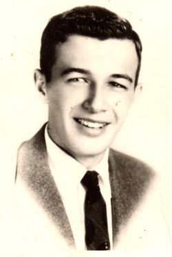
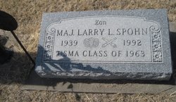
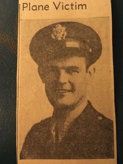
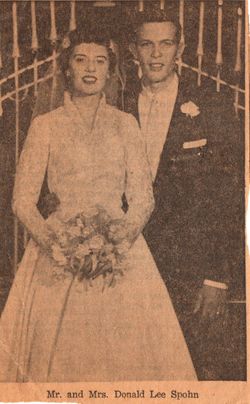
Maj Larry L Spohn
| Birth | : | 1939 Culver, Ottawa County, Kansas, USA |
| Death | : | 2 Jun 1992 Kansas City, Wyandotte County, Kansas, USA |
| Burial | : | Hosea Cemetery, Knobel, Clay County, USA |
| Coordinate | : | 36.3208008, -90.6324997 |
| Inscription | : | USMA Class of 1963 |
frequently asked questions (FAQ):
-
Where is Maj Larry L Spohn's memorial?
Maj Larry L Spohn's memorial is located at: Hosea Cemetery, Knobel, Clay County, USA.
-
When did Maj Larry L Spohn death?
Maj Larry L Spohn death on 2 Jun 1992 in Kansas City, Wyandotte County, Kansas, USA
-
Where are the coordinates of the Maj Larry L Spohn's memorial?
Latitude: 36.3208008
Longitude: -90.6324997
Family Members:
Parent
Siblings
Flowers:
Nearby Cemetories:
1. Hosea Cemetery
Knobel, Clay County, USA
Coordinate: 36.3208008, -90.6324997
2. Saint Bernard Cemetery
Knobel, Clay County, USA
Coordinate: 36.3236008, -90.6232986
3. Allen Cemetery
Knobel, Clay County, USA
Coordinate: 36.3119011, -90.6505966
4. Gilchrist Cemetery
Knobel, Clay County, USA
Coordinate: 36.3227997, -90.5886002
5. Bond Cemetery
Knobel, Clay County, USA
Coordinate: 36.3297005, -90.5864029
6. Pirtle Cemetery
Peach Orchard, Clay County, USA
Coordinate: 36.2957580, -90.6700160
7. Brownie Chapel Cemetery
Peach Orchard, Clay County, USA
Coordinate: 36.2706200, -90.7085200
8. Richwoods Cemetery
Corning, Clay County, USA
Coordinate: 36.4035988, -90.6632996
9. Nelson Clay Cemetery
Clay County, USA
Coordinate: 36.3576800, -90.7396700
10. Cherry Cemetery
Randolph County, USA
Coordinate: 36.3222008, -90.7592010
11. Corning Cemetery
Corning, Clay County, USA
Coordinate: 36.4132996, -90.5774994
12. Old Reyno Cemetery
Randolph County, USA
Coordinate: 36.3314018, -90.7592010
13. Jones Ridge Cemetery
Delaplaine, Greene County, USA
Coordinate: 36.2305984, -90.6980972
14. Albrite Cemetery
Greene County, USA
Coordinate: 36.2630997, -90.7482986
15. Blount Cemetery
Reyno, Randolph County, USA
Coordinate: 36.3518982, -90.7718964
16. Johnston Cemetery
Reyno, Randolph County, USA
Coordinate: 36.3568993, -90.7716980
17. Osborn Cemetery
Biggers, Randolph County, USA
Coordinate: 36.3320800, -90.7875000
18. Meadows Grove Cemetery
Greene County, USA
Coordinate: 36.1938960, -90.6112310
19. Redenbo Cemetery
Clay County, USA
Coordinate: 36.4077988, -90.5152969
20. Lawnbird Cemetery
Biggers, Randolph County, USA
Coordinate: 36.3177986, -90.7932968
21. Allmandinger Cemetery
Corning, Clay County, USA
Coordinate: 36.4524994, -90.6038971
22. Luttrell Cemetery
Biggers, Randolph County, USA
Coordinate: 36.3120100, -90.8014300
23. Cantwell Cemetery
Corning, Clay County, USA
Coordinate: 36.4081001, -90.5014038
24. Green Cemetery
Clay County, USA
Coordinate: 36.4641991, -90.6331024

