
| Birth | : | 21 Jun 1901 North Carolina, USA |
| Death | : | 15 Dec 1953 Rutherford County, North Carolina, USA |
| Burial | : | Cedar Grove United Methodist Church Cemetery, Rutherford County, USA |
| Coordinate | : | 35.4506110, -81.8097540 |
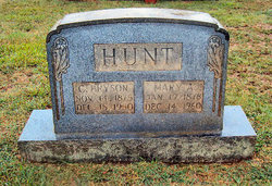
| Description | : | d/o Charlie Bryson Hunt, Mary Antonie Hopper Married w/o Lee Campbell, m. 6 Feb 1921, Cleveland, North Carolina Children James Bryson Campbell (1922-1993) Roy Lee Campbell (1924-2000) Fred William Campbell (1925-1999) Mary Pauline Campbell (1927- ) Buren Robert Campbell (1930-2008) Adam Russell Campbell (1932-2014) John Dee Campbell (1937-2007) |
frequently asked questions (FAQ):
-
Where is Mamie Lee Hunt Campbell's memorial?
Mamie Lee Hunt Campbell's memorial is located at: Cedar Grove United Methodist Church Cemetery, Rutherford County, USA.
-
When did Mamie Lee Hunt Campbell death?
Mamie Lee Hunt Campbell death on 15 Dec 1953 in Rutherford County, North Carolina, USA
-
Where are the coordinates of the Mamie Lee Hunt Campbell's memorial?
Latitude: 35.4506110
Longitude: -81.8097540
Family Members:
Parent
Spouse

Siblings
Children
Flowers:


Nearby Cemetories:
1. Mount Harmony Baptist Church Cemetery
Bostic, Rutherford County, USA
Coordinate: 35.4588380, -81.7996940
2. Ross Hill Baptist Church Cemetery
Bostic, Rutherford County, USA
Coordinate: 35.4575280, -81.7922220
3. Sunshine United Methodist Church Cemetery
Bostic, Rutherford County, USA
Coordinate: 35.4286930, -81.8132680
4. Mountain View Baptist Church Cemetery
Bostic, Rutherford County, USA
Coordinate: 35.4227630, -81.8080460
5. Hollifield Family Cemetery
Bostic, Rutherford County, USA
Coordinate: 35.4203956, -81.8117291
6. Mount Lebanon Cemetery
Rutherford County, USA
Coordinate: 35.4319000, -81.8414001
7. Cooper Springs Congregational Holiness Church Ceme
Rutherford County, USA
Coordinate: 35.4755700, -81.7844540
8. Sandy Level Baptist Cemetery
Bostic, Rutherford County, USA
Coordinate: 35.4591400, -81.8520440
9. Sweezy-Murray Family Cemetery
Rutherford County, USA
Coordinate: 35.4432090, -81.7671363
10. Wilson Baptist Cemetery
Forest City, Rutherford County, USA
Coordinate: 35.4257164, -81.8531723
11. Cansler Cemetery
Sunshine, Rutherford County, USA
Coordinate: 35.4082600, -81.8350400
12. Duggar Freeman Cemetery
Rutherford County, USA
Coordinate: 35.4247780, -81.8585810
13. Salem United Methodist Church Cemetery
Washburn, Rutherford County, USA
Coordinate: 35.4000015, -81.7985992
14. Golden Valley Missionary Methodist Church Cemetery
Bostic, Rutherford County, USA
Coordinate: 35.4961700, -81.7678800
15. Cherry Mountain Freewill Baptist Cemetery
Washburn, Rutherford County, USA
Coordinate: 35.3929060, -81.7902790
16. Brittain Cemetery
Rutherfordton, Rutherford County, USA
Coordinate: 35.4530983, -81.8861008
17. Pisgah United Methodist Church Cemetery
Rutherfordton, Rutherford County, USA
Coordinate: 35.4770130, -81.8799750
18. New Vernon Baptist Cemetery
Bostic, Rutherford County, USA
Coordinate: 35.3958320, -81.8497430
19. Robertson Creek Freewill Baptist Cemetery
Bostic, Rutherford County, USA
Coordinate: 35.3937840, -81.8465540
20. Westminister Baptist Church Cemetery
Rutherfordton, Rutherford County, USA
Coordinate: 35.4647750, -81.8927880
21. Fortune Cemetery
Rutherford County, USA
Coordinate: 35.5092010, -81.7647018
22. Duncans Creek Presbyterian Church Cemetery
Hollis, Rutherford County, USA
Coordinate: 35.4742680, -81.7276620
23. Golden Valley United Methodist Church Cemetery
Bostic, Rutherford County, USA
Coordinate: 35.5203018, -81.7900009
24. Walls Baptist Church Cemetery
Bostic, Rutherford County, USA
Coordinate: 35.3843141, -81.7757392