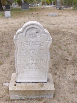
| Birth | : | 20 Oct 1865 Buntingville, Lassen County, California, USA |
| Death | : | 26 Jan 1934 Pacific Grove, Monterey County, California, USA |
| Burial | : | El Carmelo Cemetery, Pacific Grove, Monterey County, USA |
| Coordinate | : | 36.6325836, -121.9319763 |
| Description | : | Married to Mary Bantley December 24, 1896. Marcus William engaged in ranching in Lassen County, California and in 1908 moved his family to Pacific Grove, California, often jokinly referred to Pacific Grove as "Honey Lake Heaven". He was the first Ford automobile distributor in Monterey County and continued in this business until 1915 when, because of ill health, he turned the enterprise over to his brother-in-law, William Eli Spoon. In all his dealings, William had a reputation for the highest integrity. He was not only just but kind and generous. For some years he was a... Read More |
frequently asked questions (FAQ):
-
Where is Marcus William Hoffman's memorial?
Marcus William Hoffman's memorial is located at: El Carmelo Cemetery, Pacific Grove, Monterey County, USA.
-
When did Marcus William Hoffman death?
Marcus William Hoffman death on 26 Jan 1934 in Pacific Grove, Monterey County, California, USA
-
Where are the coordinates of the Marcus William Hoffman's memorial?
Latitude: 36.6325836
Longitude: -121.9319763
Family Members:
Parent
Spouse
Siblings
Children
Flowers:
Nearby Cemetories:
1. El Carmelo Cemetery
Pacific Grove, Monterey County, USA
Coordinate: 36.6325836, -121.9319763
2. Saint Mary's Episcopal Church Leslie Garden
Pacific Grove, Monterey County, USA
Coordinate: 36.6211200, -121.9145800
3. Steinbeck Estate Burial Site
Pacific Grove, Monterey County, USA
Coordinate: 36.6197319, -121.9080276
4. Presidio of Monterey Cemetery
Monterey, Monterey County, USA
Coordinate: 36.6058006, -121.9151306
5. Alexis Nino Burial Site
Monterey, Monterey County, USA
Coordinate: 36.6055565, -121.8955307
6. Mission San Carlos Cemetery
Monterey, Monterey County, USA
Coordinate: 36.5956078, -121.8904190
7. San Carlos Cemetery
Monterey, Monterey County, USA
Coordinate: 36.5951881, -121.8871460
8. Monterey City Cemetery
Monterey, Monterey County, USA
Coordinate: 36.5954475, -121.8845215
9. City of Carmel Memorials
Carmel-by-the-Sea, Monterey County, USA
Coordinate: 36.5552979, -121.9203339
10. Mission Memorial Park
Seaside, Monterey County, USA
Coordinate: 36.6191635, -121.8217926
11. Carmel Mission Cemetery
Carmel-by-the-Sea, Monterey County, USA
Coordinate: 36.5430603, -121.9199600
12. California Central Coast Veterans Cemetery
Seaside, Monterey County, USA
Coordinate: 36.6371900, -121.7963600
13. Carmelite Monastery Cemetery
Monterey, Monterey County, USA
Coordinate: 36.5231400, -121.9232635
14. Saint Dunstans Episcopal Church Columbarium
Carmel Valley, Monterey County, USA
Coordinate: 36.5197330, -121.8059160
15. Whitcher Cemetery
East Garrison, Monterey County, USA
Coordinate: 36.6501730, -121.7305270
16. Church of the Good Shepherd Cemetery
Salinas, Monterey County, USA
Coordinate: 36.5413990, -121.7260410
17. Castroville Public Cemetery
Moss Landing, Monterey County, USA
Coordinate: 36.7930145, -121.7851410
18. Calvary Catholic Cemetery
Salinas, Monterey County, USA
Coordinate: 36.6880341, -121.6818085
19. Saint Pauls Episcopal Church Columbarium
Salinas, Monterey County, USA
Coordinate: 36.6588430, -121.6558850
20. Stephen Norriss Gravesite
Monterey County, USA
Coordinate: 36.8214110, -121.7601080
21. Garden of Memories
Salinas, Monterey County, USA
Coordinate: 36.6565247, -121.6384125
22. Santa Rita Chapel and Cemetery
Salinas, Monterey County, USA
Coordinate: 36.7281303, -121.6565475
23. Saint Georges Episcopal Church Columbarium
Salinas, Monterey County, USA
Coordinate: 36.7062580, -121.6440980
24. Yamato Cemetery
Salinas, Monterey County, USA
Coordinate: 36.6552811, -121.6307297

