
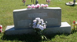
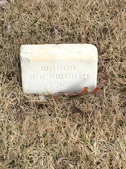
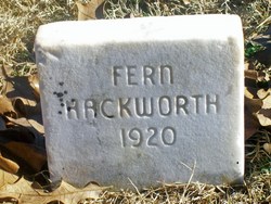
Mardell I Hackworth Lewallen
| Birth | : | 7 Oct 1922 Oregon County, Missouri, USA |
| Death | : | 12 Jan 2001 Springfield, Greene County, Missouri, USA |
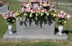
| Burial | : | Arytown Cemetery, Arytown, Oregon County, USA |
| Coordinate | : | 36.5539513, -91.3795776 |
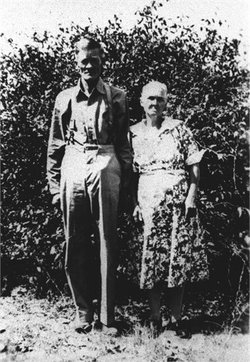
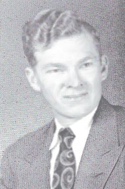
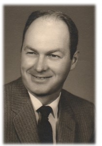
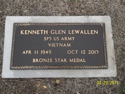
| Description | : | Daughter of James Newton Hackworth and Sarah 'Sadie' Elizabeth (Jones) Hackworth. Married Elmer Glen Lewallen 13/Oct/1946 in Ohio. ~~~~~ Mardell Lewallen, 78, Springfield and formerly of Oregon County, died Friday, Jan. 12, 2001 at Cox Medical Center South, Springfield. She was born October 7, 1922 in Oregon County, the daughter of Jim and Sarah Elizabeth (Jones) Hackworth. On October 13, 1946 she was married in Ohio to Elmer Lewallen. Mrs. Lewallen sold real estate and was a homemaker. She was of the Freewill Baptist faith. Survivors include her husband, Elmer Lewallen, of Springfield, MO; one son, Kenneth Lewallen, of Worthington, OH; one brother, Charlie Junior Hackworth... Read More |
frequently asked questions (FAQ):
-
Where is Mardell I Hackworth Lewallen's memorial?
Mardell I Hackworth Lewallen's memorial is located at: Arytown Cemetery, Arytown, Oregon County, USA.
-
When did Mardell I Hackworth Lewallen death?
Mardell I Hackworth Lewallen death on 12 Jan 2001 in Springfield, Greene County, Missouri, USA
-
Where are the coordinates of the Mardell I Hackworth Lewallen's memorial?
Latitude: 36.5539513
Longitude: -91.3795776
Family Members:
Parent

Spouse

Siblings


Children
Flowers:


Nearby Cemetories:
1. Arytown Cemetery
Arytown, Oregon County, USA
Coordinate: 36.5539513, -91.3795776
2. Russell Cemetery
Couch, Oregon County, USA
Coordinate: 36.5506477, -91.3991928
3. Olon Tucker Farm Cemetery #2
Couch, Oregon County, USA
Coordinate: 36.5867000, -91.3705400
4. New Salem Cemetery
Couch, Oregon County, USA
Coordinate: 36.6042252, -91.3712463
5. Rose Hill Cemetery
Thayer, Oregon County, USA
Coordinate: 36.5186386, -91.4263763
6. Guiteau-Risner Cemetery
Guiteau, Oregon County, USA
Coordinate: 36.5588074, -91.3156128
7. Garfield Cemetery
Garfield, Oregon County, USA
Coordinate: 36.5844400, -91.3253400
8. Adolph Ostrom Farm Cemetery
Thayer, Oregon County, USA
Coordinate: 36.5788160, -91.4426640
9. Crass Homestead
Myrtle, Oregon County, USA
Coordinate: 36.5359695, -91.3084671
10. Crabb Cemetery
Couch, Oregon County, USA
Coordinate: 36.5988541, -91.4339752
11. Bonds Cemetery
Couch, Oregon County, USA
Coordinate: 36.5989914, -91.4346619
12. Byrd Cemetery
Myrtle, Oregon County, USA
Coordinate: 36.5186005, -91.3143997
13. Baker Cemetery
Couch, Oregon County, USA
Coordinate: 36.6248283, -91.3932877
14. John Brown Cemetery
Jobe, Oregon County, USA
Coordinate: 36.5812111, -91.2953568
15. Pleasant Ridge Cemetery
Sharp County, USA
Coordinate: 36.4876710, -91.4221830
16. Davis Cemetery
Thayer, Oregon County, USA
Coordinate: 36.5339508, -91.4751358
17. Jeff Cemetery
Jeff, Oregon County, USA
Coordinate: 36.5256166, -91.4746129
18. Union Hill Cemetery
Brandsville, Howell County, USA
Coordinate: 36.5256341, -91.4746829
19. Norman Cemetery
Alton, Oregon County, USA
Coordinate: 36.6143990, -91.4499969
20. Buehler Farm Cemetery
Clifton, Oregon County, USA
Coordinate: 36.5639496, -91.4845810
21. James Cemetery
Randolph County, USA
Coordinate: 36.4660988, -91.3435974
22. Midway Cemetery
Couch, Oregon County, USA
Coordinate: 36.6031690, -91.4788520
23. Davis Cemetery
Sharp County, USA
Coordinate: 36.4606018, -91.3574982
24. Cave Springs Cemetery #2
Alton, Oregon County, USA
Coordinate: 36.6488900, -91.3652900