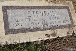
Margaret Potter Stevens
| Birth | : | 17 Aug 1927 Winfred, Lake County, South Dakota, USA |
| Death | : | 12 Jun 2015 Tucson, Pima County, Arizona, USA |
| Burial | : | Mountain Lawn Cemetery, Englewood, Lawrence County, USA |
| Coordinate | : | 44.2818985, -103.8047028 |
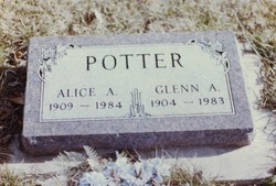
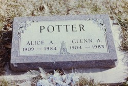
| Description | : | She was born to Glenn and Alice Winegard Potter, she graduated from High School received a teaching degree in Madison SD. She married Kenneth Earl Stevens in 1945 in Howard County SD,they were parents of five children.They lived five miles east of Carthage, SD where she was the first teacher for the Pearl Creek Hutterite Colony. They moved to Lead in 1950 where Kenneth worked for Homesteak Mining Company, and Margaret worked for JC Penney. When Kenneth retired in 1984, they began spending winters in Tucson, AZ, moving there full time in 2001 Margaret was preceded in death by her husband, Kenneth; son,... Read More |
frequently asked questions (FAQ):
-
Where is Margaret Potter Stevens's memorial?
Margaret Potter Stevens's memorial is located at: Mountain Lawn Cemetery, Englewood, Lawrence County, USA.
-
When did Margaret Potter Stevens death?
Margaret Potter Stevens death on 12 Jun 2015 in Tucson, Pima County, Arizona, USA
-
Where are the coordinates of the Margaret Potter Stevens's memorial?
Latitude: 44.2818985
Longitude: -103.8047028
Family Members:
Parent
Spouse
Siblings
Flowers:
Nearby Cemetories:
1. Holy Cross Cemetery
Englewood, Lawrence County, USA
Coordinate: 44.2818985, -103.8047028
2. Mountain Lawn Cemetery
Englewood, Lawrence County, USA
Coordinate: 44.2818985, -103.8047028
3. Terry Cemetery
Terry, Lawrence County, USA
Coordinate: 44.3344290, -103.8165110
4. Dumont Cemetery
Lawrence County, USA
Coordinate: 44.2270000, -103.7860000
5. Carr Cemetery
Hanna, Lawrence County, USA
Coordinate: 44.2411003, -103.8606033
6. West Lead Cemetery
Lead, Lawrence County, USA
Coordinate: 44.3484001, -103.7779999
7. South Lead Cemetery
Lead, Lawrence County, USA
Coordinate: 44.3478510, -103.7606260
8. Preston Ghost Town Cemetery
Preston, Lawrence County, USA
Coordinate: 44.3577500, -103.8871670
9. Roubaix Cemetery
Roubaix, Lawrence County, USA
Coordinate: 44.2789380, -103.6656600
10. Mount Moriah Cemetery
Deadwood, Lawrence County, USA
Coordinate: 44.3760986, -103.7253036
11. Saint Ambrose Cemetery
Deadwood, Lawrence County, USA
Coordinate: 44.3821983, -103.7266998
12. Carbonate Cemetery
Maurice, Lawrence County, USA
Coordinate: 44.4000000, -103.8680500
13. Galena Cemetery
Galena, Lawrence County, USA
Coordinate: 44.3349220, -103.6438410
14. Mountain Meadow Cemetery
Lawrence County, USA
Coordinate: 44.2038994, -103.6557999
15. Oak Ridge Cemetery
Deadwood, Lawrence County, USA
Coordinate: 44.3891983, -103.6766968
16. Bell Park Cemetery
Rochford, Pennington County, USA
Coordinate: 44.1116982, -103.7466965
17. Bear Gulch Cemetery
Lawrence County, USA
Coordinate: 44.3819008, -104.0325012
18. Reynolds Ranch Cemetery
Rochford, Pennington County, USA
Coordinate: 44.0875667, -103.8027265
19. Rose Hill Cemetery
Spearfish, Lawrence County, USA
Coordinate: 44.4802180, -103.8509270
20. Crook City Cemetery
Crook City, Lawrence County, USA
Coordinate: 44.4432100, -103.6241500
21. Anderson Cemetery
Lawrence County, USA
Coordinate: 44.4747009, -103.6896973
22. Whitewood Cemetery
Whitewood, Lawrence County, USA
Coordinate: 44.4617820, -103.6330030
23. Nemo Cemetery
Nemo, Lawrence County, USA
Coordinate: 44.1872800, -103.5066410
24. Saint Aloysius Cemetery
Sturgis, Meade County, USA
Coordinate: 44.4141340, -103.5193420


