
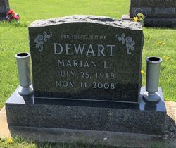
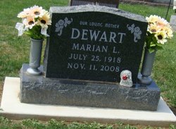
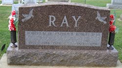
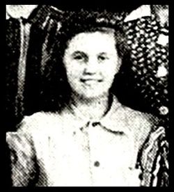
Marian Louise Ray Dewart
| Birth | : | 25 Jul 1918 Wabash, Wabash County, Indiana, USA |
| Death | : | 11 Nov 2008 La Fontaine, Wabash County, Indiana, USA |
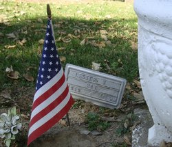
| Burial | : | Hokitika Municipal Cemetery, Hokitika, Westland District, New Zealand |
| Coordinate | : | -42.7102940, 170.9759800 |
| Plot | : | Sec 200, lot 321, sp 2 |
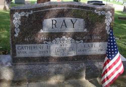
| Description | : | OBITUARY - Plain Dealer, Wabash (IN) Marian Louise Dewart, 90, formerly of 645 Washington St., died at 1:05 a.m. Tuesday, Nov. 11, 2008, at Rolling Meadows Healthcare Center, LaFontaine. She was born July 25, 1918, in Wabash County to Earl Fredrick and Catherine Iva (Crousor) Ray. She married Harold Robert Dewart in Romney on Oct. 25, 1949, and he died Dec. 14, 1993. She worked 16 years for Wabash Metals. Marian loved to cook, and enjoyed camping and reading. She lived at Rolling Meadows Healthcare Center since February 2006. She is survived by two daughters, Linda... Read More |
frequently asked questions (FAQ):
-
Where is Marian Louise Ray Dewart's memorial?
Marian Louise Ray Dewart's memorial is located at: Hokitika Municipal Cemetery, Hokitika, Westland District, New Zealand.
-
When did Marian Louise Ray Dewart death?
Marian Louise Ray Dewart death on 11 Nov 2008 in La Fontaine, Wabash County, Indiana, USA
-
Where are the coordinates of the Marian Louise Ray Dewart's memorial?
Latitude: -42.7102940
Longitude: 170.9759800
Family Members:
Parent

Spouse
Siblings
Flowers:


Nearby Cemetories:
1. Hokitika Municipal Cemetery
Hokitika, Westland District, New Zealand
Coordinate: -42.7102940, 170.9759800
2. Old Stafford Cemetery
Hokitika, Westland District, New Zealand
Coordinate: -42.6662370, 171.0893140
3. Kumara Cemetery
Kumara, Westland District, New Zealand
Coordinate: -42.6464650, 171.1721970
4. Ross Cemetery
Ross, Westland District, New Zealand
Coordinate: -42.8898440, 170.8226160
5. Gladstone Cemetery
Greymouth, Grey District, New Zealand
Coordinate: -42.5381220, 171.1522540
6. Ross Historic Cemetery
Ross, Westland District, New Zealand
Coordinate: -42.9023200, 170.8113230
7. Greenstone Cemetery
Kumara, Westland District, New Zealand
Coordinate: -42.6361450, 171.2751350
8. Karoro Cemetery
Greymouth, Grey District, New Zealand
Coordinate: -42.4678260, 171.1893800
9. St Pauls Methodist Church (Defunct)
Greymouth, Grey District, New Zealand
Coordinate: -42.4500880, 171.2114610
10. Cobden Cemetery
Greymouth, Grey District, New Zealand
Coordinate: -42.4371700, 171.2019000
11. Stillwater Cemetery
Greymouth, Grey District, New Zealand
Coordinate: -42.4394820, 171.3494380
12. Notown Cemetery
Dobson, Grey District, New Zealand
Coordinate: -42.4514530, 171.4465670
13. Blackball Cemetery
Greymouth, Grey District, New Zealand
Coordinate: -42.3757410, 171.4135760
14. Evans Grave
Arthurs Pass, Selwyn District, New Zealand
Coordinate: -42.7723610, 171.6249940
15. Nelson Creek Cemetery
Ngahere, Grey District, New Zealand
Coordinate: -42.3865620, 171.4595500
16. Barrytown Cemetery
Barrytown, Grey District, New Zealand
Coordinate: -42.2455150, 171.3166710
17. Hari Hari Cemetery
Hari Hari, Westland District, New Zealand
Coordinate: -43.1501430, 170.5576110
18. Ahaura Cemetery
Ahaura, Grey District, New Zealand
Coordinate: -42.3516790, 171.5581700
19. Whataroa Cemetery
Whataroa, Westland District, New Zealand
Coordinate: -43.2530190, 170.3587130
20. Lake Coleridge Cemetery
Lake Coleridge, Selwyn District, New Zealand
Coordinate: -43.3695530, 171.5264300
21. Charleston Catholic Cemetery
Charleston, Buller District, New Zealand
Coordinate: -41.9093390, 171.4359110
22. Nile Hill Cemetery
Charleston, Buller District, New Zealand
Coordinate: -41.8991610, 171.4394080
23. Old Reefton Cemetery
Reefton, Buller District, New Zealand
Coordinate: -42.1115220, 171.8590850
24. Reefton Cemetery
Reefton, Buller District, New Zealand
Coordinate: -42.0856940, 171.8470730