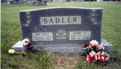
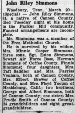
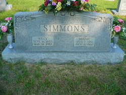
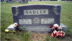
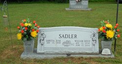
Marie Simmons Sadler
| Birth | : | 15 Jan 1911 Cannon County, Tennessee, USA |
| Death | : | 2 Apr 2000 Cannon County, Tennessee, USA |
| Burial | : | Saint Peter's Churchyard, Spixworth, Broadland District, England |
| Coordinate | : | 52.6933240, 1.3145170 |
| Description | : | Marie was the wife of William Taft Sadler. |
frequently asked questions (FAQ):
-
Where is Marie Simmons Sadler's memorial?
Marie Simmons Sadler's memorial is located at: Saint Peter's Churchyard, Spixworth, Broadland District, England.
-
When did Marie Simmons Sadler death?
Marie Simmons Sadler death on 2 Apr 2000 in Cannon County, Tennessee, USA
-
Where are the coordinates of the Marie Simmons Sadler's memorial?
Latitude: 52.6933240
Longitude: 1.3145170
Family Members:
Parent
Spouse
Siblings
Children
Flowers:
Nearby Cemetories:
1. Saint Peter's Churchyard
Spixworth, Broadland District, England
Coordinate: 52.6933240, 1.3145170
2. St. Peter Crostwick Church Cemetery
Crostwick, Broadland District, England
Coordinate: 52.6934480, 1.3395750
3. St Faith Crematorium
Horsham St Faith, Broadland District, England
Coordinate: 52.6967970, 1.2817680
4. Horsham St. Faith Priory
Horsham St Faith, Broadland District, England
Coordinate: 52.6888310, 1.2783290
5. St. Mary and St. Andrew Churchyard
Horsham St Faith, Broadland District, England
Coordinate: 52.6880970, 1.2771330
6. Horsham St. Faith cemetery
Horsham St Faith, Broadland District, England
Coordinate: 52.6870250, 1.2758110
7. St Swithin Churchyard
Frettenham, Broadland District, England
Coordinate: 52.7177780, 1.3223060
8. All Saints Churchyard
Rackheath, Broadland District, England
Coordinate: 52.6846160, 1.3573490
9. Sprowston Cemetery
Sprowston, Broadland District, England
Coordinate: 52.6644440, 1.3249400
10. St. Mary and St. Margaret Churchyard
Sprowston, Broadland District, England
Coordinate: 52.6635430, 1.3248800
11. Old Catton Churchyard
Norwich, City of Norwich, England
Coordinate: 52.6627000, 1.2969770
12. St. Margaret's Churchyard
Catton, Broadland District, England
Coordinate: 52.6626280, 1.2970190
13. All Saints Churchyard (Old Church)
Hainford, Broadland District, England
Coordinate: 52.7284190, 1.3004104
14. All Saints Churchyard
Horsford, Broadland District, England
Coordinate: 52.6913720, 1.2494360
15. All Saints Churchyard
Horstead, Broadland District, England
Coordinate: 52.7294900, 1.3499140
16. St. John the Baptist Churchyard
Coltishall, Broadland District, England
Coordinate: 52.7278530, 1.3626450
17. St. Margaret's Churchyard
Stratton Strawless, Broadland District, England
Coordinate: 52.7387400, 1.2899900
18. St. Peter's Churchyard
Belaugh, Broadland District, England
Coordinate: 52.7153080, 1.3867600
19. Christ Churchyard, New Catton
Norwich, City of Norwich, England
Coordinate: 52.6438540, 1.2977320
20. St. Mary the Virgin Churchyard
Wroxham, Broadland District, England
Coordinate: 52.7067470, 1.3984620
21. Wroxham Parish Council Cemetery
Wroxham, Broadland District, England
Coordinate: 52.7079631, 1.3994432
22. Norwich Prison
Norwich, City of Norwich, England
Coordinate: 52.6377840, 1.3174000
23. All Saints Churchyard
Salhouse, Broadland District, England
Coordinate: 52.6833600, 1.4063280
24. St. Margaret's Churchyard
Drayton, Broadland District, England
Coordinate: 52.6773010, 1.2241980

