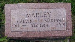
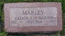
Marion Maxwell Marley
| Birth | : | 2 Aug 1914 Grant County, Indiana, USA |
| Death | : | 18 Mar 1915 Grant County, Indiana, USA |
| Burial | : | St Thomas Becket Churchyard, Digby, North Kesteven District, England |
| Coordinate | : | 53.0796030, -0.3882980 |
| Plot | : | Sec E |
frequently asked questions (FAQ):
-
Where is Marion Maxwell Marley's memorial?
Marion Maxwell Marley's memorial is located at: St Thomas Becket Churchyard, Digby, North Kesteven District, England.
-
When did Marion Maxwell Marley death?
Marion Maxwell Marley death on 18 Mar 1915 in Grant County, Indiana, USA
-
Where are the coordinates of the Marion Maxwell Marley's memorial?
Latitude: 53.0796030
Longitude: -0.3882980
Family Members:
Parent
Siblings
Flowers:
Nearby Cemetories:
1. St Thomas Becket Churchyard
Digby, North Kesteven District, England
Coordinate: 53.0796030, -0.3882980
2. Holy Cross Churchyard
Kirkby Green, North Kesteven District, England
Coordinate: 53.1062300, -0.3808000
3. Holy Cross Churchyard
Scopwick, North Kesteven District, England
Coordinate: 53.1089480, -0.4032690
4. Holy Cross Churchyard Extension
Scopwick, North Kesteven District, England
Coordinate: 53.1105880, -0.4044990
5. All Saints Churchyard
Ruskington, North Kesteven District, England
Coordinate: 53.0460330, -0.3866280
6. All Saints Churchyard
Brauncewell, North Kesteven District, England
Coordinate: 53.0587900, -0.4418200
7. Anwick Church Lane Churchyard Extension
Anwick, North Kesteven District, England
Coordinate: 53.0420800, -0.3397200
8. St. Andrew's Churchyard
Timberland, North Kesteven District, England
Coordinate: 53.1095985, -0.3267715
9. St. Andrew's Churchyard
Timberland, North Kesteven District, England
Coordinate: 53.1095985, -0.3267715
10. St. Oswald Churchyard
Walcott, North Kesteven District, England
Coordinate: 53.0944560, -0.3128500
11. St Oswald Churchyard
Walcott, North Kesteven District, England
Coordinate: 53.0945800, -0.3125240
12. St. Oswald's Churchyard
Blankney, North Kesteven District, England
Coordinate: 53.1264910, -0.4051300
13. St Edith's Church
Anwick, North Kesteven District, England
Coordinate: 53.0414520, -0.3391170
14. St Wilfrid Churchyard
Metheringham, North Kesteven District, England
Coordinate: 53.1380350, -0.4016960
15. St Andrew Churchyard
Leasingham, North Kesteven District, England
Coordinate: 53.0239040, -0.4262600
16. St Andrew Churchyard
Cranwell, North Kesteven District, England
Coordinate: 53.0370660, -0.4612070
17. Billinghay Cemetery
Billinghay, North Kesteven District, England
Coordinate: 53.0806340, -0.2852800
18. Saint Luke Churchyard
North Kyme, North Kesteven District, England
Coordinate: 53.0591550, -0.2808970
19. St Michael Church Cemetery
Billinghay, North Kesteven District, England
Coordinate: 53.0796800, -0.2748100
20. St. Michael and All Angels Churchyard
Billinghay, North Kesteven District, England
Coordinate: 53.0791130, -0.2746370
21. St Peters Churchyard
Dunston, North Kesteven District, England
Coordinate: 53.1529600, -0.4120730
22. Sleaford Cemetery
Sleaford, North Kesteven District, England
Coordinate: 53.0027590, -0.4056790
23. St. Denys Churchyard
Kirkby la Thorpe, North Kesteven District, England
Coordinate: 53.0008270, -0.3636800
24. St Denys Churchyard
Sleaford, North Kesteven District, England
Coordinate: 52.9996510, -0.4088960

