
| Birth | : | 14 Mar 1917 Genoa, Nance County, Nebraska, USA |
| Death | : | 10 Nov 2009 Saint Edward, Boone County, Nebraska, USA |
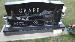
| Burial | : | Evergreen Cemetery, Saint Edward, Boone County, USA |
| Coordinate | : | 41.5677986, -97.8411026 |
| Description | : | Daughter of Clair & Lucy (Stevens) Condreay. Married to Clarence Floyd Grape on 12-16-1935. The couple lived in Boone where Marjorie worked as a housewife and worked at the Boone Grocery Store that they were co-owners of. She later became the Postmaster at the Boone Post Office until 1992 when she retired and the Post Office closed. Survived by two sons, Cecil Grape and wife, Carole of Columbus; Ron Grape, Sr. and wife, Lora of St. Edward; daughter-in-law, Sharon Grape of Albion; 11 grandchildren; 29 great-grandchildren; nine great-great-grandchildren; along with other relatives and friends. Preceded in death by her parents; husband; son, Merle; and... Read More |
frequently asked questions (FAQ):
-
Where is Marjorie Elaine Condreay Grape's memorial?
Marjorie Elaine Condreay Grape's memorial is located at: Evergreen Cemetery, Saint Edward, Boone County, USA.
-
When did Marjorie Elaine Condreay Grape death?
Marjorie Elaine Condreay Grape death on 10 Nov 2009 in Saint Edward, Boone County, Nebraska, USA
-
Where are the coordinates of the Marjorie Elaine Condreay Grape's memorial?
Latitude: 41.5677986
Longitude: -97.8411026
Family Members:
Parent

Spouse
Siblings
Children
Flowers:


Nearby Cemetories:
1. Evergreen Cemetery
Saint Edward, Boone County, USA
Coordinate: 41.5677986, -97.8411026
2. Saint Edward Catholic Cemetery
Saint Edward, Boone County, USA
Coordinate: 41.5684800, -97.8424800
3. Lingle Cemetery
Genoa, Nance County, USA
Coordinate: 41.5108000, -97.8384000
4. Skeedee Cemetery
Nance County, USA
Coordinate: 41.5038986, -97.8850021
5. Salem Lutheran Cemetery
Woodville Township, Platte County, USA
Coordinate: 41.6525800, -97.8084000
6. Boone Cemetery
Boone County, USA
Coordinate: 41.6272011, -97.9332962
7. Saint Ansgar Cemetery
Rosenborg, Platte County, USA
Coordinate: 41.6334000, -97.7539000
8. West Hill Cemetery
Platte County, USA
Coordinate: 41.5558014, -97.7161026
9. Palestine Cemetery
Rosenborg, Platte County, USA
Coordinate: 41.5980000, -97.7057000
10. Looking Glass Cemetery
Rosenborg, Platte County, USA
Coordinate: 41.6571000, -97.7617000
11. Bethany Lutheran Cemetery
Platte County, USA
Coordinate: 41.6232700, -97.7177200
12. Naomi Cemetery
Saint Edward, Boone County, USA
Coordinate: 41.5245200, -97.9907000
13. Saint Paul Evangelical Lutheran Cemetery
Monroe, Platte County, USA
Coordinate: 41.5651140, -97.6740360
14. Friends Cemetery
Oconee, Platte County, USA
Coordinate: 41.4775009, -97.6941986
15. New Hope Cemetery
Monroe, Platte County, USA
Coordinate: 41.5413000, -97.6520000
16. Genoa Indian Industrial School Cemetery
Genoa, Nance County, USA
Coordinate: 41.4471700, -97.7218400
17. Valley View Cemetery
Genoa, Nance County, USA
Coordinate: 41.4317017, -97.7319031
18. Rose Hill Cemetery
Albion, Boone County, USA
Coordinate: 41.6762000, -98.0003900
19. Saint Michael's Cemetery
Albion, Boone County, USA
Coordinate: 41.6991997, -97.9764023
20. Postville Cemetery
Platte County, USA
Coordinate: 41.5924644, -97.6203079
21. Sunnyside Cemetery
Nance County, USA
Coordinate: 41.4016991, -97.8692017
22. Main Cemetery
Belgrade, Nance County, USA
Coordinate: 41.4947014, -98.0425034
23. Saint Johns Catholic Cemetery
Lindsay, Platte County, USA
Coordinate: 41.6293500, -97.6282500
24. Holy Family Cemetery
Lindsay, Platte County, USA
Coordinate: 41.6921997, -97.6832962