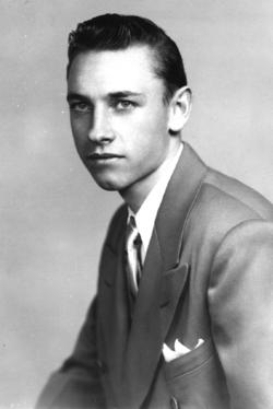
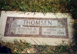
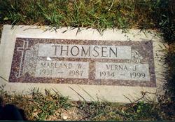
Marland Walter Thomsen
| Birth | : | 8 Oct 1931 Lead, Lawrence County, South Dakota, USA |
| Death | : | 15 Feb 1987 Lead, Lawrence County, South Dakota, USA |
| Burial | : | Union Hill Friends Church Cemetery, Red Brush, Surry County, USA |
| Coordinate | : | 36.4714410, -80.6956890 |
| Plot | : | Section 8, Lot 18, Grave 3 |
| Description | : | Marland, who went by the name Bob or Bobby, was the first born child of Marius & Edna (Kamenz) Thomsen. After High School he was employed by the Homestake Minning Company before joining the Navy during the Korean War. He returned to Lead, SD and the Homestake after serving in the Navy. He married Verna Janas on April 10, 1955; four children were born to this union Kelly, Deborah, Lori & Marla. |
frequently asked questions (FAQ):
-
Where is Marland Walter Thomsen's memorial?
Marland Walter Thomsen's memorial is located at: Union Hill Friends Church Cemetery, Red Brush, Surry County, USA.
-
When did Marland Walter Thomsen death?
Marland Walter Thomsen death on 15 Feb 1987 in Lead, Lawrence County, South Dakota, USA
-
Where are the coordinates of the Marland Walter Thomsen's memorial?
Latitude: 36.4714410
Longitude: -80.6956890
Family Members:
Parent
Spouse
Siblings
Flowers:
Nearby Cemetories:
1. Union Hill Friends Church Cemetery
Red Brush, Surry County, USA
Coordinate: 36.4714410, -80.6956890
2. Community Baptist Church Cemetery
Red Brush, Surry County, USA
Coordinate: 36.4713593, -80.7171097
3. Mosley Family Cemetery
Mount Airy, Surry County, USA
Coordinate: 36.4670770, -80.6681230
4. Tucker Cemetery
Pine Ridge, Surry County, USA
Coordinate: 36.4908889, -80.7153056
5. Tucker Cemetery
Mount Airy, Surry County, USA
Coordinate: 36.4908905, -80.7153091
6. Laurel Springs Primitive Baptist Church Cemetery
Pine Ridge, Surry County, USA
Coordinate: 36.4821930, -80.7263031
7. Dunbar Cemetery
Mount Airy, Surry County, USA
Coordinate: 36.4690010, -80.6567720
8. Antioch Baptist Church Cemetery
Toast, Surry County, USA
Coordinate: 36.5038872, -80.6841660
9. Pine Ridge Baptist Church Cemetery
Pine Ridge, Surry County, USA
Coordinate: 36.4995842, -80.7190552
10. Westside Baptist Church Cemetery
Toast, Surry County, USA
Coordinate: 36.4859720, -80.6574720
11. Blues Grove Baptist Church Cemetery
Red Brush, Surry County, USA
Coordinate: 36.4382210, -80.7058334
12. Surry County Veterans Cemetery
Toast, Surry County, USA
Coordinate: 36.5052800, -80.6835300
13. Semper Fi Cemetery
Pine Ridge, Surry County, USA
Coordinate: 36.5010540, -80.7216920
14. Johnson Family Cemetery
Mount Airy, Surry County, USA
Coordinate: 36.5037500, -80.6698330
15. Masadona Cemetery
Dobson, Surry County, USA
Coordinate: 36.4321940, -80.6973270
16. Creed Family Cemetery
Mount Airy, Surry County, USA
Coordinate: 36.4905280, -80.6525830
17. Old Fisher River Church Cemetery
Dobson, Surry County, USA
Coordinate: 36.4304420, -80.6992580
18. Whitlock Family Cemetery
Mount Airy, Surry County, USA
Coordinate: 36.4813056, -80.6422222
19. Genesis Full Gospel Church Cemetery
Toast, Surry County, USA
Coordinate: 36.5120010, -80.6711960
20. Oak Grove Baptist Church Cemetery
Oak Grove (Bottom), Surry County, USA
Coordinate: 36.4788770, -80.7540890
21. Gordon Cemetery
Mount Airy, Surry County, USA
Coordinate: 36.4234440, -80.6966390
22. Copeland Home Graveyard
Dobson, Surry County, USA
Coordinate: 36.4223490, -80.7089350
23. McCraw Cemetery
Beulah, Surry County, USA
Coordinate: 36.4671370, -80.7626220
24. County Home Cemetery
New Hope, Surry County, USA
Coordinate: 36.4192840, -80.7152490


