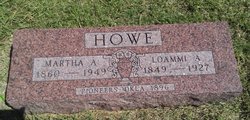
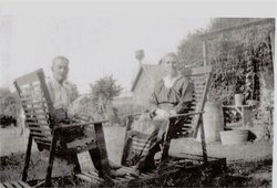
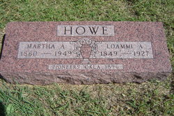
Martha A. Durrant Howe
| Birth | : | 23 Dec 1860 Trenton, Grundy County, Missouri, USA |
| Death | : | 19 Mar 1949 Billings, Noble County, Oklahoma, USA |
| Burial | : | Greenlawn Cemetery, Milford, Clermont County, USA |
| Coordinate | : | 39.1706009, -84.2758026 |
| Description | : | Parents: William E Durrant 1840 – 1875 Eliza Jane Woods 1840 – 1924 1930 United States Federal Census Name: Martha A Howe Home in 1930: Billings, Noble, Oklahoma Age: 69 Estimated Birth Year: abt 1861 Birthplace: Missouri Relation to Head of House: Head Race: White Household Members: Name Age Martha A Howe 69 1910 United States Federal Census Name: Martha Howe Age in 1910: 49 Estimated Birth Year: 1861 Birthplace: Missouri Relation to Head of House: Wife Father's Birth Place: Pennsylvania Mother's Birth Place: Missouri Spouse's Name: L A Howe Home in 1910: Billings, Noble, Oklahoma Marital Status: Married Race: White Gender: Female Household... Read More |
frequently asked questions (FAQ):
-
Where is Martha A. Durrant Howe's memorial?
Martha A. Durrant Howe's memorial is located at: Greenlawn Cemetery, Milford, Clermont County, USA.
-
When did Martha A. Durrant Howe death?
Martha A. Durrant Howe death on 19 Mar 1949 in Billings, Noble County, Oklahoma, USA
-
Where are the coordinates of the Martha A. Durrant Howe's memorial?
Latitude: 39.1706009
Longitude: -84.2758026
Family Members:
Parent
Spouse
Siblings
Children
Flowers:
Nearby Cemetories:
1. Greenlawn Cemetery
Milford, Clermont County, USA
Coordinate: 39.1706009, -84.2758026
2. Milford First United Methodist Church Columbarium
Milford, Clermont County, USA
Coordinate: 39.1768880, -84.2910680
3. Jesuit Cemetery
Milford, Clermont County, USA
Coordinate: 39.1655400, -84.2932700
4. Milford Cemetery
Milford, Clermont County, USA
Coordinate: 39.1795550, -84.2908500
5. Saint Andrews Cemetery
Milford, Clermont County, USA
Coordinate: 39.1632996, -84.2941971
6. Covalt Cemetery
Terrace Park, Hamilton County, USA
Coordinate: 39.1671400, -84.3028080
7. Saint Thomas Episcopal Church Columbarium
Terrace Park, Hamilton County, USA
Coordinate: 39.1666300, -84.3029760
8. Waldschmidt Cemetery
Camp Dennison, Hamilton County, USA
Coordinate: 39.1944900, -84.2882200
9. Brown Family Cemetery
Top-of-the-Ridge, Clermont County, USA
Coordinate: 39.1968980, -84.2695320
10. Old Indian Hill Baptist Churchyard
Indian Hill, Hamilton County, USA
Coordinate: 39.1628685, -84.3127518
11. Mulberry Cemetery
Milford, Clermont County, USA
Coordinate: 39.1947784, -84.2469864
12. Eli Davis Family Cemetery
Summerside, Clermont County, USA
Coordinate: 39.1377580, -84.2838960
13. Round Bottom Road Cemetery
Perintown, Clermont County, USA
Coordinate: 39.1400170, -84.2568330
14. Ranson Family Cemetery
Top-of-the-Ridge, Clermont County, USA
Coordinate: 39.2077220, -84.2719890
15. William Jones Cemetery
Summerside, Clermont County, USA
Coordinate: 39.1304900, -84.2657990
16. Marriott Cemetery (Defunct)
Ancor, Hamilton County, USA
Coordinate: 39.1442610, -84.3187690
17. Perintown United Methodist Church Cemetery
Perintown, Clermont County, USA
Coordinate: 39.1374512, -84.2339783
18. Martin Family Cemetery
Newtown, Hamilton County, USA
Coordinate: 39.1400060, -84.3226040
19. Evergreen Cemetery
Miamiville, Clermont County, USA
Coordinate: 39.2113500, -84.3098300
20. Union Cemetery
Branch Hill, Clermont County, USA
Coordinate: 39.2152850, -84.2409180
21. Indian Hill Episcopal Presbyterian Churchyard
Cincinnati, Hamilton County, USA
Coordinate: 39.1748880, -84.3441490
22. Armstrong Chapel Cemetery
Indian Hill, Hamilton County, USA
Coordinate: 39.1601600, -84.3472200
23. Tealtown Cemetery
Perintown, Clermont County, USA
Coordinate: 39.1190500, -84.2419830
24. Jewish Cemeteries of Greater Cincinnati – Loveland
Loveland, Clermont County, USA
Coordinate: 39.2281970, -84.2641830

