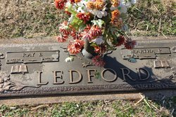
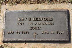
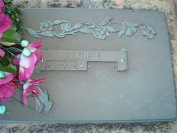
Martha Pyrtle Ledford
| Birth | : | 14 Feb 1932 |
| Death | : | 14 Jan 2007 |
| Burial | : | All Saints Churchyard, Winteringham, North Lincolnshire Unitary Authority, England |
| Coordinate | : | 53.6904182, -0.6010190 |
| Description | : | Martha Pyrtle Ledford, 74, of Eden, NC, died January 14, 2007, at Moses Cone Memorial Hospital in Greensboro, NC. Mrs. Ledford was born February 14, 1932, in Leaksville (now Eden), NC, to the late Jesse D. Pyrtle and Bessie Cofer Pyrtle. She was a devoted member of the Baptist faith. Mrs. Ledford was formerly the owner and operator of Mount Airy Meat Center. Surviving are her sons Mike Ledford, Gray Ledford, and Scott Ledford; her sisters, Argie Cox, Alma Reynolds, Eloise Pruitt, and Mary Lou Champion. In addition to her parents, she was preceded in death by her husband, Ray... Read More |
frequently asked questions (FAQ):
-
Where is Martha Pyrtle Ledford's memorial?
Martha Pyrtle Ledford's memorial is located at: All Saints Churchyard, Winteringham, North Lincolnshire Unitary Authority, England.
-
When did Martha Pyrtle Ledford death?
Martha Pyrtle Ledford death on 14 Jan 2007 in
-
Where are the coordinates of the Martha Pyrtle Ledford's memorial?
Latitude: 53.6904182
Longitude: -0.6010190
Family Members:
Parent
Spouse
Siblings
Children
Flowers:
Nearby Cemetories:
1. All Saints Churchyard
Winteringham, North Lincolnshire Unitary Authority, England
Coordinate: 53.6904182, -0.6010190
2. All Saints Churchyard
Winteringham, North Lincolnshire Unitary Authority, England
Coordinate: 53.6902800, -0.6010700
3. St John the Baptist
Whitton, North Lincolnshire Unitary Authority, England
Coordinate: 53.7093390, -0.6342340
4. All Saints Churchyard
Winterton, North Lincolnshire Unitary Authority, England
Coordinate: 53.6555710, -0.5968640
5. Winterton Cemetery
Winterton, North Lincolnshire Unitary Authority, England
Coordinate: 53.6548190, -0.5847270
6. Alkborough Cemetery
Alkborough, North Lincolnshire Unitary Authority, England
Coordinate: 53.6816460, -0.6686090
7. Welton Church Cemetery
Brough, East Riding of Yorkshire Unitary Authority, England
Coordinate: 53.7297800, -0.5514800
8. St Mary the Virgin Churchyard Extension
Elloughton, East Riding of Yorkshire Unitary Authority, England
Coordinate: 53.7419100, -0.5706700
9. St Mary the Virgin Churchyard
Elloughton, East Riding of Yorkshire Unitary Authority, England
Coordinate: 53.7419270, -0.5695290
10. St Mary Churchyard
Broomfleet, East Riding of Yorkshire Unitary Authority, England
Coordinate: 53.7338120, -0.6649730
11. St Nicholas Churchyard
South Ferriby, North Lincolnshire Unitary Authority, England
Coordinate: 53.6746420, -0.5051450
12. St Anne Churchyard
Ellerker, East Riding of Yorkshire Unitary Authority, England
Coordinate: 53.7527200, -0.6034700
13. St Andrew's Church
Burton upon Stather, North Lincolnshire Unitary Authority, England
Coordinate: 53.6501180, -0.6850550
14. St Maurice Churchyard
Horkstow, North Lincolnshire Unitary Authority, England
Coordinate: 53.6512040, -0.5079660
15. All Saints Churchyard
Brantingham, East Riding of Yorkshire Unitary Authority, England
Coordinate: 53.7585800, -0.5699600
16. St Bartholomew's Church
Appleby, North Lincolnshire Unitary Authority, England
Coordinate: 53.6234280, -0.5603240
17. St Mary the Virgin Church
Fockerby, North Lincolnshire Unitary Authority, England
Coordinate: 53.6613050, -0.7138730
18. All Saints Churchyard
Adlingfleet, East Riding of Yorkshire Unitary Authority, England
Coordinate: 53.6786760, -0.7238110
19. Holy Trinity Churchyard
Blacktoft, East Riding of Yorkshire Unitary Authority, England
Coordinate: 53.7082510, -0.7271700
20. All Saints' Churchyard
Saxby-All-Saints, North Lincolnshire Unitary Authority, England
Coordinate: 53.6372500, -0.5010260
21. All Saints' Churchyard
Flixborough, North Lincolnshire Unitary Authority, England
Coordinate: 53.6247100, -0.6819480
22. All Saints Churchyard Old
Flixborough, North Lincolnshire Unitary Authority, England
Coordinate: 53.6178950, -0.6754930
23. St Oswald Church
Luddington, North Lincolnshire Unitary Authority, England
Coordinate: 53.6448740, -0.7387490
24. St Andrew Churchyard
Bonby, North Lincolnshire Unitary Authority, England
Coordinate: 53.6266000, -0.4838000

