
| Birth | : | 10 Apr 1923 Steinauer, Pawnee County, Nebraska, USA |
| Death | : | 25 Feb 2001 Tecumseh, Johnson County, Nebraska, USA |
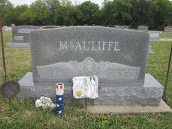
| Burial | : | Saint Anthonys Cemetery, Steinauer, Pawnee County, USA |
| Coordinate | : | 40.2075005, -96.2189026 |
| Description | : | Daughter of John & Hildegarde (Steinauer) Schutz. She attended and graduated from Steinauer High School. She was a stenographer and clerk at Tecumseh Building and Loan for many years until her retirement. She enjoyed Quilting and bowling. She was married August 15, 1945 to Paul Holter at Topeka, KS and later divorced. |
frequently asked questions (FAQ):
-
Where is Mary Ann Schutz Holter's memorial?
Mary Ann Schutz Holter's memorial is located at: Saint Anthonys Cemetery, Steinauer, Pawnee County, USA.
-
When did Mary Ann Schutz Holter death?
Mary Ann Schutz Holter death on 25 Feb 2001 in Tecumseh, Johnson County, Nebraska, USA
-
Where are the coordinates of the Mary Ann Schutz Holter's memorial?
Latitude: 40.2075005
Longitude: -96.2189026
Family Members:
Parent

Spouse
Siblings
Flowers:


Nearby Cemetories:
1. Saint Anthonys Cemetery
Steinauer, Pawnee County, USA
Coordinate: 40.2075005, -96.2189026
2. Salems Cemetery
Steinauer, Pawnee County, USA
Coordinate: 40.2166000, -96.2555000
3. Beranek Cemetery
Table Rock, Pawnee County, USA
Coordinate: 40.2042007, -96.1607971
4. Saint Peters Lutheran Church Cemetery
Steinauer, Pawnee County, USA
Coordinate: 40.2555000, -96.1801000
5. Rinne Cemetery
Pawnee County, USA
Coordinate: 40.2472000, -96.2742004
6. Clear Creek Cemetery
Table Rock, Pawnee County, USA
Coordinate: 40.2193985, -96.1391983
7. Table Rock Cemetery
Table Rock, Pawnee County, USA
Coordinate: 40.1791400, -96.1037400
8. Saint Pauls United Church of Christ Cemetery
Tecumseh, Johnson County, USA
Coordinate: 40.2996000, -96.2742000
9. Pawnee City Cemetery
Pawnee City, Pawnee County, USA
Coordinate: 40.1109009, -96.1608810
10. Mount Hope Cemetery
Elk Creek, Johnson County, USA
Coordinate: 40.2976000, -96.1406000
11. Saint Johns Cemetery
Table Rock, Pawnee County, USA
Coordinate: 40.2148000, -96.0657000
12. Burchard Cemetery
Burchard, Pawnee County, USA
Coordinate: 40.1383018, -96.3538971
13. East Amish Cemetery
Table Rock, Pawnee County, USA
Coordinate: 40.1310000, -96.0854000
14. Sacred Heart Cemetery
Burchard, Pawnee County, USA
Coordinate: 40.1460991, -96.3683014
15. Lewiston Cemetery
Lewiston, Pawnee County, USA
Coordinate: 40.2477989, -96.3882980
16. West Branch Cemetery
Pawnee County, USA
Coordinate: 40.0787940, -96.2797160
17. Bohemian Cemetery
Table Rock, Pawnee County, USA
Coordinate: 40.1786003, -96.0374985
18. Mount Pleasant Cemetery
Burchard, Pawnee County, USA
Coordinate: 40.1822014, -96.4049988
19. Grandview Cemetery
Elk Creek, Johnson County, USA
Coordinate: 40.3274994, -96.1042023
20. Tecumseh Cemetery
Tecumseh, Johnson County, USA
Coordinate: 40.3645000, -96.1800000
21. Saint James Lutheran Cemetery
Nemaha County, USA
Coordinate: 40.2757500, -96.0161500
22. Evergreen Cemetery
Pawnee County, USA
Coordinate: 40.0485992, -96.1417007
23. Mount Zion Cemetery
Nemaha County, USA
Coordinate: 40.2761002, -96.0113983
24. Dry Branch Pioneer Cemetery
Richardson County, USA
Coordinate: 40.1292000, -96.0100021