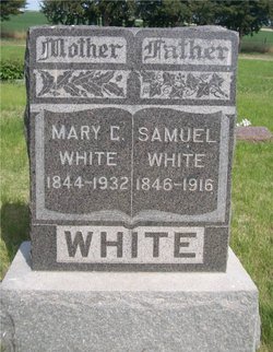
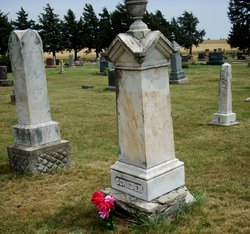
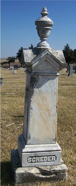
Mary Catherine “Mollie” Scneder White
| Birth | : | 18 Mar 1844 Greensburg, Westmoreland County, Pennsylvania, USA |
| Death | : | 1 Jan 1932 Ada, Ottawa County, Kansas, USA |
| Burial | : | Adams Cemetery, Parkers Crossroads, Henderson County, USA |
| Coordinate | : | 35.7560370, -88.3893920 |
| Description | : | Minneapolis Messenger, Ottawa County, Kansas, January 7, 1932 (same obit appeared in the Better Way, Jan. 7, 1932, page 4;) OBITUARY Mary Catherine Scneder was born March 18, 1844, in Pennsylvania, and died January 1, 1932, at her home in Fountain township, near Ada, Kansas, aged 87 years, 9 months, 13 days. She removed in early childhood with her parents to Illinois, later to Fountain township, Kansas, where she has made her home since, almost 59 years. She was married at Ada, Kansas, on March 26, 1876 to Samuel White, who preceded her to the great beyond, July 9,... Read More |
frequently asked questions (FAQ):
-
Where is Mary Catherine “Mollie” Scneder White's memorial?
Mary Catherine “Mollie” Scneder White's memorial is located at: Adams Cemetery, Parkers Crossroads, Henderson County, USA.
-
When did Mary Catherine “Mollie” Scneder White death?
Mary Catherine “Mollie” Scneder White death on 1 Jan 1932 in Ada, Ottawa County, Kansas, USA
-
Where are the coordinates of the Mary Catherine “Mollie” Scneder White's memorial?
Latitude: 35.7560370
Longitude: -88.3893920
Family Members:
Parent
Spouse
Siblings
Children
Flowers:
Nearby Cemetories:
1. Adams Cemetery
Parkers Crossroads, Henderson County, USA
Coordinate: 35.7560370, -88.3893920
2. Lewis Cemetery
Wildersville, Henderson County, USA
Coordinate: 35.7527250, -88.4059170
3. Kizer Cemetery
Wildersville, Henderson County, USA
Coordinate: 35.7702960, -88.3727800
4. Berry Olive Graveyard
Henderson County, USA
Coordinate: 35.7702980, -88.4128510
5. Marlin Cemetery
Wildersville, Henderson County, USA
Coordinate: 35.7792015, -88.3796997
6. Rhodes Cemetery
Henderson County, USA
Coordinate: 35.7331009, -88.4032974
7. Flake Cemetery
Wildersville, Henderson County, USA
Coordinate: 35.7640440, -88.4199870
8. Olive Branch Cemetery
Lexington, Henderson County, USA
Coordinate: 35.7344330, -88.3697210
9. Boswell Cemetery
Henderson County, USA
Coordinate: 35.7402992, -88.4178009
10. Pine Grove Church Cemetery
Wildersville, Henderson County, USA
Coordinate: 35.7262300, -88.3930680
11. Timberlake Grove Cemetery
Lexington, Henderson County, USA
Coordinate: 35.7214970, -88.3904810
12. Pearson Cemetery #1
Wildersville, Henderson County, USA
Coordinate: 35.7667880, -88.4319880
13. Kizer Cemetery
Lexington, Henderson County, USA
Coordinate: 35.7195610, -88.3915660
14. Jones Cemetery
Parkers Crossroads, Henderson County, USA
Coordinate: 35.7935982, -88.3803024
15. Williams Cemetery
Parkers Crossroads, Henderson County, USA
Coordinate: 35.7931730, -88.4010400
16. Tennessee State Veterans Cemetery
Parkers Crossroads, Henderson County, USA
Coordinate: 35.7940000, -88.3788200
17. Rush-Moore Cemetery
Wildersville, Henderson County, USA
Coordinate: 35.7748200, -88.3464800
18. Rush Cemetery
Wildersville, Henderson County, USA
Coordinate: 35.7748310, -88.3464810
19. Cain Cemetery
Henderson County, USA
Coordinate: 35.7839012, -88.3527985
20. Carrington Cemetery
Wildersville, Henderson County, USA
Coordinate: 35.7924170, -88.3658560
21. Parkers Crossroads Cemetery
Parkers Crossroads, Henderson County, USA
Coordinate: 35.7985992, -88.3944016
22. Dameron Cemetery
Wildersville, Henderson County, USA
Coordinate: 35.7865700, -88.3455940
23. Dodd Cemetery
Wildersville, Henderson County, USA
Coordinate: 35.7973300, -88.3615800
24. Miller Cemetery
Wildersville, Henderson County, USA
Coordinate: 35.7615960, -88.3315000

