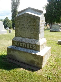
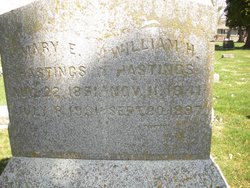
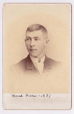
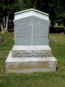
Mary E Fisher Hastings
| Birth | : | 22 Aug 1851 Iowa, USA |
| Death | : | 8 Jul 1931 West Branch, Cedar County, Iowa, USA |
| Burial | : | St. Mary's Churchyard, Bridgwater, Sedgemoor District, England |
| Coordinate | : | 51.1277430, -3.0050330 |
| Description | : | Muscatine Journal and News-Tribune, Muscatine, Iowa, Thursday, July 9, 1931 West Branch--Mrs. Mary Hastings, who has for many years been a sufferer with rheumatism, and who for several months has been confined to her bed in the home of her daughter, Mrs. John W. Wertzbaugher, of West Branch, died at 9 o'clock Wednesday morning. Mrs. Hastings was the daughter of Mr. and Mrs. James Henry Fisher and was born in Muscatine, Aug. 22, 1851. Her mother was Sara Salome Hoffman of Westhoven, Alsace, France. Mrs. Hastings was the widow of William H. Hastings, long time prominent in business in West Branch and... Read More |
frequently asked questions (FAQ):
-
Where is Mary E Fisher Hastings's memorial?
Mary E Fisher Hastings's memorial is located at: St. Mary's Churchyard, Bridgwater, Sedgemoor District, England.
-
When did Mary E Fisher Hastings death?
Mary E Fisher Hastings death on 8 Jul 1931 in West Branch, Cedar County, Iowa, USA
-
Where are the coordinates of the Mary E Fisher Hastings's memorial?
Latitude: 51.1277430
Longitude: -3.0050330
Family Members:
Parent
Spouse
Siblings
Children
Flowers:
Nearby Cemetories:
1. St. Mary's Churchyard
Bridgwater, Sedgemoor District, England
Coordinate: 51.1277430, -3.0050330
2. Bridgwater Baptist Church
Bridgwater, Sedgemoor District, England
Coordinate: 51.1272613, -3.0046282
3. Gray Friar's
Bridgwater, Sedgemoor District, England
Coordinate: 51.1264260, -3.0065160
4. Quaker Burial Ground
Bridgwater, Sedgemoor District, England
Coordinate: 51.1261740, -3.0078020
5. Former Holy Trinity Churchyard
Bridgwater, Sedgemoor District, England
Coordinate: 51.1261850, -3.0021850
6. Wembdon Road Cemetery
Bridgwater, Sedgemoor District, England
Coordinate: 51.1280877, -3.0138897
7. St John The Baptist Churchyard
Bridgwater, Sedgemoor District, England
Coordinate: 51.1311160, -2.9969910
8. St George Churchyard
Wembdon, Sedgemoor District, England
Coordinate: 51.1364420, -3.0171170
9. St. John Bristol Road Cemetery
Bridgwater, Sedgemoor District, England
Coordinate: 51.1391470, -2.9901660
10. Quantock Road Cemetery
Bridgwater, Sedgemoor District, England
Coordinate: 51.1284270, -3.0285630
11. Holy Trinity Churchyard
Chilton Trinity, Sedgemoor District, England
Coordinate: 51.1474390, -3.0072360
12. St Hugh's Church
Durleigh, Sedgemoor District, England
Coordinate: 51.1198090, -3.0375260
13. Heathfield Cemetery
North Petherton, Sedgemoor District, England
Coordinate: 51.0957200, -3.0081100
14. St. Mary Parish Churchyard
North Petherton, Sedgemoor District, England
Coordinate: 51.0920790, -3.0149060
15. Church of the Blessed Virgin Mary Churchyard
Chedzoy, Sedgemoor District, England
Coordinate: 51.1344600, -2.9429400
16. Blessed Virgin Mary Churchyard
Cannington, Sedgemoor District, England
Coordinate: 51.1500970, -3.0622850
17. St Edward King and Martyr Churchyard
Goathurst, Sedgemoor District, England
Coordinate: 51.1034930, -3.0633930
18. Saint Michael & All Angels Churchyard
Bawdrip, Sedgemoor District, England
Coordinate: 51.1517260, -2.9429330
19. Cannington Cemetery
Cannington, Sedgemoor District, England
Coordinate: 51.1500620, -3.0697070
20. Saint Michael and All Angels Churchyard
Puriton, Sedgemoor District, England
Coordinate: 51.1706000, -2.9735000
21. Westonzoyland Cemetery New
Westonzoyland, Sedgemoor District, England
Coordinate: 51.1096271, -2.9349336
22. St. John The Baptist Churchyard
Pawlett, Sedgemoor District, England
Coordinate: 51.1789100, -3.0012650
23. The Old Chapel
Westonzoyland, Sedgemoor District, England
Coordinate: 51.1077425, -2.9285237
24. St. Mary's Churchyard
Westonzoyland, Sedgemoor District, England
Coordinate: 51.1087000, -2.9273800

