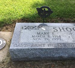
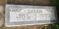
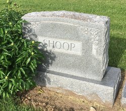
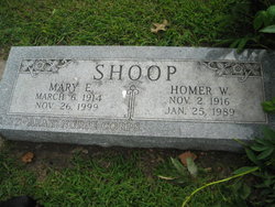
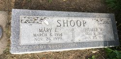
Mary E. Nicholson Shoop
| Birth | : | 6 Mar 1914 Omaha, Douglas County, Nebraska, USA |
| Death | : | 26 Nov 1999 Red Oak, Montgomery County, Iowa, USA |
| Burial | : | St. Mary's Churchyard, Tickhill, Metropolitan Borough of Doncaster, England |
| Coordinate | : | 53.4309200, -1.1112200 |
| Plot | : | 1st Addition #26 |
| Inscription | : | CAPTAIN ARMY NURSE CORPS |
| Description | : | Mary Shoop, age 85, of Emerson, Iowa passed away Friday, November 26, 1999 at the Montgomery County Memorial Hospital. Mary E. Shoop was born March 6, 1914 in Omaha, Nebraska the daughter of John and Geneva Owens Nicholson. After graduation high school, she went to college and became a Registered Nurse. May then went into the Army during World War 11, where she spent four years as a nurse in Europe. In 1949 she united in marriage to Home W. Shoop inOmaha, Nebraska. Home and Mary lived all of their married life in the Emerson area. She worked at the... Read More |
frequently asked questions (FAQ):
-
Where is Mary E. Nicholson Shoop's memorial?
Mary E. Nicholson Shoop's memorial is located at: St. Mary's Churchyard, Tickhill, Metropolitan Borough of Doncaster, England.
-
When did Mary E. Nicholson Shoop death?
Mary E. Nicholson Shoop death on 26 Nov 1999 in Red Oak, Montgomery County, Iowa, USA
-
Where are the coordinates of the Mary E. Nicholson Shoop's memorial?
Latitude: 53.4309200
Longitude: -1.1112200
Family Members:
Spouse
Flowers:
Nearby Cemetories:
1. St. Mary's Churchyard
Tickhill, Metropolitan Borough of Doncaster, England
Coordinate: 53.4309200, -1.1112200
2. Saint Mary's Cemetery
Tickhill, Metropolitan Borough of Doncaster, England
Coordinate: 53.4315867, -1.1108661
3. Austin Friars Churchyard
Tickhill, Metropolitan Borough of Doncaster, England
Coordinate: 53.4283270, -1.1194740
4. Tickhill Friary
Tickhill, Metropolitan Borough of Doncaster, England
Coordinate: 53.4283330, -1.1195830
5. Styrrup Road Cemetery
Harworth, Bassetlaw District, England
Coordinate: 53.4160400, -1.0816770
6. All Saints Churchyard
Harworth, Bassetlaw District, England
Coordinate: 53.4187800, -1.0781900
7. Harworth Cemetery
Harworth, Bassetlaw District, England
Coordinate: 53.4185060, -1.0733460
8. Sandbeck Park
Maltby, Metropolitan Borough of Rotherham, England
Coordinate: 53.4061450, -1.1460050
9. St Winifred Churchyard
Stainton, Metropolitan Borough of Doncaster, England
Coordinate: 53.4367385, -1.1657988
10. St Helen's Roman Catholic Churchyard
Nottingham, Nottingham Unitary Authority, England
Coordinate: 53.3903220, -1.1131860
11. St. John the Baptist Churchyard
Wadworth, Metropolitan Borough of Doncaster, England
Coordinate: 53.4673170, -1.1447000
12. Rossington Cemetery
Rossington, Metropolitan Borough of Doncaster, England
Coordinate: 53.4704340, -1.0896950
13. Rossington Grange Lane Cemetery
New Rossington, Metropolitan Borough of Doncaster, England
Coordinate: 53.4705000, -1.0897200
14. St. Martin Churchyard
Firbeck, Metropolitan Borough of Rotherham, England
Coordinate: 53.3900080, -1.1561770
15. Maltby Cemetery
Maltby, Metropolitan Borough of Rotherham, England
Coordinate: 53.4255480, -1.1960280
16. Roche Abbey
Maltby, Metropolitan Borough of Rotherham, England
Coordinate: 53.4025000, -1.1834000
17. Respect Green Burial Park
Bawtry, Metropolitan Borough of Doncaster, England
Coordinate: 53.4200210, -1.0250520
18. St. Katherine Churchyard
Loversall, Metropolitan Borough of Doncaster, England
Coordinate: 53.4821700, -1.1333650
19. Langold Cemetery
Worksop, Bassetlaw District, England
Coordinate: 53.3777600, -1.1170100
20. St Nicholas Chapel of All Souls Ancillary Cemetery
Bawtry, Metropolitan Borough of Doncaster, England
Coordinate: 53.4344798, -1.0211632
21. Bawtry Cemetery
Bawtry, Metropolitan Borough of Doncaster, England
Coordinate: 53.4341255, -1.0192066
22. St. Nicholas' Churchyard
Bawtry, Metropolitan Borough of Doncaster, England
Coordinate: 53.4297900, -1.0183400
23. St. Michael's Churchyard
Rossington, Metropolitan Borough of Doncaster, England
Coordinate: 53.4782772, -1.0596305
24. St. James' Churchyard
Braithwell, Metropolitan Borough of Doncaster, England
Coordinate: 53.4465700, -1.2035400

