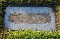
| Birth | : | 18 Aug 1855 Marshall County, Iowa, USA |
| Death | : | 3 Mar 1943 Arapahoe, Furnas County, Nebraska, USA |
| Burial | : | East Muddy Cemetery, Gosper County, USA |
| Coordinate | : | 40.4166985, -99.9614029 |
| Description | : | Mary Elizabeth Ford, daughter of Mr. and Mrs. Calvin Ford, was born in Layfette, Marshall county, Iowa, August 15, 1855 and passed away at her home in Arapahoe, Nebraska, at 3:45 a.m., March 3, 1943, at the age of 87 years, 6 months and 15 days. She was united in marriage to James Dunlap, May 16, 1875, at Louisburg, Kansas. They then moved to Marshalltown, Iowa, and came from there to Gosper county, Nebraska in 1879, where they homesteaded and lived until the death of Mr. Dunlap in December 1912. Five children were born to this union, three sons and... Read More |
frequently asked questions (FAQ):
-
Where is Mary Elizabeth Ford Dunlap's memorial?
Mary Elizabeth Ford Dunlap's memorial is located at: East Muddy Cemetery, Gosper County, USA.
-
When did Mary Elizabeth Ford Dunlap death?
Mary Elizabeth Ford Dunlap death on 3 Mar 1943 in Arapahoe, Furnas County, Nebraska, USA
-
Where are the coordinates of the Mary Elizabeth Ford Dunlap's memorial?
Latitude: 40.4166985
Longitude: -99.9614029
Family Members:
Spouse
Children
Flowers:
Nearby Cemetories:
1. Pleasant Grove Cemetery
Gosper County, USA
Coordinate: 40.4664001, -99.9250031
2. Saint Matthew Lutheran Cemetery
Elwood, Gosper County, USA
Coordinate: 40.3519000, -99.9630000
3. Immanuel Lutheran Cemetery
Elwood, Gosper County, USA
Coordinate: 40.4206500, -99.8672000
4. McGuire Cemetery
Gosper County, USA
Coordinate: 40.4380989, -99.8664017
5. Salem East Cemetery
Gosper County, USA
Coordinate: 40.4972000, -99.9803009
6. Salem West Cemetery
Frontier County, USA
Coordinate: 40.4968987, -99.9886017
7. Miller Cemetery
Elwood, Gosper County, USA
Coordinate: 40.3514980, -100.0374350
8. Homerville Cemetery
Gosper County, USA
Coordinate: 40.4668999, -99.8593979
9. Norwegian Lutheran Cemetery
Holbrook, Furnas County, USA
Coordinate: 40.3380910, -100.0425560
10. Arapahoe Cemetery
Arapahoe, Furnas County, USA
Coordinate: 40.3239600, -99.8985500
11. Holbrook Cemetery
Holbrook, Furnas County, USA
Coordinate: 40.3138000, -100.0045000
12. Stowe Cemetery
Stockville, Frontier County, USA
Coordinate: 40.4900017, -100.0753021
13. Fairfield Cemetery
Gosper County, USA
Coordinate: 40.4672012, -99.7549973
14. Stump Cemetery
Furnas County, USA
Coordinate: 40.3478012, -99.7621994
15. Evergreen Cemetery
Frontier County, USA
Coordinate: 40.5689011, -100.0571976
16. Garfield Cemetery
Furnas County, USA
Coordinate: 40.2491989, -99.8992004
17. Edison Cemetery
Edison, Furnas County, USA
Coordinate: 40.2919006, -99.7902985
18. Denny Cemetery
Frontier County, USA
Coordinate: 40.4393997, -100.2082977
19. Highland Union Cemetery
Gosper County, USA
Coordinate: 40.3513990, -99.7172360
20. Zion Cemetery
Gosper County, USA
Coordinate: 40.4085999, -99.7005997
21. Elwood Cemetery
Elwood, Gosper County, USA
Coordinate: 40.5999300, -99.8397300
22. Hammond Cemetery
Frontier County, USA
Coordinate: 40.4002953, -100.2353134
23. Pleasantview Cemetery
Arapahoe, Furnas County, USA
Coordinate: 40.2043991, -99.9669037
24. Saint John's Catholic Cemetery
Cambridge, Furnas County, USA
Coordinate: 40.2850000, -100.1817000


